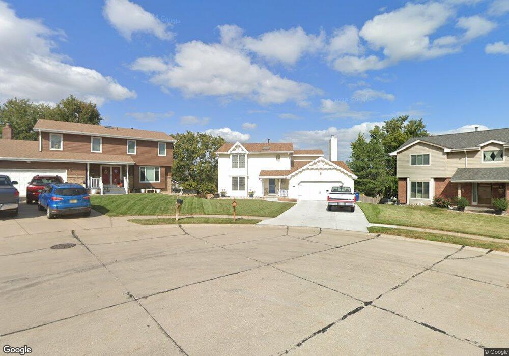
2512 Sheridan Rd Bellevue, NE 68123
Estimated Value: $331,918 - $343,000
4
Beds
6
Baths
2,130
Sq Ft
$159/Sq Ft
Est. Value
About This Home
This home is located at 2512 Sheridan Rd, Bellevue, NE 68123 and is currently estimated at $338,730, approximately $159 per square foot. 2512 Sheridan Rd is a home located in Sarpy County with nearby schools including Leonard Lawrence Elementary School, Lewis & Clark Middle School, and Bellevue West High School.
Ownership History
Date
Name
Owned For
Owner Type
Purchase Details
Closed on
Mar 15, 2019
Sold by
Marshall Joseph D and Marshall Nora L
Bought by
Joseph D And Nora L Marshall Liv Tr
Current Estimated Value
Purchase Details
Closed on
May 9, 2000
Sold by
Bacon Donald J and Bacon Angela J
Bought by
Marshall Joseph D and Marshall Nora L
Home Financials for this Owner
Home Financials are based on the most recent Mortgage that was taken out on this home.
Original Mortgage
$144,800
Interest Rate
8.18%
Purchase Details
Closed on
May 22, 1998
Sold by
Oleary Jeffrey C and Oleary Cynthia L
Bought by
Bacon Donald J and Bacon Angela J
Home Financials for this Owner
Home Financials are based on the most recent Mortgage that was taken out on this home.
Original Mortgage
$89,000
Interest Rate
7.21%
Create a Home Valuation Report for This Property
The Home Valuation Report is an in-depth analysis detailing your home's value as well as a comparison with similar homes in the area
Home Values in the Area
Average Home Value in this Area
Purchase History
| Date | Buyer | Sale Price | Title Company |
|---|---|---|---|
| Joseph D And Nora L Marshall Liv Tr | -- | None Available | |
| Marshall Joseph D | $142,000 | -- | |
| Bacon Donald J | $139,000 | -- |
Source: Public Records
Mortgage History
| Date | Status | Borrower | Loan Amount |
|---|---|---|---|
| Closed | Marshall Joseph D | $144,800 | |
| Closed | Bacon Donald J | $89,000 |
Source: Public Records
Tax History Compared to Growth
Tax History
| Year | Tax Paid | Tax Assessment Tax Assessment Total Assessment is a certain percentage of the fair market value that is determined by local assessors to be the total taxable value of land and additions on the property. | Land | Improvement |
|---|---|---|---|---|
| 2025 | $4,788 | $295,048 | $46,000 | $249,048 |
| 2024 | $5,283 | $274,198 | $44,000 | $230,198 |
| 2023 | $5,283 | $250,174 | $39,000 | $211,174 |
| 2022 | $4,743 | $220,383 | $35,000 | $185,383 |
| 2021 | $4,384 | $201,538 | $30,000 | $171,538 |
| 2020 | $4,319 | $197,936 | $30,000 | $167,936 |
| 2019 | $4,181 | $192,800 | $30,000 | $162,800 |
| 2018 | $3,780 | $178,980 | $25,000 | $153,980 |
| 2017 | $3,652 | $171,735 | $25,000 | $146,735 |
| 2016 | $3,528 | $169,576 | $25,000 | $144,576 |
| 2015 | $3,509 | $169,670 | $25,000 | $144,670 |
| 2014 | $3,379 | $162,312 | $25,000 | $137,312 |
| 2012 | -- | $163,239 | $25,000 | $138,239 |
Source: Public Records
Map
Nearby Homes
- 2512 Nottingham Dr
- 13211 S 26th Ave
- 13403 S 28th St
- 12901 S 29th Place
- 2923 Blackhawk Dr
- 12722 S 28th Ave
- 2939 Lone Tree Rd
- 3105 Mirror Cir
- 2940 Leawood Dr
- 2810 Bar Harbor Dr
- 3102 Redwing Dr
- 14002 Tregaron Ridge Ave Unit B
- 3105 Leawood Dr
- 3309 Lookingglass Dr
- 14112 S 22nd St
- 3113 Tammy St
- 3504 Sheridan Cir
- 13908 S 17th St
- 0000 Cedar Island Road East of Old 36th St
- 1506 Halifax St
- 2510 Sheridan Rd
- 2514 Sheridan Rd
- 2509 Nottingham Dr
- 2508 Sheridan Rd
- 2511 Nottingham Dr
- 2507 Nottingham Dr
- 2513 Nottingham Dr
- 2516 Sheridan Rd
- 2506 Sheridan Rd
- 2505 Nottingham Dr
- 2518 Sheridan Rd
- 2515 Nottingham Dr
- 2515 Sheridan Rd
- 2517 Sheridan Rd
- 2513 Sheridan Rd
- 2513 Sheridan Rd
- 2519 Sheridan Rd
- 2511 Sheridan Rd
- 2510 Nottingham Dr
- 13311 S 26th Ave