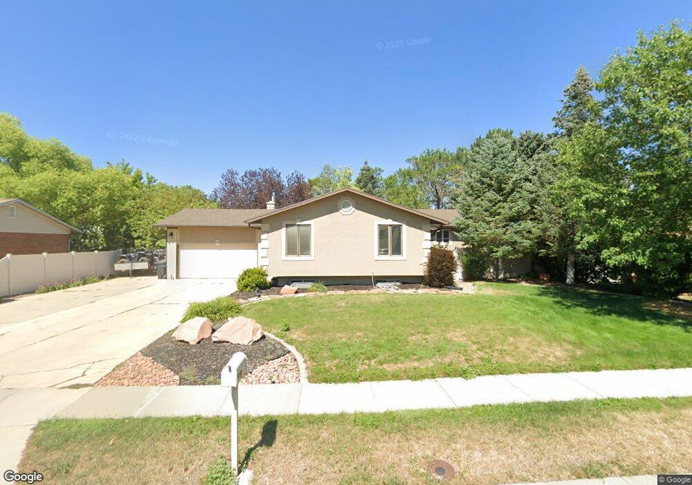
2512 W Blake Dr Taylorsville, UT 84129
Estimated Value: $569,000 - $703,000
4
Beds
3
Baths
2,211
Sq Ft
$283/Sq Ft
Est. Value
About This Home
This home is located at 2512 W Blake Dr, Taylorsville, UT 84129 and is currently estimated at $625,231, approximately $282 per square foot. 2512 W Blake Dr is a home located in Salt Lake County with nearby schools including Calvin S Smith Elementary School, Bennion Junior High School, and Taylorsville High School.
Ownership History
Date
Name
Owned For
Owner Type
Purchase Details
Closed on
Nov 15, 2021
Sold by
Skeem Cody B and Skeem Robyn L
Bought by
Holden Melanic Hickea and Holden Aaron Neal
Current Estimated Value
Home Financials for this Owner
Home Financials are based on the most recent Mortgage that was taken out on this home.
Original Mortgage
$533,500
Outstanding Balance
$489,267
Interest Rate
3.05%
Mortgage Type
New Conventional
Estimated Equity
$135,964
Purchase Details
Closed on
Jul 12, 2017
Sold by
Skeem Cody B and Skeem Robyn L
Bought by
Skeem Cody B and Skeem Robyn L
Create a Home Valuation Report for This Property
The Home Valuation Report is an in-depth analysis detailing your home's value as well as a comparison with similar homes in the area
Home Values in the Area
Average Home Value in this Area
Purchase History
| Date | Buyer | Sale Price | Title Company |
|---|---|---|---|
| Holden Melanic Hickea | -- | Backman Title Services | |
| Skeem Cody B | -- | None Available |
Source: Public Records
Mortgage History
| Date | Status | Borrower | Loan Amount |
|---|---|---|---|
| Open | Holden Melanic Hickea | $533,500 |
Source: Public Records
Tax History Compared to Growth
Tax History
| Year | Tax Paid | Tax Assessment Tax Assessment Total Assessment is a certain percentage of the fair market value that is determined by local assessors to be the total taxable value of land and additions on the property. | Land | Improvement |
|---|---|---|---|---|
| 2025 | $3,347 | $572,800 | $147,900 | $424,900 |
| 2024 | $3,347 | $548,800 | $140,700 | $408,100 |
| 2023 | $3,039 | $488,800 | $135,300 | $353,500 |
| 2022 | $3,176 | $515,300 | $132,600 | $382,700 |
| 2021 | $2,503 | $353,700 | $102,000 | $251,700 |
| 2020 | $2,359 | $315,500 | $102,000 | $213,500 |
| 2019 | $2,288 | $298,800 | $95,000 | $203,800 |
| 2018 | $2,231 | $280,900 | $95,000 | $185,900 |
| 2017 | $1,939 | $256,600 | $95,000 | $161,600 |
| 2016 | $1,527 | $201,900 | $95,000 | $106,900 |
| 2015 | $1,657 | $204,800 | $98,000 | $106,800 |
| 2014 | $1,616 | $196,200 | $94,900 | $101,300 |
Source: Public Records
Map
Nearby Homes
- 2503 5520 S
- 1891 S Jordan Canal Rd
- 5668 Lolene Way
- 5574 Easton St
- 5725 S 2665 W
- 2266 W Arches Dr
- 2579 W 5780 S
- 5600 S Ralph Dr
- 2320 W 5400 S
- 5557 S 2200 W
- 5597 S Bastile Dr
- 2794 W Harker Ridge Cove
- 2127 Cedar Breaks Dr
- 2337 Sharron Dr
- 2322 W Surrey Rd
- 2001 W 5540 S
- 5539 S Danube Dr
- 3002 Carranza Dr
- 5552 Hew Wood Dr
- 2104 W Champagne Cir
- 2512 Blake Dr
- 2502 Blake Dr
- 2522 Blake Dr
- 2517 W Blake Dr
- 2517 Blake Dr
- 2493 Candy Crest Cir
- 2509 Blake Dr
- 2492 Blake Dr
- 2536 W Blake Dr
- 2536 Blake Dr
- 2492 W Blake Dr
- 2525 W Blake Dr
- 2525 Blake Dr
- 2499 Blake Dr
- 5574 S Harvey Heights Dr
- 5574 Harvey Heights Dr
- 5586 S Harvey Heights Dr
- 5586 Harvey Heights Dr
- 5605 Lolene Way
- 2475 Candy Crest Cir