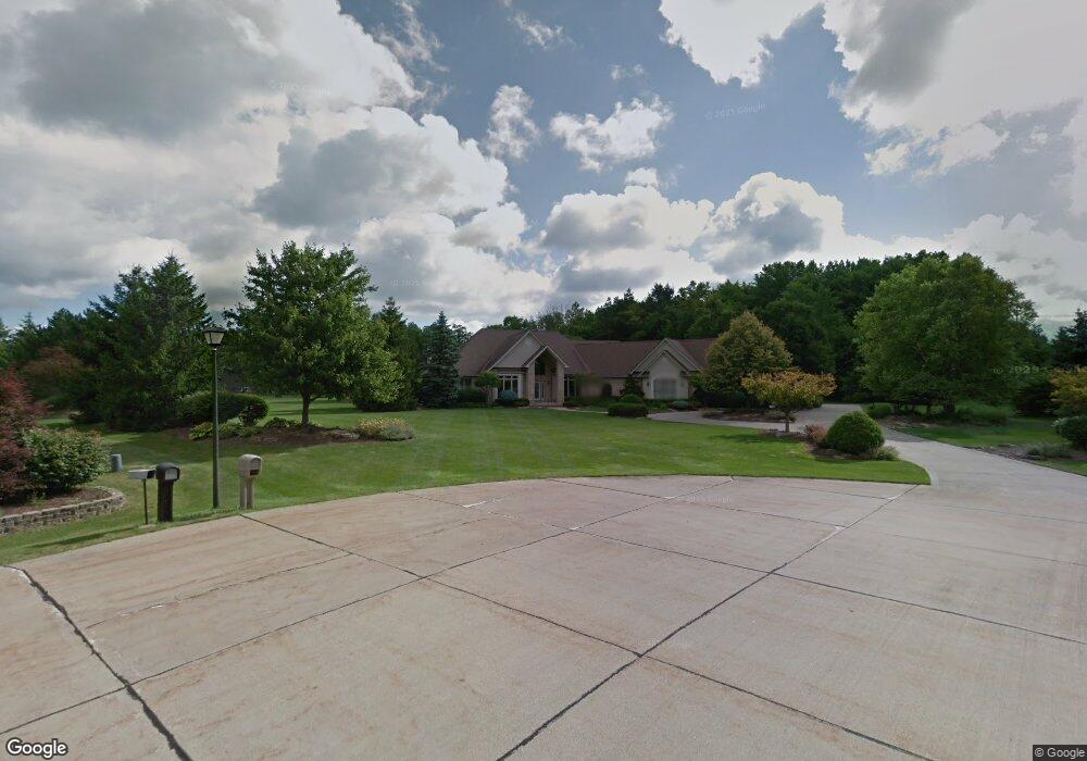
25120 Trotter Ct Columbia Station, OH 44028
Estimated Value: $588,000 - $856,000
4
Beds
4
Baths
4,117
Sq Ft
$174/Sq Ft
Est. Value
About This Home
This home is located at 25120 Trotter Ct, Columbia Station, OH 44028 and is currently estimated at $717,648, approximately $174 per square foot. 25120 Trotter Ct is a home located in Lorain County with nearby schools including Copopa Elementary School, Columbia Middle School, and Columbia High School.
Ownership History
Date
Name
Owned For
Owner Type
Purchase Details
Closed on
Sep 9, 1998
Sold by
Gill Construction Company Inc
Bought by
Sexton John E and Sexton Susan C
Current Estimated Value
Home Financials for this Owner
Home Financials are based on the most recent Mortgage that was taken out on this home.
Original Mortgage
$385,150
Outstanding Balance
$95,232
Interest Rate
7.06%
Estimated Equity
$622,416
Purchase Details
Closed on
Aug 24, 1998
Sold by
Bradley Development Corp Inc
Bought by
Gill Construction Company Inc
Home Financials for this Owner
Home Financials are based on the most recent Mortgage that was taken out on this home.
Original Mortgage
$385,150
Outstanding Balance
$95,232
Interest Rate
7.06%
Estimated Equity
$622,416
Create a Home Valuation Report for This Property
The Home Valuation Report is an in-depth analysis detailing your home's value as well as a comparison with similar homes in the area
Home Values in the Area
Average Home Value in this Area
Purchase History
| Date | Buyer | Sale Price | Title Company |
|---|---|---|---|
| Sexton John E | $75,000 | Title Xperts Agency Inc | |
| Gill Construction Company Inc | $55,000 | Title Experts Agency Inc |
Source: Public Records
Mortgage History
| Date | Status | Borrower | Loan Amount |
|---|---|---|---|
| Open | Sexton John E | $385,150 | |
| Closed | Sexton John E | $48,150 |
Source: Public Records
Tax History Compared to Growth
Tax History
| Year | Tax Paid | Tax Assessment Tax Assessment Total Assessment is a certain percentage of the fair market value that is determined by local assessors to be the total taxable value of land and additions on the property. | Land | Improvement |
|---|---|---|---|---|
| 2024 | $11,085 | $250,128 | $36,547 | $213,581 |
| 2023 | $8,711 | $171,416 | $26,436 | $144,981 |
| 2022 | $8,510 | $171,416 | $26,436 | $144,981 |
| 2021 | $8,595 | $171,416 | $26,436 | $144,981 |
| 2020 | $8,758 | $156,830 | $24,190 | $132,640 |
| 2019 | $8,710 | $156,830 | $24,190 | $132,640 |
| 2018 | $9,336 | $156,830 | $24,190 | $132,640 |
| 2017 | $9,893 | $164,270 | $25,520 | $138,750 |
| 2016 | $9,968 | $164,270 | $25,520 | $138,750 |
| 2015 | $10,011 | $164,270 | $25,520 | $138,750 |
| 2014 | $6,537 | $142,840 | $22,190 | $120,650 |
| 2013 | $6,537 | $142,840 | $22,190 | $120,650 |
Source: Public Records
Map
Nearby Homes
- 10700 Whitewing Way
- Belleville Plan at The Estates of Columbia Ridge
- Ash Lawn Plan at The Estates of Columbia Ridge
- Brennan Plan at The Estates of Columbia Ridge
- Lyndhurst Plan at The Estates of Columbia Ridge
- Alden Plan at The Estates of Columbia Ridge
- Vanderburgh Plan at The Estates of Columbia Ridge
- Buchanan Plan at The Estates of Columbia Ridge
- 8924 Leatherleaf Dr
- 8960 Leatherleaf Dr
- 8981 Leatherleaf Dr
- 8839 Leatherleaf Dr
- 8809 Leatherleaf Dr
- 8896 Firethorne Dr
- V/L Aldridge Dr
- 8748 Bottle Brush Dr
- 12584 Caribou Ct
- Lehigh Plan at Ashford Cove
- Anderson Plan at Ashford Cove
- Ballenger Plan at Ashford Cove
- 25116 Trotter Ct
- 25126 Crosstie Trail
- 25122 Crosstie Trail
- 23737 Redfern Rd
- 25114 Crosstie Trail
- 23785 Redfern Rd
- 25130 Crosstie Trail
- 10729 Bridle Path
- 10701 Bridle Path
- 25110 Crosstie Trail
- 10741 Bridle Path
- 10625 Bridle Path
- 25134 Crosstie Trail
- 10687 Bridle Path
- 23805 Redfern Rd
- 25140 Crosstie Trail
- 25138 Crosstie Trail
- 25106 Crosstie Trail
- 23691 Redfern Rd
- 10605 Bridle Path