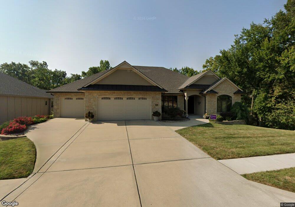
2513 NW Ashurst Dr Lees Summit, MO 64081
Estimated Value: $692,000 - $795,000
2
Beds
3
Baths
3,040
Sq Ft
$245/Sq Ft
Est. Value
About This Home
This home is located at 2513 NW Ashurst Dr, Lees Summit, MO 64081 and is currently estimated at $744,435, approximately $244 per square foot. 2513 NW Ashurst Dr is a home with nearby schools including Cedar Creek Elementary School, Pleasant Lea Middle School, and Lee's Summit Senior High School.
Ownership History
Date
Name
Owned For
Owner Type
Purchase Details
Closed on
May 30, 2025
Sold by
Dorothy E Turano Revocable Trust
Bought by
Steven L Meadows And Sharmin E Meadows Trust
Current Estimated Value
Purchase Details
Closed on
Sep 10, 2014
Sold by
Turano Dorothy E
Bought by
Turano Dorothy E and Dorothy E Turano Revocable Trust
Purchase Details
Closed on
Aug 5, 2009
Sold by
Steve Thomas Homes Inc
Bought by
Turano William L and Turano Dorothy E
Home Financials for this Owner
Home Financials are based on the most recent Mortgage that was taken out on this home.
Original Mortgage
$385,000
Interest Rate
5.44%
Mortgage Type
Credit Line Revolving
Purchase Details
Closed on
Jul 24, 2007
Sold by
Thomas Lee and Thomas Donna
Bought by
Steve Thomas Homes Inc
Create a Home Valuation Report for This Property
The Home Valuation Report is an in-depth analysis detailing your home's value as well as a comparison with similar homes in the area
Home Values in the Area
Average Home Value in this Area
Purchase History
| Date | Buyer | Sale Price | Title Company |
|---|---|---|---|
| Steven L Meadows And Sharmin E Meadows Trust | $785,000 | Chicago Title | |
| Turano Dorothy E | -- | None Available | |
| Turano William L | -- | Coffelt Land Title Inc | |
| Steve Thomas Homes Inc | -- | None Available |
Source: Public Records
Mortgage History
| Date | Status | Borrower | Loan Amount |
|---|---|---|---|
| Previous Owner | Turano William L | $385,000 |
Source: Public Records
Tax History
| Year | Tax Paid | Tax Assessment Tax Assessment Total Assessment is a certain percentage of the fair market value that is determined by local assessors to be the total taxable value of land and additions on the property. | Land | Improvement |
|---|---|---|---|---|
| 2025 | $10,206 | $121,617 | $11,045 | $110,572 |
| 2024 | $10,206 | $141,341 | $13,870 | $127,471 |
| 2023 | $10,132 | $141,341 | $17,106 | $124,235 |
| 2022 | $7,423 | $91,960 | $12,167 | $79,793 |
| 2021 | $7,577 | $91,960 | $12,167 | $79,793 |
| 2020 | $7,285 | $87,551 | $12,167 | $75,384 |
| 2019 | $7,086 | $87,551 | $12,167 | $75,384 |
| 2018 | $6,645 | $76,197 | $10,589 | $65,608 |
| 2017 | $6,665 | $76,197 | $10,589 | $65,608 |
| 2016 | $6,665 | $75,639 | $10,146 | $65,493 |
| 2014 | $6,575 | $73,150 | $9,481 | $63,669 |
Source: Public Records
Map
Nearby Homes
- 507 NW Ashurst Ct
- 2635 NW Ashurst Ln
- 2430 NW Windwood Dr
- 336 NW Thoreau Cir
- 334 NW Ambersham Dr
- 321 NW Nutall Dr
- 2809 NW Audubon Ln
- 129 NW Morton Dr
- 2214 NW Killarney Ln
- 2224 NW Summerfield Dr
- 2122 NW Ashurst Dr
- 2074 NW O'Brien Rd
- 433 NW Kaylea Ct
- 2110 NW Ashurst Dr
- 2070 NW O'Brien Rd
- 2114 NW Killarney Ln
- 317 NW Lovins
- 316 NW Lovins
- 320 NW Lovins
- 321 NW Lovins
- 2509 NW Ashurst Dr
- 2599 NW Ashurst Dr
- 2507 NW Ashurst Dr
- 489 NW Riven Rock Trail
- 2505 NW Ashurst Dr
- 2510 NW Ashurst Dr
- 2506 NW Ashurst Dr
- 2504 NW Ashurst Dr
- 485 NW Riven Rock Trail
- 593 NW Riven Rock Trail
- 2508 NW Ashurst Dr
- 2503 NW Ashurst Dr
- 500 NW Ashurst Place
- 502 NW Ashurst Place
- 2501 NW Ashurst Dr
- 504 NW Ashurst Place
- 481 NW Riven Rock Trail
- 597 NW Riven Rock Trail
- 505 NW Westvale Cir
- 505 NW Westvale Cir Unit A
Your Personal Tour Guide
Ask me questions while you tour the home.