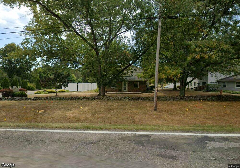
2514 Raber Rd Uniontown, OH 44685
Estimated Value: $120,938 - $140,000
2
Beds
1
Bath
924
Sq Ft
$143/Sq Ft
Est. Value
About This Home
This home is located at 2514 Raber Rd, Uniontown, OH 44685 and is currently estimated at $131,735, approximately $142 per square foot. 2514 Raber Rd is a home located in Summit County with nearby schools including Greenwood Elementary School, Green Primary School, and Green Intermediate Elementary School.
Ownership History
Date
Name
Owned For
Owner Type
Purchase Details
Closed on
Jun 7, 2022
Sold by
Sharp Donald K
Bought by
Sharp Irrevocable Heritage Trust
Current Estimated Value
Purchase Details
Closed on
Nov 18, 2021
Sold by
Sharp Kenneth C
Bought by
Kenneth C Sharp And Nancy L Sharp Revocable L and Sh Nancy
Purchase Details
Closed on
Nov 13, 2021
Sold by
Sharp Jessica M and Sharp Kenneth C
Bought by
Sharp Donald K
Purchase Details
Closed on
Apr 3, 2020
Sold by
Sharp Nancy L
Bought by
Sharp Kenneth C and Sh Nancy
Purchase Details
Closed on
Jan 2, 2020
Sold by
Sharp Kenneth C
Bought by
Sharp Nancy L
Purchase Details
Closed on
Jul 8, 1999
Sold by
Sharp Kenneth C and Sharp Nancy L
Bought by
Sharp Kenneth C and Sharp Nancy L
Create a Home Valuation Report for This Property
The Home Valuation Report is an in-depth analysis detailing your home's value as well as a comparison with similar homes in the area
Purchase History
| Date | Buyer | Sale Price | Title Company |
|---|---|---|---|
| Sharp Irrevocable Heritage Trust | -- | Alerstallings Llc | |
| Kenneth C Sharp And Nancy L Sharp Revocable L | -- | -- | |
| Sharp Donald K | -- | None Available | |
| Kenneth C Sharp And Nancy L Sharp Revocable L | -- | -- | |
| Sharp Kenneth C | -- | None Listed On Document | |
| Sharp Nancy L | -- | -- | |
| Sharp Nancy L | -- | -- | |
| Sharp Kenneth C | -- | Midland Commerce Group |
Source: Public Records
Tax History
| Year | Tax Paid | Tax Assessment Tax Assessment Total Assessment is a certain percentage of the fair market value that is determined by local assessors to be the total taxable value of land and additions on the property. | Land | Improvement |
|---|---|---|---|---|
| 2024 | $1,711 | $32,278 | $4,323 | $27,955 |
| 2023 | $1,711 | $32,278 | $4,323 | $27,955 |
| 2022 | $1,137 | $20,062 | $2,667 | $17,395 |
| 2021 | $1,071 | $20,062 | $2,667 | $17,395 |
| 2020 | $1,052 | $20,070 | $2,670 | $17,400 |
| 2019 | $917 | $16,240 | $2,450 | $13,790 |
| 2018 | $937 | $16,240 | $2,450 | $13,790 |
| 2017 | $1,050 | $16,240 | $2,450 | $13,790 |
| 2016 | $1,046 | $17,230 | $2,590 | $14,640 |
| 2015 | $1,050 | $17,230 | $2,590 | $14,640 |
| 2014 | $1,044 | $17,230 | $2,590 | $14,640 |
| 2013 | $1,159 | $19,060 | $2,590 | $16,470 |
Source: Public Records
Map
Nearby Homes
- 2535 Royal County Down Unit B
- 3549 Elmhurst Cir
- 3302 Ashton Dr
- 3495 Chadwick Dr
- 2667 Spade Rd
- 2229 E Park Dr
- 2348 E Turkeyfoot Lake Rd
- 0 E Turkeyfoot Lake Rd Unit 5181695
- 3632 Kenwood Dr Unit 84
- 3912 Raintree Cir
- 2033 Carlile Dr
- 2390 Auberry Dr
- 2013 Dornoch Dr Unit 118
- 2958 E Turkeyfoot Lake Rd
- 11931 Walton Cir NW
- 3680 Timber Lake St NW
- 3788 Carl St NW
- 3878 Sprucehaven St NW
- 3586 Leafland St NW
- 2771 Superior Dr
- 2514 Raber Rd
- 2514 Raber Rd
- 2514 Raber Rd Unit E
- 2514 Raber Rd
- 2514 Raber Rd Unit D
- 2514 Raber Rd Unit C
- 2514 Raber Rd Unit 4A
- 2514 Raber Rd Unit 4C
- 2514 Raber Rd Unit 4E
- 2500 Raber Rd Unit 5b
- 2500 Raber Rd
- 2500 Raber Rd
- 2500 Raber Rd
- 2500 Raber Rd Unit B
- 2500 Raber Rd Unit 5C
- 2500 Raber Rd Unit 5b
- 2500 Raber Rd Unit C
- 2480 Raber Rd Unit B
- 2480 Raber Rd Unit 6D
- 2480 Raber Rd Unit C
Your Personal Tour Guide
Ask me questions while you tour the home.