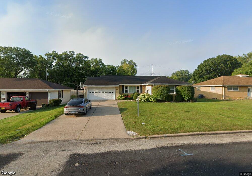
2514 W Westport Rd Peoria, IL 61615
North Peoria NeighborhoodEstimated Value: $150,000 - $168,000
3
Beds
2
Baths
1,748
Sq Ft
$90/Sq Ft
Est. Value
About This Home
This home is located at 2514 W Westport Rd, Peoria, IL 61615 and is currently estimated at $157,854, approximately $90 per square foot. 2514 W Westport Rd is a home located in Peoria County with nearby schools including Dr Maude A Sanders Primary School, Sterling Middle School, and Peoria High School.
Ownership History
Date
Name
Owned For
Owner Type
Purchase Details
Closed on
Apr 10, 2019
Sold by
Rutherford James L
Bought by
Rutherford Timika
Current Estimated Value
Home Financials for this Owner
Home Financials are based on the most recent Mortgage that was taken out on this home.
Original Mortgage
$88,110
Interest Rate
3.5%
Mortgage Type
New Conventional
Purchase Details
Closed on
Oct 3, 2002
Bought by
Rutherford Timika T and Rutherford James Robert L
Create a Home Valuation Report for This Property
The Home Valuation Report is an in-depth analysis detailing your home's value as well as a comparison with similar homes in the area
Home Values in the Area
Average Home Value in this Area
Purchase History
| Date | Buyer | Sale Price | Title Company |
|---|---|---|---|
| Rutherford Timika | -- | Borsberry Law Offices Pc | |
| Rutherford Timika T | $102,500 | -- |
Source: Public Records
Mortgage History
| Date | Status | Borrower | Loan Amount |
|---|---|---|---|
| Previous Owner | Rutherford Timika | $88,110 |
Source: Public Records
Tax History Compared to Growth
Tax History
| Year | Tax Paid | Tax Assessment Tax Assessment Total Assessment is a certain percentage of the fair market value that is determined by local assessors to be the total taxable value of land and additions on the property. | Land | Improvement |
|---|---|---|---|---|
| 2024 | $3,188 | $41,250 | $6,090 | $35,160 |
| 2023 | $2,997 | $37,850 | $5,590 | $32,260 |
| 2022 | $2,876 | $35,810 | $5,300 | $30,510 |
| 2021 | $2,795 | $34,110 | $5,050 | $29,060 |
| 2020 | $2,783 | $33,770 | $5,000 | $28,770 |
| 2019 | $2,835 | $34,460 | $5,100 | $29,360 |
| 2018 | $2,867 | $35,440 | $5,150 | $30,290 |
| 2017 | $2,873 | $35,800 | $5,200 | $30,600 |
| 2016 | $2,782 | $35,800 | $5,200 | $30,600 |
| 2015 | $2,735 | $35,100 | $5,100 | $30,000 |
| 2014 | $2,741 | $35,710 | $5,070 | $30,640 |
| 2013 | -- | $36,140 | $5,130 | $31,010 |
Source: Public Records
Map
Nearby Homes
- 4011 N Sterling Ave
- 2705 W Millbrook Ct
- 3808 N Walround Ln
- 2214 W Bainter Ln
- 3623 N Sterling Ave Unit b-17
- 2910 W Westport Rd
- 2922 W Larchmont Ln
- 3720 N Saint Michael Ave
- 4426 N Wilco Dr
- 3423 N El Vista Ave
- 3010 W Brookside Dr
- 4036 N Westport Ct
- 2724 W Scenic Dr
- 2221 W Tripp Ave
- 2627 Eugenie Ave
- 2036 W Richwoods Blvd
- 2318 W Albany Ave
- 2011 W Richwoods Blvd
- 2315 W Hudson St
- 3347 W Saymore Ln
- 2520 W Westport Rd
- 2510 W Westport Rd
- 2515 W Bainter Ln
- 2511 W Bainter Ln
- 2605 W Bainter Ln
- 2526 W Westport Rd
- 2504 W Westport Rd
- 2607 W Bainter Ln
- 2517 W Westport Rd
- 2505 W Bainter Ln
- 2511 W Westport Rd
- 2604 W Westport Rd
- 2615 W Bainter Ln
- 2521 W Westport Rd
- 2603 W Westport Rd
- 2512 W Bainter Ln
- 3923 N Wilkins Rd
- 2608 W Westport Rd
- 2515 W Westport Rd
- 2617 W Bainter Ln