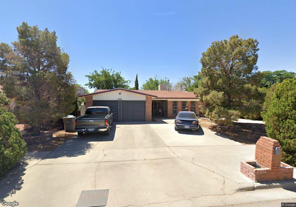
2516 Anise Dr El Paso, TX 79936
Glen Cove NeighborhoodEstimated Value: $222,000 - $245,000
--
Bed
2
Baths
1,733
Sq Ft
$137/Sq Ft
Est. Value
About This Home
This home is located at 2516 Anise Dr, El Paso, TX 79936 and is currently estimated at $237,895, approximately $137 per square foot. 2516 Anise Dr is a home located in El Paso County with nearby schools including Glen Cove Elementary School, J.M. Hanks Middle School, and J M Hanks High School.
Ownership History
Date
Name
Owned For
Owner Type
Purchase Details
Closed on
Nov 20, 2018
Sold by
Garcia Socorro A
Bought by
Navarro Irene and Garcia David
Current Estimated Value
Purchase Details
Closed on
Aug 25, 2008
Sold by
Navarro Santos Uriel
Bought by
Navarro Arturo and Navarro Irene
Home Financials for this Owner
Home Financials are based on the most recent Mortgage that was taken out on this home.
Original Mortgage
$30,000
Outstanding Balance
$19,858
Interest Rate
6.42%
Mortgage Type
Seller Take Back
Estimated Equity
$218,037
Create a Home Valuation Report for This Property
The Home Valuation Report is an in-depth analysis detailing your home's value as well as a comparison with similar homes in the area
Home Values in the Area
Average Home Value in this Area
Purchase History
| Date | Buyer | Sale Price | Title Company |
|---|---|---|---|
| Navarro Irene | -- | None Available | |
| Navarro Irene | -- | None Available | |
| Navarro Arturo | -- | None Available |
Source: Public Records
Mortgage History
| Date | Status | Borrower | Loan Amount |
|---|---|---|---|
| Open | Navarro Arturo | $30,000 |
Source: Public Records
Tax History Compared to Growth
Tax History
| Year | Tax Paid | Tax Assessment Tax Assessment Total Assessment is a certain percentage of the fair market value that is determined by local assessors to be the total taxable value of land and additions on the property. | Land | Improvement |
|---|---|---|---|---|
| 2025 | $4,150 | $240,328 | -- | -- |
| 2024 | $4,150 | $218,480 | -- | -- |
| 2023 | $3,842 | $198,618 | $0 | $0 |
| 2022 | $5,607 | $180,562 | $0 | $0 |
| 2021 | $5,336 | $164,147 | $25,295 | $138,852 |
| 2020 | $5,073 | $160,609 | $21,793 | $138,816 |
| 2018 | $5,005 | $160,942 | $21,793 | $139,149 |
| 2017 | $4,496 | $147,086 | $21,793 | $125,293 |
| 2016 | $4,148 | $135,696 | $21,793 | $113,903 |
| 2015 | $3,268 | $135,696 | $21,793 | $113,903 |
| 2014 | $3,268 | $136,325 | $21,793 | $114,532 |
Source: Public Records
Map
Nearby Homes
- 2604 Anise Dr
- 2308 Tom Watson Ct
- 11013 Bob Stone Dr
- 1913 Seagull Dr
- 11016 Bob Stone Dr
- 11012 Bob Stone Dr
- 1868 Tom Bolt Dr
- 2348 Sea Side Dr
- 2009 Bobby Jones Dr Unit B
- 11008 Johnny Miller Dr
- 2001 Bobby Jones Dr Unit A
- 1817 Hugh Royer Place
- 1901 Bobby Jones Dr
- 2101 E Glen Dr
- 11132 Wharf Cove Dr
- 2325 Ken Venturi Ln
- 11276 Skipper Dr
- 11201 Skipper Dr
- 2825 Wong Place Unit A/D
- 2820 Beachcomber Dr
- 2520 Anise Dr
- 2512 Anise Dr
- 2105 Sea Palm Dr
- 2111 Sea Palm Dr
- 2101 Sea Palm Dr
- 2524 Anise Dr
- 2115 Sea Palm Dr
- 2519 Anise Dr
- 2513 Anise Dr
- 2525 Anise Dr
- 2121 Sea Palm Dr
- 2528 Anise Dr
- 2109 Mermaid Dr
- 2105 Mermaid Dr
- 2108 Sea Palm Dr
- 2104 Sea Palm Dr
- 2200 Sea Side Dr
- 2204 Sea Side Dr
- 2112 Sea Palm Dr
- 2101 Mermaid Dr