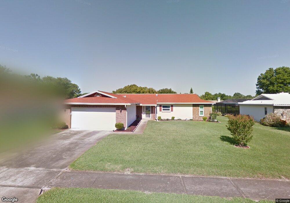
2517 Colony Dr Dunedin, FL 34698
Estimated Value: $469,552 - $558,000
--
Bed
2
Baths
1,758
Sq Ft
$300/Sq Ft
Est. Value
About This Home
This home is located at 2517 Colony Dr, Dunedin, FL 34698 and is currently estimated at $526,638, approximately $299 per square foot. 2517 Colony Dr is a home located in Pinellas County with nearby schools including Garrison-Jones Elementary School, Safety Harbor Middle School, and Dunedin High School.
Ownership History
Date
Name
Owned For
Owner Type
Purchase Details
Closed on
Jul 24, 2017
Sold by
Alderman Christy R
Bought by
Alderman Christy R and Rainey Emilie Bostian
Current Estimated Value
Purchase Details
Closed on
Jul 1, 2017
Bought by
Alderman Christy R
Purchase Details
Closed on
May 20, 1999
Sold by
Leifheit Veda E
Bought by
Alderman Christy R
Home Financials for this Owner
Home Financials are based on the most recent Mortgage that was taken out on this home.
Original Mortgage
$108,000
Interest Rate
6.87%
Mortgage Type
New Conventional
Create a Home Valuation Report for This Property
The Home Valuation Report is an in-depth analysis detailing your home's value as well as a comparison with similar homes in the area
Home Values in the Area
Average Home Value in this Area
Purchase History
| Date | Buyer | Sale Price | Title Company |
|---|---|---|---|
| Alderman Christy R | -- | Attorney | |
| Alderman Christy R | $100 | -- | |
| Alderman Christy R | $120,000 | -- |
Source: Public Records
Mortgage History
| Date | Status | Borrower | Loan Amount |
|---|---|---|---|
| Previous Owner | Alderman Christy R | $108,000 |
Source: Public Records
Tax History Compared to Growth
Tax History
| Year | Tax Paid | Tax Assessment Tax Assessment Total Assessment is a certain percentage of the fair market value that is determined by local assessors to be the total taxable value of land and additions on the property. | Land | Improvement |
|---|---|---|---|---|
| 2024 | $2,415 | $172,550 | -- | -- |
| 2023 | $2,415 | $167,524 | $0 | $0 |
| 2022 | $2,338 | $162,645 | $0 | $0 |
| 2021 | $2,362 | $157,908 | $0 | $0 |
| 2020 | $2,408 | $155,728 | $0 | $0 |
| 2019 | $2,381 | $152,227 | $0 | $0 |
| 2018 | $2,365 | $149,389 | $0 | $0 |
| 2017 | $2,337 | $146,316 | $0 | $0 |
| 2016 | $2,309 | $143,307 | $0 | $0 |
| 2015 | $2,344 | $142,311 | $0 | $0 |
| 2014 | $2,337 | $141,182 | $0 | $0 |
Source: Public Records
Map
Nearby Homes
- 2485 Indigo Dr
- 2031 Scotland Dr
- 2015 Hillwood Dr
- 2036 Forest Dr
- 2030 High Ridge Dr
- 2542 Bramblewood Dr W
- 2019 High Ridge Dr
- 2612 Bellhurst Dr
- 2127 Scotland Dr
- 2589 Redwood Cir
- 1073 Kenwood Dr
- 1641 Fieldfare Ct
- 2121 Greenbriar Blvd
- 2186 Greenbriar Blvd
- 2190 Bramblewood Dr N
- 2566 Bay Berry Dr
- 1609 Fieldfare Ct
- 1604 Fieldfare Ct
- 2211 Bay Berry Ln
- 1007 Vineyard Ct
- 2521 Colony Dr
- 2505 Colony Dr
- 2514 Indigo Dr
- 2526 Indigo Dr
- 2502 Indigo Dr
- 2529 Colony Dr
- 2033 Ridgecrest Dr
- 2032 Southpointe Dr
- 2034 Ridgecrest Dr
- 2533 Colony Dr
- 2019 Southpointe Dr
- 2011 Southpointe Dr
- 2045 Ridgecrest Dr
- 2540 Indigo Dr
- 2027 Southpointe Dr
- 2048 Southpointe Dr
- 2005 Southpointe Dr
- 2517 Indigo Dr
- 2521 Indigo Dr
- 2046 Ridgecrest Dr