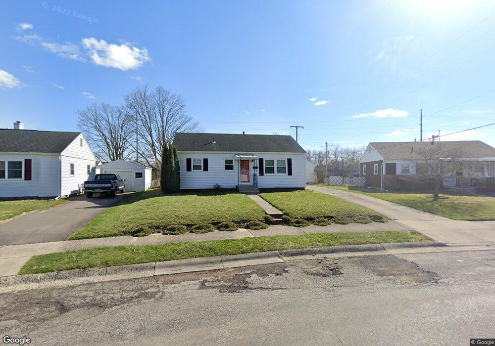
2517 Mayfair Dr Springfield, OH 45505
Estimated Value: $112,546 - $137,000
2
Beds
1
Bath
816
Sq Ft
$158/Sq Ft
Est. Value
About This Home
This home is located at 2517 Mayfair Dr, Springfield, OH 45505 and is currently estimated at $128,887, approximately $157 per square foot. 2517 Mayfair Dr is a home located in Clark County with nearby schools including Mann Elementary School, Schaefer Middle School, and Springfield High School.
Ownership History
Date
Name
Owned For
Owner Type
Purchase Details
Closed on
Jun 5, 2013
Sold by
Woodside Advisors Ltd
Bought by
Sehen Joann F
Current Estimated Value
Purchase Details
Closed on
Sep 12, 2012
Sold by
Tropp Paul L and Tropp Patricia L
Bought by
Woodside Advisors Limited
Purchase Details
Closed on
May 11, 2012
Sold by
Jordan Jennifer L
Bought by
Federal National Mortgage Association
Purchase Details
Closed on
Sep 14, 2007
Sold by
Schwartz Sally Jo
Bought by
Jordan Jennifer L
Home Financials for this Owner
Home Financials are based on the most recent Mortgage that was taken out on this home.
Original Mortgage
$67,650
Interest Rate
6.63%
Mortgage Type
Purchase Money Mortgage
Purchase Details
Closed on
Jun 17, 1994
Sold by
Hillman Pearlene L
Bought by
Schwartz Benjamin and Schwartz Sally
Purchase Details
Closed on
Aug 26, 1991
Create a Home Valuation Report for This Property
The Home Valuation Report is an in-depth analysis detailing your home's value as well as a comparison with similar homes in the area
Home Values in the Area
Average Home Value in this Area
Purchase History
| Date | Buyer | Sale Price | Title Company |
|---|---|---|---|
| Sehen Joann F | $65,000 | Ohio Real Estate Title | |
| Woodside Advisors Limited | -- | None Available | |
| Federal National Mortgage Association | $30,000 | None Available | |
| Jordan Jennifer L | $67,700 | Attorney | |
| Schwartz Benjamin | $46,500 | -- | |
| -- | $43,500 | -- |
Source: Public Records
Mortgage History
| Date | Status | Borrower | Loan Amount |
|---|---|---|---|
| Previous Owner | Jordan Jennifer L | $67,650 |
Source: Public Records
Tax History Compared to Growth
Tax History
| Year | Tax Paid | Tax Assessment Tax Assessment Total Assessment is a certain percentage of the fair market value that is determined by local assessors to be the total taxable value of land and additions on the property. | Land | Improvement |
|---|---|---|---|---|
| 2025 | $683 | $31,450 | $5,300 | $26,150 |
| 2024 | $696 | $23,600 | $4,770 | $18,830 |
| 2023 | $696 | $23,600 | $4,770 | $18,830 |
| 2022 | $734 | $23,600 | $4,770 | $18,830 |
| 2021 | $420 | $16,600 | $3,780 | $12,820 |
| 2020 | $421 | $16,600 | $3,780 | $12,820 |
| 2019 | $422 | $16,600 | $3,780 | $12,820 |
| 2018 | $384 | $15,620 | $2,840 | $12,780 |
| 2017 | $384 | $15,681 | $2,839 | $12,842 |
| 2016 | $385 | $15,681 | $2,839 | $12,842 |
| 2015 | $188 | $15,681 | $2,839 | $12,842 |
| 2014 | $187 | $15,681 | $2,839 | $12,842 |
| 2013 | $886 | $15,681 | $2,839 | $12,842 |
Source: Public Records
Map
Nearby Homes
- 2605 Morton Dr
- 2222 Kenton St
- 2345 Irwin Ave
- 2434 Irwin Ave
- 2751 Share St
- 728 Mavor St
- 374 Raffensperger Ave
- 360 Buxton Ave
- 535 S Belmont Ave
- 1915 Kenwood Ave
- 1714 Kenton St
- 1014 Beacon St
- 1554 S Belmont Ave
- 273 S Clairmont Ave
- 1652 Kenton St
- 1225 Beacon St
- 1701 Lexington Ave
- 3012 E High St
- 1601 Kenton St
- 1609 Irwin Ave
- 2511 Mayfair Dr
- 2523 Mayfair Dr
- 909 Eastmoor Dr
- 2507 Mayfair Dr
- 2516 Mayfair Dr
- 2501 Mayfair Dr
- 2508 Mayfair Dr
- 821 Eastmoor Dr
- 2502 Mayfair Dr
- 2445 Mayfair Dr
- 832 Eastmoor Dr
- 836 Eastmoor Dr
- 811 Eastmoor Dr
- 2450 Mayfair Dr
- 826 Eastmoor Dr
- 904 Eastmoor Dr
- 2441 Mayfair Dr
- 908 Eastmoor Dr
- 820 Eastmoor Dr
- 912 Eastmoor Dr