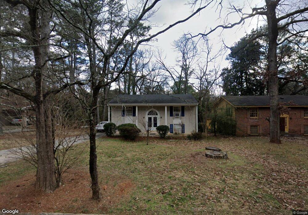
2519 Brentwood Ct Unit 4 Decatur, GA 30032
Estimated Value: $211,000 - $238,000
3
Beds
2
Baths
1,444
Sq Ft
$154/Sq Ft
Est. Value
About This Home
This home is located at 2519 Brentwood Ct Unit 4, Decatur, GA 30032 and is currently estimated at $222,015, approximately $153 per square foot. 2519 Brentwood Ct Unit 4 is a home located in DeKalb County with nearby schools including Kelley Lake Elementary School, McNair Middle School, and McNair High School.
Ownership History
Date
Name
Owned For
Owner Type
Purchase Details
Closed on
Dec 9, 2015
Sold by
Jackson Gene Edward
Bought by
Jackson Emma A
Current Estimated Value
Purchase Details
Closed on
May 30, 2002
Sold by
Evans Doris
Bought by
Delk Ida
Home Financials for this Owner
Home Financials are based on the most recent Mortgage that was taken out on this home.
Original Mortgage
$154,500
Interest Rate
10%
Mortgage Type
New Conventional
Purchase Details
Closed on
Dec 20, 1999
Sold by
Evans Lafayette
Bought by
Evans Doris
Create a Home Valuation Report for This Property
The Home Valuation Report is an in-depth analysis detailing your home's value as well as a comparison with similar homes in the area
Home Values in the Area
Average Home Value in this Area
Purchase History
| Date | Buyer | Sale Price | Title Company |
|---|---|---|---|
| Jackson Emma A | -- | -- | |
| Delk Ida | $154,500 | -- | |
| Evans Doris | -- | -- |
Source: Public Records
Mortgage History
| Date | Status | Borrower | Loan Amount |
|---|---|---|---|
| Previous Owner | Delk Ida | $154,500 |
Source: Public Records
Tax History Compared to Growth
Tax History
| Year | Tax Paid | Tax Assessment Tax Assessment Total Assessment is a certain percentage of the fair market value that is determined by local assessors to be the total taxable value of land and additions on the property. | Land | Improvement |
|---|---|---|---|---|
| 2025 | $2,578 | $88,400 | $25,120 | $63,280 |
| 2024 | $2,635 | $88,000 | $25,120 | $62,880 |
| 2023 | $2,635 | $83,000 | $20,680 | $62,320 |
| 2022 | $2,327 | $77,760 | $12,000 | $65,760 |
| 2021 | $1,665 | $49,920 | $12,000 | $37,920 |
| 2020 | $1,910 | $59,480 | $12,000 | $47,480 |
| 2019 | $1,454 | $44,080 | $12,000 | $32,080 |
| 2018 | $1,031 | $37,160 | $12,000 | $25,160 |
| 2017 | $1,158 | $34,400 | $3,200 | $31,200 |
| 2016 | $1,048 | $32,000 | $3,200 | $28,800 |
| 2014 | $634 | $19,800 | $3,200 | $16,600 |
Source: Public Records
Map
Nearby Homes
- 2522 Brentwood Ct
- 2510 Brentwood Ct
- 2504 Brentwood Rd
- 2500 Brentwood Rd
- 2544 Brentwood Rd
- 2490 Brentwood Rd
- 2554 Brentwood Rd
- 2671 Tilson Rd
- 2564 Brentwood Rd
- 2530 Habersham Dr
- 2653 Tilson Rd
- 2203 Knoll Dr
- 2479 Brentwood Rd
- 2576 Brentwood Rd
- 2196 Knoll Dr
- 2490 Habersham Dr
- 2190 Greystone Way
- 2529 Habersham Dr
- 2525 Brentwood Ct
- 2513 Brentwood Ct
- 0 Brentwood Ct Unit 7242680
- 0 Brentwood Ct Unit 7125885
- 0 Brentwood Ct Unit 7087955
- 0 Brentwood Ct Unit 8862747
- 0 Brentwood Ct Unit 8104181
- 0 Brentwood Ct Unit 8666639
- 0 Brentwood Ct Unit 8552524
- 0 Brentwood Ct Unit 8733317
- 0 Brentwood Ct Unit 7325461
- 0 Brentwood Ct
- 2507 Brentwood Ct
- 2520 Brentwood Rd
- 2516 Brentwood Rd
- 2526 Brentwood Rd
- 2510 Brentwood Rd
- 2532 Brentwood Rd
- 2537 Brentwood Ct
- 2516 Brentwood Ct