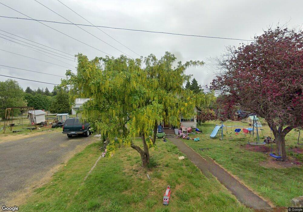
2519 E Pioneer Rd Port Angeles, WA 98362
Estimated Value: $422,000 - $538,000
3
Beds
1
Bath
992
Sq Ft
$476/Sq Ft
Est. Value
About This Home
This home is located at 2519 E Pioneer Rd, Port Angeles, WA 98362 and is currently estimated at $472,230, approximately $476 per square foot. 2519 E Pioneer Rd is a home located in Clallam County with nearby schools including Roosevelt Elementary School, Stevens Middle School, and Port Angeles High School.
Ownership History
Date
Name
Owned For
Owner Type
Purchase Details
Closed on
Feb 1, 2019
Sold by
Reid Burt W and Reid Kyllikki M
Bought by
Reid Kyllikki M
Current Estimated Value
Purchase Details
Closed on
Jun 27, 2005
Sold by
Sanford Arvil C
Bought by
Reid Burt W and Reid Kyllikki M
Home Financials for this Owner
Home Financials are based on the most recent Mortgage that was taken out on this home.
Original Mortgage
$172,000
Outstanding Balance
$90,134
Interest Rate
5.72%
Mortgage Type
New Conventional
Estimated Equity
$382,096
Create a Home Valuation Report for This Property
The Home Valuation Report is an in-depth analysis detailing your home's value as well as a comparison with similar homes in the area
Home Values in the Area
Average Home Value in this Area
Purchase History
| Date | Buyer | Sale Price | Title Company |
|---|---|---|---|
| Reid Kyllikki M | -- | Olympic Peninsula Title Co | |
| Reid Burt W | $215,000 | Olympic Peninsula Title Co |
Source: Public Records
Mortgage History
| Date | Status | Borrower | Loan Amount |
|---|---|---|---|
| Open | Reid Burt W | $172,000 |
Source: Public Records
Tax History Compared to Growth
Tax History
| Year | Tax Paid | Tax Assessment Tax Assessment Total Assessment is a certain percentage of the fair market value that is determined by local assessors to be the total taxable value of land and additions on the property. | Land | Improvement |
|---|---|---|---|---|
| 2021 | $2,620 | $218,929 | $133,809 | $85,120 |
| 2020 | $1,964 | $211,418 | $133,809 | $77,609 |
| 2018 | $1,872 | $205,651 | $133,809 | $71,842 |
| 2017 | $0 | $173,392 | $133,809 | $39,583 |
| 2016 | $1,992 | $176,289 | $133,809 | $42,480 |
| 2015 | $1,992 | $177,009 | $133,809 | $43,200 |
| 2013 | $1,992 | $178,128 | $133,809 | $44,319 |
| 2012 | $1,992 | $192,256 | $142,172 | $50,084 |
Source: Public Records
Map
Nearby Homes
- 9999 E Highway 101
- 2436 E Ryan Dr
- 2361 E Pioneer Rd
- 2826 E Myrtle St
- 5 S Del Guzzi Dr
- 16 S Del Guzzi Dr
- Lot 9 S Del Guzzi Dr
- Lot 15 S Del Guzzi Dr
- Lot 7 S Del Guzzi Dr
- 7 S Del Guzzi Dr
- 1 S Del Guzzi Dr
- Lot 18 S Del Guzzi Dr
- 15 S Del Guzzi Dr
- Lot 1 S Del Guzzi Dr
- 6 S Del Guzzi Dr
- Lot 5 S Del Guzzi Dr
- 9 S Del Guzzi Dr
- Lot 16 S Del Guzzi Dr
- Lot 6 S Del Guzzi Dr
- 9999 S Del Guzzi Dr
- 2517 E Eddy Ln
- 9999 E Highway 101 - Nob Hill
- 9999 E Highway 101 - Nob Hill
- 24701 E Highway 101
- 233814 E Highway 101
- 9999 E Hwy 101
- 9999 W Hwy 101
- 9999 W Hwy 101 Unit Parcel A just east o
- 9999 W Hwy 101 Unit 20.51 acres Hwy 101
- 9999 W Hwy 101 Unit 20.58 acres Hwy 101
- 0 Monroe Rd Unit 1103717
- 0 Monroe Rd Unit 1207231
- 0 Monroe Rd Unit Road NWM2421563
- 2444 E Pioneer Rd
- 221 N Carne St
- 2223 E Pioneer Rd
- 2442 E Highway 101
- 2431 E Highway 101
- 2431 E Highway 101 Unit E. Pioneer Road
- 2431 E Highway 101 Unit 2431 Highway 101 E