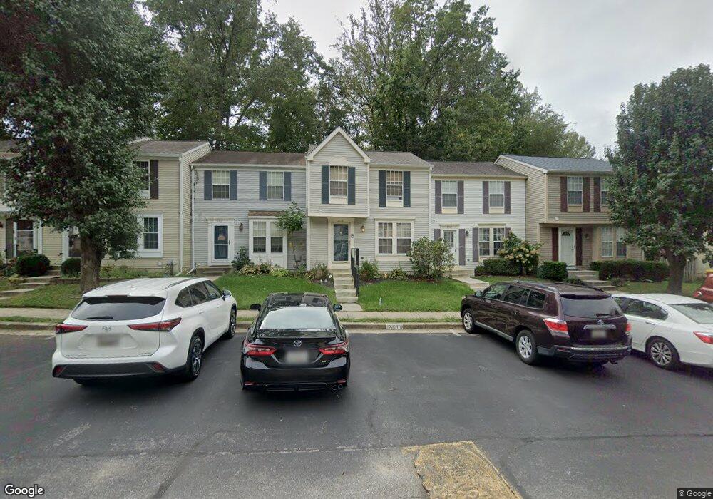
2519 Log Mill Ct Crofton, MD 21114
Estimated Value: $340,000 - $401,000
Studio
3
Baths
1,138
Sq Ft
$327/Sq Ft
Est. Value
About This Home
This home is located at 2519 Log Mill Ct, Crofton, MD 21114 and is currently estimated at $371,570, approximately $326 per square foot. 2519 Log Mill Ct is a home located in Anne Arundel County with nearby schools including Crofton Meadows Elementary School, Crofton Middle School, and Crofton High School.
Ownership History
Date
Name
Owned For
Owner Type
Purchase Details
Closed on
Oct 21, 2003
Sold by
Arnold Laura L
Bought by
Vanderweit Charles and Vanderweit Karyn
Current Estimated Value
Purchase Details
Closed on
Jul 10, 1992
Sold by
Ryland Group Inc
Bought by
Arnold Laura L
Home Financials for this Owner
Home Financials are based on the most recent Mortgage that was taken out on this home.
Original Mortgage
$129,542
Interest Rate
8.13%
Purchase Details
Closed on
Feb 5, 1992
Sold by
Crofton Meadows
Bought by
Ryland Group Inc
Create a Home Valuation Report for This Property
The Home Valuation Report is an in-depth analysis detailing your home's value as well as a comparison with similar homes in the area
Home Values in the Area
Average Home Value in this Area
Purchase History
| Date | Buyer | Sale Price | Title Company |
|---|---|---|---|
| Vanderweit Charles | $190,000 | -- | |
| Arnold Laura L | $128,800 | -- | |
| Ryland Group Inc | $234,000 | -- |
Source: Public Records
Mortgage History
| Date | Status | Borrower | Loan Amount |
|---|---|---|---|
| Previous Owner | Arnold Laura L | $129,542 |
Source: Public Records
Tax History
| Year | Tax Paid | Tax Assessment Tax Assessment Total Assessment is a certain percentage of the fair market value that is determined by local assessors to be the total taxable value of land and additions on the property. | Land | Improvement |
|---|---|---|---|---|
| 2025 | $2,864 | $296,300 | -- | -- |
| 2024 | $2,864 | $282,300 | $0 | $0 |
| 2023 | $2,774 | $268,300 | $140,000 | $128,300 |
| 2022 | $2,800 | $267,900 | $0 | $0 |
| 2020 | $2,480 | $267,100 | $140,000 | $127,100 |
| 2019 | $4,865 | $255,767 | $0 | $0 |
| 2018 | $2,479 | $244,433 | $0 | $0 |
| 2017 | $2,657 | $233,100 | $0 | $0 |
| 2016 | -- | $226,433 | $0 | $0 |
| 2015 | -- | $219,767 | $0 | $0 |
| 2014 | -- | $213,100 | $0 | $0 |
Source: Public Records
Map
Nearby Homes
- 2036 Howard Chapel Turn
- 1928 Tilghman Dr
- 1681 Yorktown Ct
- 1910 Seven Oaks Terrace
- 1648 New Windsor Ct
- 1822 Foxdale Ct
- 2004 Cambridge Dr
- 1753 Castleford Square
- 2059 Happy Ln Unit E
- 1904 Ardenwood Terrace
- 1906 Jacinto Ct
- 1746 Underwood Rd
- 2517 Chelmsford Dr
- 2444 Hightee Ct
- 1683 Hart Ct
- 1762 Lang Dr
- 2801 Klein Ct
- 2508 Stow Ct
- 1521 Fenway Rd
- 1600 Twigs Ct
- 2511 Log Mill Ct
- 2521 Log Mill Ct
- 2517 Log Mill Ct
- 2515 Log Mill Ct
- 2523 Log Mill Ct
- 2513 Log Mill Ct
- 1814 Whites Ferry Place
- 2535 Log Mill Ct Unit 1
- 2535 Log Mill Ct
- 1812 Whites Ferry Place
- 1810 Whites Ferry Place
- 2537 Log Mill Ct
- 2537 Log Mill Ct Unit 2
- 1808 Whites Ferry Place
- 2539 Log Mill Ct
- 1806 Whites Ferry Place
- 2518 Log Mill Ct
- 2516 Log Mill Ct
- 2520 Log Mill Ct
- 2520 Log Mill Ct Unit 4
Your Personal Tour Guide
Ask me questions while you tour the home.