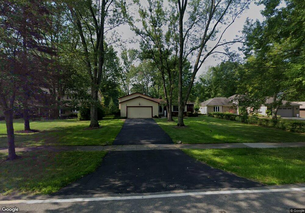
25197 Nobottom Rd Olmsted Falls, OH 44138
Estimated Value: $322,000 - $414,000
3
Beds
2
Baths
2,344
Sq Ft
$155/Sq Ft
Est. Value
About This Home
This home is located at 25197 Nobottom Rd, Olmsted Falls, OH 44138 and is currently estimated at $363,142, approximately $154 per square foot. 25197 Nobottom Rd is a home located in Cuyahoga County with nearby schools including Falls-Lenox Primary Elementary School, Olmsted Falls Intermediate Building, and Olmsted Falls Middle School.
Ownership History
Date
Name
Owned For
Owner Type
Purchase Details
Closed on
Sep 11, 2020
Sold by
Teper Anthony F and Anthony F Revocable Trust
Bought by
Teper Anthony F and Teper Gail H
Current Estimated Value
Purchase Details
Closed on
Jun 12, 2009
Sold by
Teper Anthony F and Teper Gail H
Bought by
Teper Anthony F and Teper Gail H
Purchase Details
Closed on
Jan 1, 1975
Bought by
Teper Anthony F and Teper Gail H
Create a Home Valuation Report for This Property
The Home Valuation Report is an in-depth analysis detailing your home's value as well as a comparison with similar homes in the area
Home Values in the Area
Average Home Value in this Area
Purchase History
| Date | Buyer | Sale Price | Title Company |
|---|---|---|---|
| Teper Anthony F | -- | None Available | |
| Teper Anthony F | -- | Attorney | |
| Teper Anthony F | -- | -- |
Source: Public Records
Tax History Compared to Growth
Tax History
| Year | Tax Paid | Tax Assessment Tax Assessment Total Assessment is a certain percentage of the fair market value that is determined by local assessors to be the total taxable value of land and additions on the property. | Land | Improvement |
|---|---|---|---|---|
| 2024 | $5,655 | $87,745 | $12,530 | $75,215 |
| 2023 | $5,517 | $71,440 | $13,230 | $58,210 |
| 2022 | $5,509 | $71,440 | $13,230 | $58,210 |
| 2021 | $4,895 | $71,440 | $13,230 | $58,210 |
| 2020 | $4,744 | $62,690 | $11,620 | $51,070 |
| 2019 | $4,210 | $179,100 | $33,200 | $145,900 |
| 2018 | $4,207 | $62,690 | $11,620 | $51,070 |
| 2017 | $4,452 | $61,640 | $10,010 | $51,630 |
| 2016 | $4,429 | $61,640 | $10,010 | $51,630 |
| 2015 | $4,163 | $61,640 | $10,010 | $51,630 |
| 2014 | $4,163 | $57,090 | $9,280 | $47,810 |
Source: Public Records
Map
Nearby Homes
- 7593 Columbia Rd
- 3 Dogwood Ln
- 281-12-007 River Rd
- 281-12-024 River Rd
- 25725 Cook Rd
- 7030 Columbia Rd
- V/L Columbia Rd
- 5 Hawthorn Dr
- 0 River Rd Unit 5169658
- 27 Sycamore Dr
- 11 Brookins Dr
- 55 Patio Ln
- 7587 Lewis Rd
- 11 Concert Ct
- 3 Concert Ln
- 260 Stone Ridge Way
- 16 Van Ess Dr
- 42 Periwinkle Dr
- 25950 Bagley Rd
- 20 Van Ess Dr
- 25247 Nobottom Rd
- 25141 Nobottom Rd
- 25297 Nobottom Rd
- 25085 Nobottom Rd
- 25029 Nobottom Rd
- 25190 Nobottom Rd
- 7401 Columbia Rd
- 7353 Columbia Rd
- 25000 Nobottom Rd
- 7385 Columbia Rd
- 24977 Nobottom Rd
- 25390 Nobottom Rd
- 24976 Nobottom Rd
- 7433 Columbia Rd
- 24923 Nobottom Rd
- 0 Nobottom Unit 2483359
- 0 Nobottom Unit 3092591
- 0 Nobottom Unit 4440147
- V/L Nobottom Rd
- 7435 Columbia Rd