Estimated Value: $390,000 - $469,000
4
Beds
2
Baths
1,004
Sq Ft
$421/Sq Ft
Est. Value
About This Home
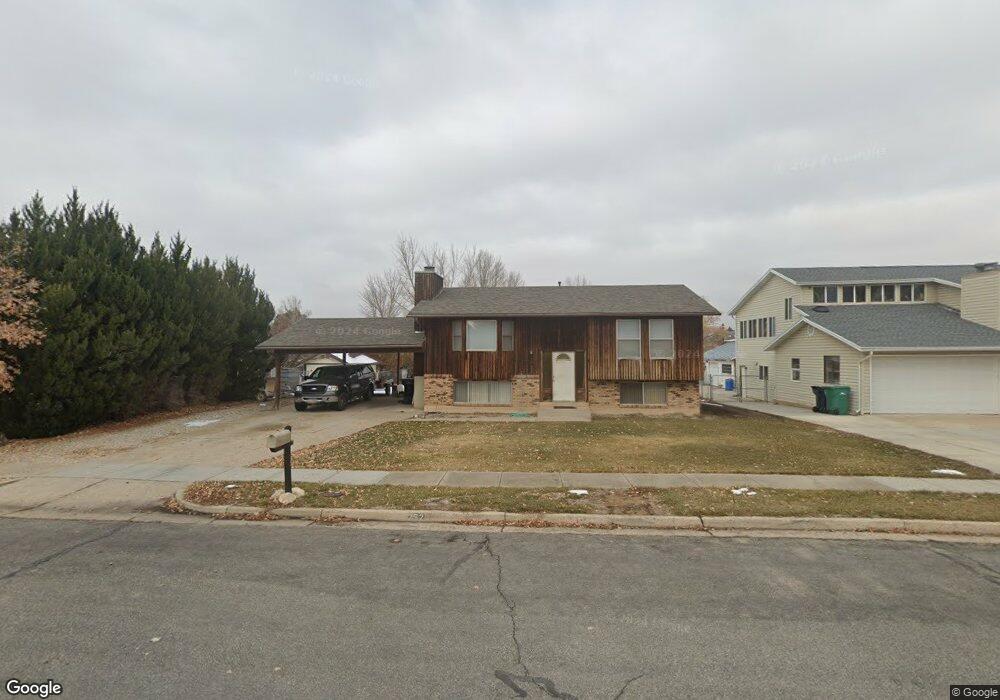
This home is located at 252 Independence Blvd, Ogden, UT 84404 and is currently estimated at $423,113, approximately $421 per square foot. 252 Independence Blvd is a home located in Weber County with nearby schools including Pioneer School, Orion Junior High School, and Fremont High School.
Ownership History
Date
Name
Owned For
Owner Type
Purchase Details
Closed on
Sep 18, 2023
Sold by
Roy Earl Bronson Family Trust
Bought by
Stagge Jason R
Current Estimated Value
Home Financials for this Owner
Home Financials are based on the most recent Mortgage that was taken out on this home.
Original Mortgage
$268,000
Outstanding Balance
$261,215
Interest Rate
6.9%
Mortgage Type
New Conventional
Estimated Equity
$161,898
Purchase Details
Closed on
Apr 19, 2017
Sold by
Bronson Roy E
Bought by
Bronson Roy E and The Roy Earl Bronson Family Tr
Purchase Details
Closed on
Oct 20, 2001
Sold by
Bronson Roy E and Bronson Gaye B
Bought by
Bronson Roy E
Create a Home Valuation Report for This Property
The Home Valuation Report is an in-depth analysis detailing your home's value as well as a comparison with similar homes in the area
Home Values in the Area
Average Home Value in this Area
Purchase History
| Date | Buyer | Sale Price | Title Company |
|---|---|---|---|
| Stagge Jason R | -- | Stewart Title | |
| Bronson Roy E | -- | None Available | |
| Bronson Roy E | -- | Security Title |
Source: Public Records
Mortgage History
| Date | Status | Borrower | Loan Amount |
|---|---|---|---|
| Open | Stagge Jason R | $268,000 |
Source: Public Records
Tax History
| Year | Tax Paid | Tax Assessment Tax Assessment Total Assessment is a certain percentage of the fair market value that is determined by local assessors to be the total taxable value of land and additions on the property. | Land | Improvement |
|---|---|---|---|---|
| 2025 | $2,727 | $213,539 | $72,543 | $140,996 |
| 2024 | $2,705 | $210,099 | $72,542 | $137,557 |
| 2023 | $2,552 | $364,000 | $130,896 | $233,104 |
| 2022 | $2,379 | $190,300 | $66,147 | $124,153 |
| 2021 | $1,879 | $271,000 | $75,702 | $195,298 |
| 2020 | $1,892 | $254,000 | $58,635 | $195,365 |
| 2019 | $1,769 | $223,000 | $48,453 | $174,547 |
| 2018 | $1,647 | $197,000 | $46,420 | $150,580 |
| 2017 | $1,462 | $162,000 | $46,420 | $115,580 |
| 2016 | $1,389 | $82,960 | $24,437 | $58,523 |
| 2015 | $1,285 | $75,299 | $21,648 | $53,651 |
| 2014 | $1,253 | $71,849 | $21,648 | $50,201 |
Source: Public Records
Map
Nearby Homes
- 1307 N 225 W
- 1212 N Virginia Ave
- 2440 U S Highway 89
- 116 E 1150 N
- 2458 N Highway 89 Hwy
- 1743 N 400 W
- 247 E 1825 N Unit 11
- 247 E 1825 N Unit 7
- 247 E 1825 N Unit 5
- 1016 N 325 W
- 180 W 1825 N
- 293 E 1500 North St
- 302 E 1275 N Unit 109
- 1268 N 300 E Unit 177
- 1262 N 300 E Unit 178
- 1256 N 300 E Unit 179
- 1252 N 300 E Unit 180
- 318 E 1275 N Unit 115
- 315 E 1650 N Unit 124
- 315 E 1650 N Unit 125
- 264 Independence Blvd
- 246 Independence Blvd
- 270 Independence Blvd
- 234 Independence Blvd
- 241 Independence Blvd
- 257 Independence Blvd
- 278 Independence Blvd
- 222 Independence Blvd
- 239 Independence Blvd
- 1384 Franklin Cir
- 227 Independence Blvd
- 279 Independence Blvd
- 1368 Franklin Cir
- 1314 Georgia Ave
- 295 Independence Blvd
- 1292 Georgia Ave
- 1273 Georgia Ave
- 1273 Georgia Ave Unit 10
- 1355 Franklin Cir
- 1377 N Franklin Cir
Your Personal Tour Guide
Ask me questions while you tour the home.