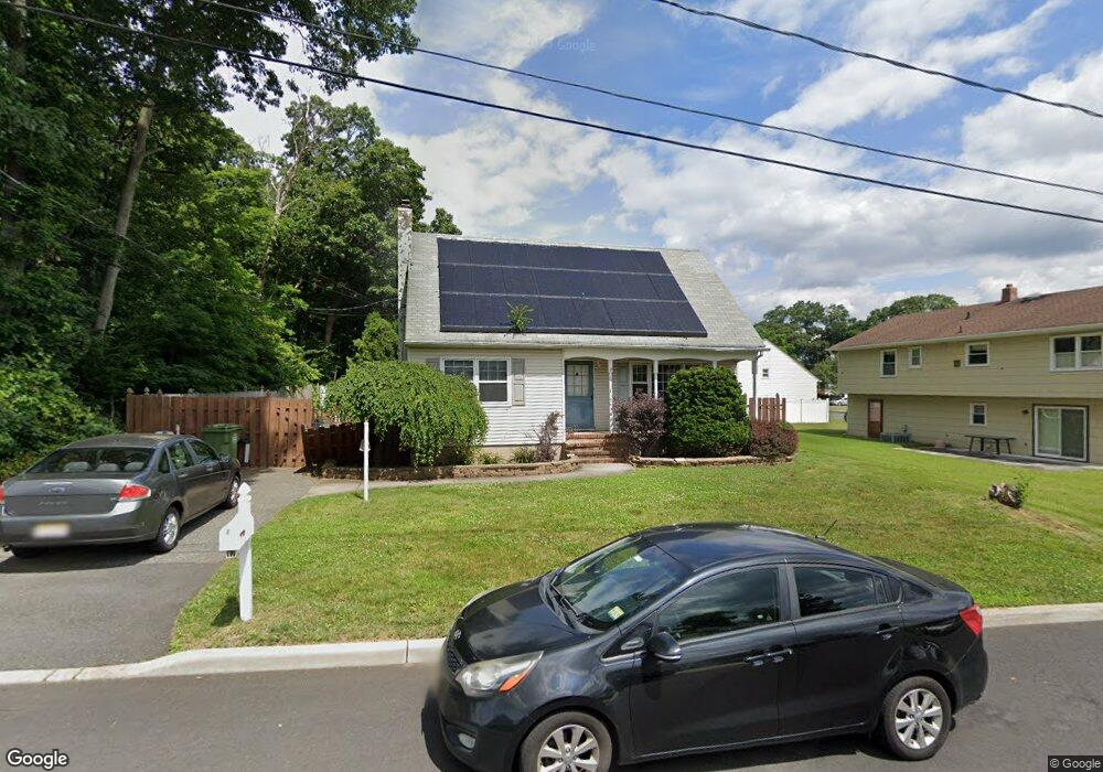
252 Kath St South Amboy, NJ 08879
Estimated Value: $458,065 - $604,000
--
Bed
--
Bath
--
Sq Ft
6,490
Sq Ft Lot
About This Home
This home is located at 252 Kath St, South Amboy, NJ 08879 and is currently estimated at $532,016. 252 Kath St is a home located in Middlesex County with nearby schools including Sayreville War Memorial High School, St. Mary Elementary School, and Cardinal Mccarrick High School.
Ownership History
Date
Name
Owned For
Owner Type
Purchase Details
Closed on
Aug 7, 2002
Sold by
Czarnecki Greg
Bought by
Pereira Frances and Pereira Jesus
Current Estimated Value
Home Financials for this Owner
Home Financials are based on the most recent Mortgage that was taken out on this home.
Original Mortgage
$222,000
Outstanding Balance
$93,469
Interest Rate
6.48%
Estimated Equity
$438,547
Purchase Details
Closed on
Aug 5, 1994
Sold by
Presnal Michael
Bought by
Czarnecki Greg
Home Financials for this Owner
Home Financials are based on the most recent Mortgage that was taken out on this home.
Original Mortgage
$136,000
Interest Rate
8.52%
Create a Home Valuation Report for This Property
The Home Valuation Report is an in-depth analysis detailing your home's value as well as a comparison with similar homes in the area
Home Values in the Area
Average Home Value in this Area
Purchase History
| Date | Buyer | Sale Price | Title Company |
|---|---|---|---|
| Pereira Frances | $247,000 | -- | |
| Czarnecki Greg | $151,200 | -- |
Source: Public Records
Mortgage History
| Date | Status | Borrower | Loan Amount |
|---|---|---|---|
| Open | Pereira Frances | $222,000 | |
| Previous Owner | Czarnecki Greg | $136,000 |
Source: Public Records
Tax History Compared to Growth
Tax History
| Year | Tax Paid | Tax Assessment Tax Assessment Total Assessment is a certain percentage of the fair market value that is determined by local assessors to be the total taxable value of land and additions on the property. | Land | Improvement |
|---|---|---|---|---|
| 2025 | $8,394 | $137,500 | $49,000 | $88,500 |
| 2024 | $8,162 | $137,500 | $49,000 | $88,500 |
| 2023 | $8,162 | $137,500 | $49,000 | $88,500 |
| 2022 | $7,624 | $137,500 | $49,000 | $88,500 |
| 2021 | $7,046 | $137,500 | $49,000 | $88,500 |
| 2020 | $7,349 | $137,500 | $49,000 | $88,500 |
| 2019 | $7,195 | $137,500 | $49,000 | $88,500 |
| 2018 | $7,066 | $137,500 | $49,000 | $88,500 |
| 2017 | $6,903 | $137,500 | $49,000 | $88,500 |
| 2016 | $6,718 | $137,500 | $49,000 | $88,500 |
| 2015 | $6,566 | $137,500 | $49,000 | $88,500 |
| 2014 | $6,390 | $137,500 | $49,000 | $88,500 |
Source: Public Records
Map
Nearby Homes
- 442 Brook Ave
- 259 Gereghty St
- 452 Brook Ave
- 251 Kath St
- 436 Brook Ave
- 1 Radford Ferry Rd
- 1 Radford Ferry Rd Unit 141
- 255 Gereghty St
- 439 Brook Ave
- 430 Brook Ave
- 264 Gereghty St
- 9 Singleton St
- 460 Brook Ave
- 251 Gereghty St
- 248 Kath St
- 249 Kath St
- 245 Gereghty St
- 429 Brook Ave
- 244 Kath St
- 250 Gereghty St