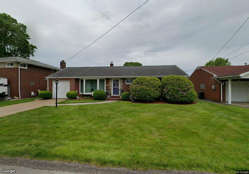
252 Marlboro Dr New Kensington, PA 15068
Estimated Value: $81,802 - $278,000
--
Bed
--
Bath
--
Sq Ft
7,797
Sq Ft Lot
About This Home
This home is located at 252 Marlboro Dr, New Kensington, PA 15068 and is currently estimated at $199,951. 252 Marlboro Dr is a home located in Westmoreland County with nearby schools including Mary Queen of Apostles School.
Ownership History
Date
Name
Owned For
Owner Type
Purchase Details
Closed on
Apr 3, 2010
Sold by
Saellam Selma L
Bought by
Saellam Selma L
Current Estimated Value
Home Financials for this Owner
Home Financials are based on the most recent Mortgage that was taken out on this home.
Original Mortgage
$84,500
Interest Rate
5.11%
Mortgage Type
Stand Alone Refi Refinance Of Original Loan
Create a Home Valuation Report for This Property
The Home Valuation Report is an in-depth analysis detailing your home's value as well as a comparison with similar homes in the area
Home Values in the Area
Average Home Value in this Area
Purchase History
| Date | Buyer | Sale Price | Title Company |
|---|---|---|---|
| Saellam Selma L | $80,000 | None Available |
Source: Public Records
Mortgage History
| Date | Status | Borrower | Loan Amount |
|---|---|---|---|
| Closed | Saellam Selma L | $84,500 |
Source: Public Records
Tax History Compared to Growth
Tax History
| Year | Tax Paid | Tax Assessment Tax Assessment Total Assessment is a certain percentage of the fair market value that is determined by local assessors to be the total taxable value of land and additions on the property. | Land | Improvement |
|---|---|---|---|---|
| 2025 | $3,252 | $20,370 | $4,180 | $16,190 |
| 2024 | $3,222 | $20,370 | $4,180 | $16,190 |
| 2023 | $3,049 | $20,370 | $4,180 | $16,190 |
| 2022 | $2,955 | $20,370 | $4,180 | $16,190 |
| 2021 | $2,888 | $20,370 | $4,180 | $16,190 |
| 2020 | $2,827 | $20,370 | $4,180 | $16,190 |
| 2019 | $2,756 | $20,370 | $4,180 | $16,190 |
| 2018 | $2,715 | $20,370 | $4,180 | $16,190 |
| 2017 | $2,674 | $20,370 | $4,180 | $16,190 |
| 2016 | $2,674 | $20,370 | $4,180 | $16,190 |
| 2015 | $2,674 | $20,370 | $4,180 | $16,190 |
| 2014 | $2,570 | $20,370 | $4,180 | $16,190 |
Source: Public Records
Map
Nearby Homes
- 220 Falcon Ridge Dr
- 2538 Richdale Dr
- 408 Craigdell Rd
- 201 Adia Ln
- 181 Edward St
- 901 Valentina Ln
- 2647 Paige St
- 2647 Norma Dr
- 103 Woodstone Ln Unit 34
- 1038 Manor Rd
- 2108 Hollingsworth St
- 715 Carl Ave
- 1741 Freeport Rd Unit U
- 648 Earl Ave
- 1802 Kimball Ave
- 1024 Knollwood Rd
- 1407 Drey St Unit 29
- 158 Michigan Ave
- 1735 Kimball Ave
- 1809 Kimball Ave