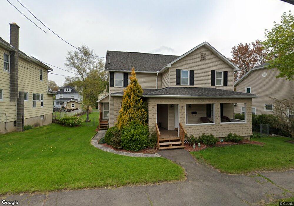
252 N Main St Archbald, PA 18403
Estimated Value: $175,000 - $268,000
4
Beds
2
Baths
1,784
Sq Ft
$123/Sq Ft
Est. Value
About This Home
This home is located at 252 N Main St, Archbald, PA 18403 and is currently estimated at $219,740, approximately $123 per square foot. 252 N Main St is a home located in Lackawanna County with nearby schools including Valley View Intermediate School, Valley View Middle School, and Valley View High School.
Ownership History
Date
Name
Owned For
Owner Type
Purchase Details
Closed on
Aug 2, 2024
Sold by
Castrogiovanni Tara Mae and Castrogiovanni Jeremy
Bought by
Castrogiovanni Tara Mae
Current Estimated Value
Purchase Details
Closed on
Aug 17, 2010
Sold by
Wells Fargo Bank National Association
Bought by
Hudson Holdings Llc
Purchase Details
Closed on
Jul 21, 2010
Sold by
Chapman Michael J and Chapman Shawn D
Bought by
Wells Fargo Bank National Association
Purchase Details
Closed on
May 3, 2006
Sold by
Chapman Michael J and Tasker Shawn D
Bought by
Chapman Michael J and Chapman Shawn D
Create a Home Valuation Report for This Property
The Home Valuation Report is an in-depth analysis detailing your home's value as well as a comparison with similar homes in the area
Home Values in the Area
Average Home Value in this Area
Purchase History
| Date | Buyer | Sale Price | Title Company |
|---|---|---|---|
| Castrogiovanni Tara Mae | -- | None Listed On Document | |
| Hudson Holdings Llc | $44,750 | None Available | |
| Wells Fargo Bank National Association | $1,913 | None Available | |
| Chapman Michael J | -- | None Available |
Source: Public Records
Tax History Compared to Growth
Tax History
| Year | Tax Paid | Tax Assessment Tax Assessment Total Assessment is a certain percentage of the fair market value that is determined by local assessors to be the total taxable value of land and additions on the property. | Land | Improvement |
|---|---|---|---|---|
| 2025 | $1,647 | $6,400 | $2,400 | $4,000 |
| 2024 | $1,413 | $6,400 | $2,400 | $4,000 |
| 2023 | $1,413 | $6,400 | $2,400 | $4,000 |
| 2022 | $1,368 | $6,400 | $2,400 | $4,000 |
| 2021 | $1,365 | $6,400 | $2,400 | $4,000 |
| 2020 | $1,340 | $6,400 | $2,400 | $4,000 |
| 2019 | $1,243 | $6,400 | $2,400 | $4,000 |
| 2018 | $1,220 | $6,400 | $2,400 | $4,000 |
| 2017 | $1,214 | $6,400 | $2,400 | $4,000 |
| 2016 | $712 | $6,400 | $2,400 | $4,000 |
| 2015 | -- | $6,400 | $2,400 | $4,000 |
| 2014 | -- | $6,400 | $2,400 | $4,000 |
Source: Public Records
Map
Nearby Homes
- 287 Main St Unit REAR STURGES
- 818 Henry St
- 0 Joel (Lot 30) Dr
- 462 Delaware St
- 0 Ledgewood Dr
- 1104 E Filbert St
- 1108 Filbert St
- 0 Skyline Dr
- 197 Columbus Dr
- 1119 E State St
- 0 Forest Ln
- 217 219 Laurel St
- 00 Hickory St
- 112 Pine St
- 116 S Main St
- 0 Joel (Lot 4) Dr
- 1317 Crestwood Dr
- 446 Kennedy Dr
- 0 Joel (Lot 49) Dr Unit GSBSC3076
- 140 Cemetery St