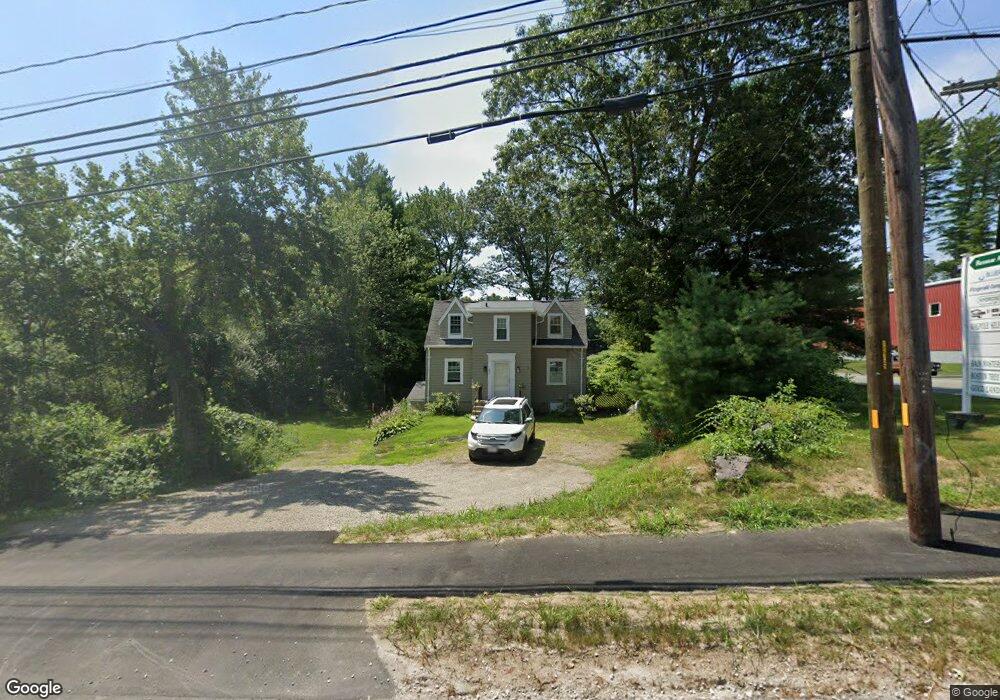
252 Norfolk St Walpole, MA 02081
3
Beds
1
Bath
1,253
Sq Ft
0.92
Acres
About This Home
This home is located at 252 Norfolk St, Walpole, MA 02081. 252 Norfolk St is a home located in Norfolk County with nearby schools including Elm Street School, Eleanor N. Johnson Middle School, and Walpole High School.
Ownership History
Date
Name
Owned For
Owner Type
Purchase Details
Closed on
Mar 23, 2009
Sold by
Cataldo Paul and Cataldo April
Bought by
Norfolk-Renmar Rlty Ll
Home Financials for this Owner
Home Financials are based on the most recent Mortgage that was taken out on this home.
Original Mortgage
$440,000
Outstanding Balance
$281,556
Interest Rate
5.25%
Mortgage Type
Commercial
Purchase Details
Closed on
Aug 31, 1995
Sold by
Cuddy Ann
Bought by
Cataldo Paul
Home Financials for this Owner
Home Financials are based on the most recent Mortgage that was taken out on this home.
Original Mortgage
$109,295
Interest Rate
7.61%
Mortgage Type
Commercial
Create a Home Valuation Report for This Property
The Home Valuation Report is an in-depth analysis detailing your home's value as well as a comparison with similar homes in the area
Home Values in the Area
Average Home Value in this Area
Purchase History
| Date | Buyer | Sale Price | Title Company |
|---|---|---|---|
| Norfolk-Renmar Rlty Ll | $315,000 | -- | |
| Cataldo Paul | $109,500 | -- |
Source: Public Records
Mortgage History
| Date | Status | Borrower | Loan Amount |
|---|---|---|---|
| Open | Norfolk-Renmar Rlty Ll | $440,000 | |
| Previous Owner | Cataldo Paul | $143,150 | |
| Previous Owner | Cataldo Paul | $109,295 | |
| Previous Owner | Cataldo Paul | $100,000 |
Source: Public Records
Tax History Compared to Growth
Tax History
| Year | Tax Paid | Tax Assessment Tax Assessment Total Assessment is a certain percentage of the fair market value that is determined by local assessors to be the total taxable value of land and additions on the property. | Land | Improvement |
|---|---|---|---|---|
| 2025 | -- | $741,900 | $323,200 | $418,700 |
| 2024 | -- | $713,000 | $314,900 | $398,100 |
| 2023 | $0 | $691,800 | $300,900 | $390,900 |
| 2022 | $0 | $621,600 | $278,600 | $343,000 |
| 2021 | $0 | $578,900 | $252,200 | $326,700 |
| 2020 | $0 | $570,600 | $252,200 | $318,400 |
| 2019 | $0 | $550,300 | $242,000 | $308,300 |
| 2018 | $0 | $538,400 | $242,000 | $296,400 |
| 2017 | $0 | $527,100 | $237,300 | $289,800 |
| 2016 | -- | $488,400 | $220,000 | $268,400 |
| 2015 | -- | $465,600 | $209,600 | $256,000 |
| 2014 | -- | $450,300 | $209,600 | $240,700 |
Source: Public Records
Map
Nearby Homes
- 13 Sandtrap Cir Unit 14
- 11 Sandtrap Cir Unit 15
- 20 Sandtrap Cir Unit 4
- 18 Sandtrap Cir Unit 3
- 17 Sandtrap Cir Unit 12
- 15 Sandtrap Cir Unit 13
- 10 Sandtrap Cir Unit 2
- 31 Sandtrap Cir Unit 5
- 14 Tiger Terrace Unit 29
- 16 Magpie Cir Unit 16
- 137 Clear Pond Dr
- 127 Clear Pond Dr
- 18 Teal Cir
- 24 Pelican Dr
- 1391 Main St Unit 304
- 1391 Main St Unit 208
- 1391 Main St Unit 305
- 1391 Main St Unit 308
- 12 Timberline Dr Unit 28
- 43 Chandler Ave
- 19 Forrest Rd
- 480 West St
- 35 Merchants Dr
- 35 Merchants Dr Unit C
- 220 Norfolk St
- 22 Forrest Rd
- 475 West St
- 20 Forrest Rd
- 10 Forrest Rd
- 5 Merchants Dr
- 231 Norfolk St
- 530 West St
- 6 Merchants Drive Lot 6
- 30 Merchants Dr
- 20 Merchants Dr
- 534 West St
- 531 West St
- 10 Merchants Dr
- 200 Norfolk St
- 200 Norfolk St Unit B