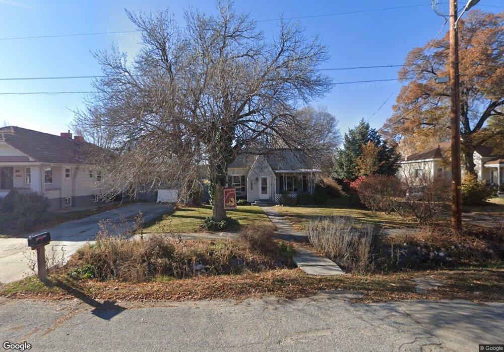
252 S 100 W American Fork, UT 84003
Estimated Value: $386,000 - $417,000
2
Beds
1
Bath
1,101
Sq Ft
$366/Sq Ft
Est. Value
About This Home
This home is located at 252 S 100 W, American Fork, UT 84003 and is currently estimated at $402,607, approximately $365 per square foot. 252 S 100 W is a home located in Utah County with nearby schools including Greenwood Elementary School, American Fork Junior High School, and American Fork High School.
Ownership History
Date
Name
Owned For
Owner Type
Purchase Details
Closed on
Sep 30, 2025
Sold by
Lynne Rhodes Revocable Trust and Bullock Connie
Bought by
Bullock William Brent and Bullock Connie
Current Estimated Value
Home Financials for this Owner
Home Financials are based on the most recent Mortgage that was taken out on this home.
Original Mortgage
$220,000
Outstanding Balance
$220,000
Interest Rate
6.58%
Mortgage Type
New Conventional
Estimated Equity
$182,607
Purchase Details
Closed on
Nov 1, 2023
Sold by
Rhodes Lynnel
Bought by
Lynnel Rhodes Revocable Trust and Rhodes
Purchase Details
Closed on
Jul 23, 2009
Sold by
Rhodes Lynnel
Bought by
Utah Department Of Transportation
Home Financials for this Owner
Home Financials are based on the most recent Mortgage that was taken out on this home.
Original Mortgage
$54,698
Interest Rate
5.19%
Mortgage Type
Purchase Money Mortgage
Purchase Details
Closed on
May 18, 1998
Sold by
Rhodes Lynnel
Bought by
Rhodes Lynnel
Home Financials for this Owner
Home Financials are based on the most recent Mortgage that was taken out on this home.
Original Mortgage
$60,000
Interest Rate
7.07%
Create a Home Valuation Report for This Property
The Home Valuation Report is an in-depth analysis detailing your home's value as well as a comparison with similar homes in the area
Home Values in the Area
Average Home Value in this Area
Purchase History
| Date | Buyer | Sale Price | Title Company |
|---|---|---|---|
| Bullock William Brent | -- | First American Title Insurance | |
| Lynnel Rhodes Revocable Trust | -- | None Listed On Document | |
| Utah Department Of Transportation | -- | None Available | |
| Rhodes Lynnel | -- | -- |
Source: Public Records
Mortgage History
| Date | Status | Borrower | Loan Amount |
|---|---|---|---|
| Open | Bullock William Brent | $220,000 | |
| Previous Owner | Utah Department Of Transportation | $54,698 | |
| Previous Owner | Rhodes Lynnel | $60,000 |
Source: Public Records
Tax History Compared to Growth
Tax History
| Year | Tax Paid | Tax Assessment Tax Assessment Total Assessment is a certain percentage of the fair market value that is determined by local assessors to be the total taxable value of land and additions on the property. | Land | Improvement |
|---|---|---|---|---|
| 2025 | $1,600 | $190,190 | $212,500 | $133,300 |
| 2024 | $1,600 | $177,760 | $0 | $0 |
| 2023 | $1,469 | $173,635 | $0 | $0 |
| 2022 | $1,605 | $186,560 | $0 | $0 |
| 2021 | $1,360 | $247,000 | $152,500 | $94,500 |
| 2020 | $1,266 | $222,900 | $136,200 | $86,700 |
| 2019 | $1,117 | $203,400 | $116,700 | $86,700 |
| 2018 | $1,036 | $180,500 | $105,100 | $75,400 |
| 2017 | $989 | $92,950 | $0 | $0 |
| 2016 | $906 | $79,145 | $0 | $0 |
| 2015 | $955 | $79,145 | $0 | $0 |
| 2014 | $942 | $77,000 | $0 | $0 |
Source: Public Records
Map
Nearby Homes
- 195 S Center St
- 271 S Barratt Cir
- 55 S 200 W
- Evergreen Plan at Storrs Court
- Juniper Plan at Storrs Court
- Redwood Plan at Storrs Court
- Ashwood Plan at Storrs Court
- 65 E 400 S Unit 8
- 429 S Storrs Ave
- 316 W 390 S
- 228 W 470 S
- 351 Washington Ave
- 382 W 330 S
- 365 W 370 S
- 82 S Lincoln Ave
- 424 S 340 W
- 129 W Pacific Dr
- 105 N 100 W
- 55 Roosevelt Ave
- 217 W Main St