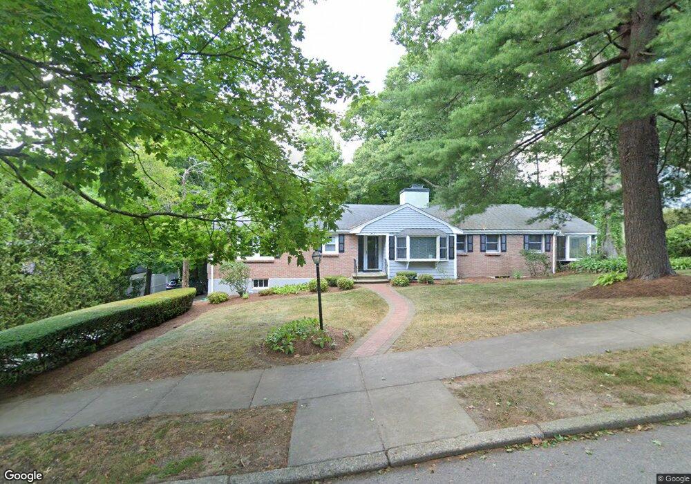
252 Upland Ave Newton Highlands, MA 02461
Newton Highlands NeighborhoodEstimated Value: $1,613,000 - $1,880,000
4
Beds
3
Baths
2,365
Sq Ft
$740/Sq Ft
Est. Value
About This Home
This home is located at 252 Upland Ave, Newton Highlands, MA 02461 and is currently estimated at $1,749,399, approximately $739 per square foot. 252 Upland Ave is a home located in Middlesex County with nearby schools including Countryside Elementary School, Charles E Brown Middle School, and Newton South High School.
Ownership History
Date
Name
Owned For
Owner Type
Purchase Details
Closed on
May 6, 2021
Sold by
Goldman Barbara G and Bloom Steven H
Bought by
B G Goldman 2021 Ret
Current Estimated Value
Purchase Details
Closed on
Mar 15, 2006
Sold by
Penzias Alan S and Goldman Barbara G
Bought by
Goldman Barbara G
Purchase Details
Closed on
Jul 19, 1993
Sold by
Fine Gerald S and Schneider-Fine Risa
Bought by
Penzias Alan S and Penzias Barbara G
Home Financials for this Owner
Home Financials are based on the most recent Mortgage that was taken out on this home.
Original Mortgage
$340,000
Interest Rate
7.4%
Mortgage Type
Purchase Money Mortgage
Create a Home Valuation Report for This Property
The Home Valuation Report is an in-depth analysis detailing your home's value as well as a comparison with similar homes in the area
Home Values in the Area
Average Home Value in this Area
Purchase History
| Date | Buyer | Sale Price | Title Company |
|---|---|---|---|
| B G Goldman 2021 Ret | -- | None Available | |
| Goldman Barbara G | -- | -- | |
| Penzias Alan S | $425,000 | -- |
Source: Public Records
Mortgage History
| Date | Status | Borrower | Loan Amount |
|---|---|---|---|
| Previous Owner | Penzias Alan S | $186,500 | |
| Previous Owner | Penzias Alan S | $218,000 | |
| Previous Owner | Penzias Alan S | $340,000 | |
| Previous Owner | Penzias Alan S | $150,000 |
Source: Public Records
Tax History Compared to Growth
Tax History
| Year | Tax Paid | Tax Assessment Tax Assessment Total Assessment is a certain percentage of the fair market value that is determined by local assessors to be the total taxable value of land and additions on the property. | Land | Improvement |
|---|---|---|---|---|
| 2025 | $14,033 | $1,431,900 | $1,227,200 | $204,700 |
| 2024 | $13,568 | $1,390,200 | $1,191,500 | $198,700 |
| 2023 | $12,867 | $1,263,900 | $941,400 | $322,500 |
| 2022 | $12,312 | $1,170,300 | $871,700 | $298,600 |
| 2021 | $11,880 | $1,104,100 | $822,400 | $281,700 |
| 2020 | $11,527 | $1,104,100 | $822,400 | $281,700 |
| 2019 | $11,201 | $1,071,900 | $798,400 | $273,500 |
| 2018 | $10,846 | $1,002,400 | $722,400 | $280,000 |
| 2017 | $10,516 | $945,700 | $681,500 | $264,200 |
| 2016 | $10,058 | $883,800 | $636,900 | $246,900 |
| 2015 | $9,590 | $826,000 | $595,200 | $230,800 |
Source: Public Records
Map
Nearby Homes
- 36 Cannon St
- 116 Upland Ave
- 51 Carl St
- 250 Woodcliff Rd
- 15 Buff Cir
- 128 Charlemont St
- 36 Roland St
- 415 Dedham St Unit D
- 1308 Walnut St
- 1292 Walnut St
- 125 Oakdale Rd
- 19 Selwyn Rd
- 3 Glenmore Terrace Unit 2
- 183 Oak St Unit 307
- 183 Oak St Unit 205
- 1629 Centre St
- 1623-1625 Centre St
- 45 Brandeis Rd
- 671 Boylston St
- 66 Linden St
- 61 Brush Hill Rd
- 244 Upland Ave
- 125 Dane Hill Rd
- 51 Brush Hill Rd
- 236 Upland Ave
- 119 Dane Hill Rd
- 237 Upland Ave
- 131 Dane Hill Rd
- 60 Brush Hill Rd
- 265 Upland Ave
- 241 Upland Ave
- 111 Dane Hill Rd
- 243 Upland Ave
- 54 Brush Hill Rd
- 115 Willard St
- 41 Brush Hill Rd
- 120 Willard St
- 231 Upland Ave
- 44 Brush Hill Rd
- 273 Upland Ave