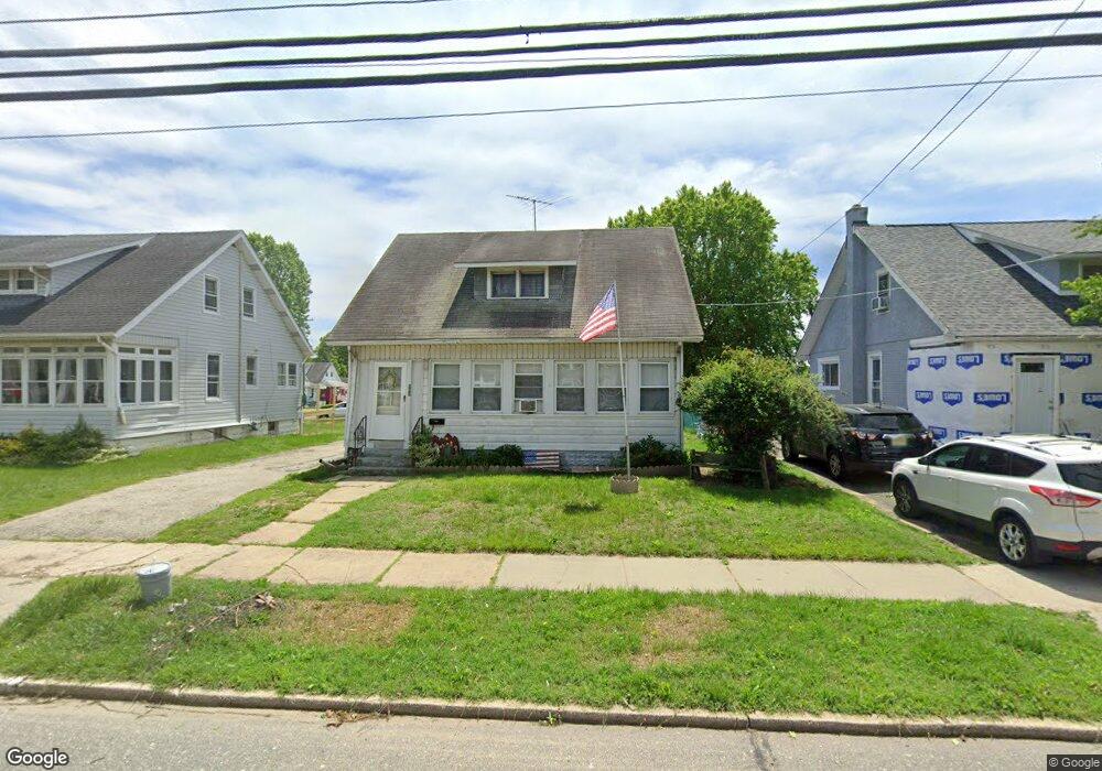
252 W Broad St Gibbstown, NJ 08027
Greenwich Township NeighborhoodEstimated Value: $211,738 - $265,000
--
Bed
--
Bath
1,209
Sq Ft
$203/Sq Ft
Est. Value
About This Home
This home is located at 252 W Broad St, Gibbstown, NJ 08027 and is currently estimated at $245,685, approximately $203 per square foot. 252 W Broad St is a home located in Gloucester County with nearby schools including Nehaunsey Middle School and Guardian Angels Regional School.
Ownership History
Date
Name
Owned For
Owner Type
Purchase Details
Closed on
Jul 12, 2016
Sold by
Pihs Gertrude M
Bought by
Wood David E and Wood Christine T
Current Estimated Value
Create a Home Valuation Report for This Property
The Home Valuation Report is an in-depth analysis detailing your home's value as well as a comparison with similar homes in the area
Home Values in the Area
Average Home Value in this Area
Purchase History
| Date | Buyer | Sale Price | Title Company |
|---|---|---|---|
| Wood David E | -- | None Available |
Source: Public Records
Tax History Compared to Growth
Tax History
| Year | Tax Paid | Tax Assessment Tax Assessment Total Assessment is a certain percentage of the fair market value that is determined by local assessors to be the total taxable value of land and additions on the property. | Land | Improvement |
|---|---|---|---|---|
| 2025 | $4,159 | $120,800 | $20,600 | $100,200 |
| 2024 | $3,941 | $120,800 | $20,600 | $100,200 |
| 2023 | $3,941 | $120,800 | $20,600 | $100,200 |
| 2022 | $3,943 | $120,800 | $20,600 | $100,200 |
| 2021 | $3,902 | $120,800 | $20,600 | $100,200 |
| 2020 | $3,956 | $120,800 | $20,600 | $100,200 |
| 2019 | $3,959 | $120,800 | $20,600 | $100,200 |
| 2018 | $3,846 | $120,800 | $20,600 | $100,200 |
| 2017 | $3,753 | $120,800 | $20,600 | $100,200 |
| 2016 | $3,712 | $120,800 | $20,600 | $100,200 |
| 2015 | $3,593 | $120,800 | $20,600 | $100,200 |
| 2014 | $3,438 | $120,800 | $20,600 | $100,200 |
Source: Public Records
Map
Nearby Homes
- 431 Washington St
- 433 Jefferson St
- 157 S Poplar St
- W Broad St
- 132 Tomlin Station Rd
- 752 Duncan Ave
- 456 Freund Ave
- 0 S Democrat Rd Unit NJGL2065008
- 0 Swedesboro Ave Unit NJGL2061592
- 330 Croce Ave
- 126 Repaupo Station Rd
- 43 45 Repaupo Station Rd
- 219 Vanneman Blvd
- 792 Paulsboro Rd
- 344 W Washington St
- 335 W Buck St
- 788 Paulsboro Rd
- L18 20 W Broad St
- 0 Rd Unit NJGL2061600
- 255 Elizabeth Ave