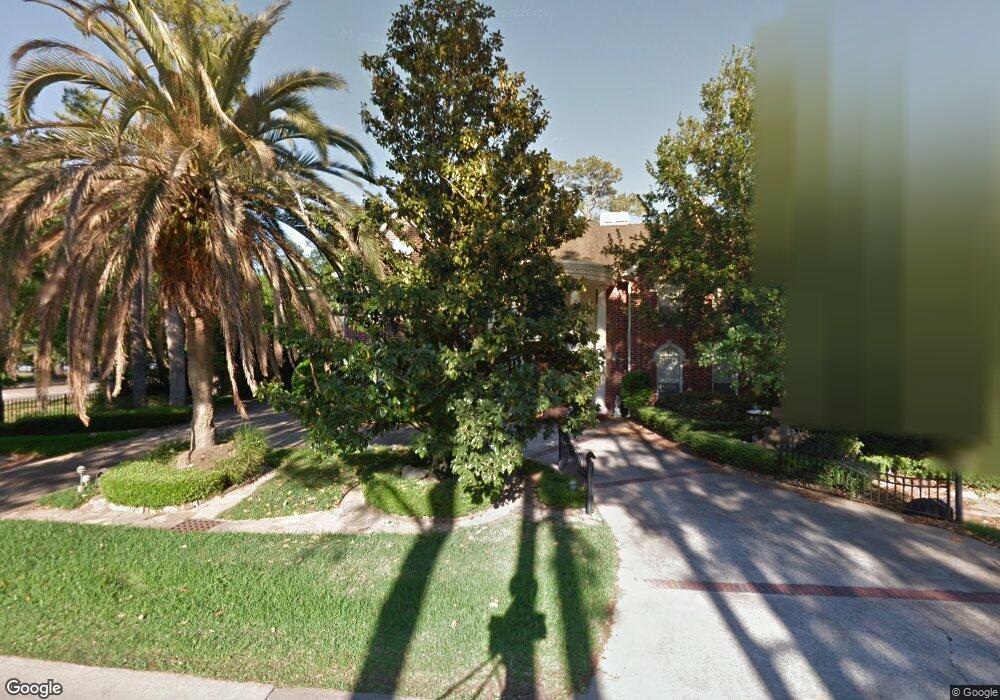
252 Warrenton Dr Houston, TX 77024
Memorial NeighborhoodEstimated Value: $1,801,000 - $2,091,000
5
Beds
6
Baths
4,528
Sq Ft
$424/Sq Ft
Est. Value
About This Home
This home is located at 252 Warrenton Dr, Houston, TX 77024 and is currently estimated at $1,918,732, approximately $423 per square foot. 252 Warrenton Dr is a home located in Harris County with nearby schools including Frostwood Elementary School, Memorial Middle, and Memorial High School.
Ownership History
Date
Name
Owned For
Owner Type
Purchase Details
Closed on
Oct 2, 2013
Sold by
Horn Michael
Bought by
Kurlander Harold
Current Estimated Value
Purchase Details
Closed on
Dec 23, 2011
Sold by
Kurlander Harold M
Bought by
Kurlander Harold M
Home Financials for this Owner
Home Financials are based on the most recent Mortgage that was taken out on this home.
Original Mortgage
$355,500
Interest Rate
4.02%
Mortgage Type
New Conventional
Create a Home Valuation Report for This Property
The Home Valuation Report is an in-depth analysis detailing your home's value as well as a comparison with similar homes in the area
Home Values in the Area
Average Home Value in this Area
Purchase History
| Date | Buyer | Sale Price | Title Company |
|---|---|---|---|
| Kurlander Harold | -- | None Available | |
| Kurlander Harold M | -- | American Title Co |
Source: Public Records
Mortgage History
| Date | Status | Borrower | Loan Amount |
|---|---|---|---|
| Previous Owner | Kurlander Harold M | $355,500 |
Source: Public Records
Tax History Compared to Growth
Tax History
| Year | Tax Paid | Tax Assessment Tax Assessment Total Assessment is a certain percentage of the fair market value that is determined by local assessors to be the total taxable value of land and additions on the property. | Land | Improvement |
|---|---|---|---|---|
| 2025 | $16,331 | $1,557,972 | $594,966 | $963,006 |
| 2024 | $16,331 | $1,412,694 | $568,718 | $843,976 |
| 2023 | $16,331 | $1,304,989 | $568,718 | $736,271 |
| 2022 | $27,775 | $1,335,801 | $568,718 | $767,083 |
| 2021 | $27,484 | $1,269,076 | $568,718 | $700,358 |
| 2020 | $28,348 | $1,280,000 | $568,718 | $711,282 |
| 2019 | $31,044 | $1,345,855 | $568,718 | $777,137 |
| 2018 | $5,400 | $1,529,976 | $542,469 | $987,507 |
| 2017 | $26,477 | $1,529,976 | $542,469 | $987,507 |
| 2016 | $24,070 | $1,421,338 | $542,469 | $878,869 |
| 2015 | $4,388 | $1,421,338 | $542,469 | $878,869 |
| 2014 | $4,388 | $1,163,025 | $498,722 | $664,303 |
Source: Public Records
Map
Nearby Homes
- 234 Plantation Rd
- 12003 Tall Oaks St
- 12327 Tunbridge Ln
- 0 Gessner Rd
- 170 Haversham Dr
- 12334 Beauregard Dr
- 150 Gessner Rd Unit 5A
- 201 Vanderpool Ln Unit 103
- 201 Vanderpool Ln Unit 65
- 201 Vanderpool Ln Unit 64
- 354 Tealwood Dr
- 358 Tealwood Dr
- 345 Knipp Rd
- 601 Strey Ln
- 318 Litchfield Ln
- 336 Litchfield Ln
- 271 Litchfield Ln
- 241 Litchfield Ln
- 318 Knipp Rd
- 259 Litchfield Ln Unit 66
- 250 Warrenton Dr
- 275 Plantation Rd
- 271 Plantation Rd
- 253 Warrenton Dr
- 251 Warrenton Dr
- 267 Plantation Rd
- 249 Warrenton Dr
- 263 Plantation Rd
- 242 Warrenton Dr
- 274 Plantation Rd
- 247 Warrenton Dr
- 259 Plantation Rd
- 270 Plantation Rd
- 12135 Tara Dr
- 266 Plantation Rd
- 238 Warrenton Dr
- 262 Plantation Rd
- 12131 Tara Dr
- 255 Plantation Rd
- 245 Warrenton Dr