Estimated Value: $235,000 - $249,000
3
Beds
2
Baths
1,502
Sq Ft
$159/Sq Ft
Est. Value
About This Home
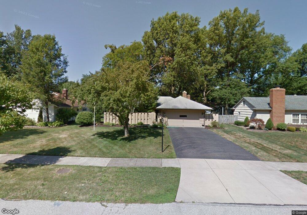
This home is located at 252 Wayne Dr, Berea, OH 44017 and is currently estimated at $239,350, approximately $159 per square foot. 252 Wayne Dr is a home located in Cuyahoga County with nearby schools including Grindstone Elementary School, Berea-Midpark Middle School, and Berea-Midpark High School.
Ownership History
Date
Name
Owned For
Owner Type
Purchase Details
Closed on
Oct 6, 2008
Sold by
Meredith Colleen
Bought by
Polombo Nicholas A
Current Estimated Value
Home Financials for this Owner
Home Financials are based on the most recent Mortgage that was taken out on this home.
Original Mortgage
$100,000
Outstanding Balance
$66,498
Interest Rate
6.43%
Mortgage Type
Purchase Money Mortgage
Estimated Equity
$172,852
Purchase Details
Closed on
Aug 29, 1983
Sold by
Schiller Samuel A
Bought by
Masterson John R
Purchase Details
Closed on
Oct 14, 1976
Sold by
Craig John K
Bought by
Schiller Samuel A
Purchase Details
Closed on
Jan 1, 1975
Bought by
Craig John K
Create a Home Valuation Report for This Property
The Home Valuation Report is an in-depth analysis detailing your home's value as well as a comparison with similar homes in the area
Home Values in the Area
Average Home Value in this Area
Purchase History
| Date | Buyer | Sale Price | Title Company |
|---|---|---|---|
| Polombo Nicholas A | $125,000 | Attorney | |
| Masterson John R | $70,000 | -- | |
| Schiller Samuel A | $44,000 | -- | |
| Craig John K | -- | -- |
Source: Public Records
Mortgage History
| Date | Status | Borrower | Loan Amount |
|---|---|---|---|
| Open | Polombo Nicholas A | $100,000 |
Source: Public Records
Tax History
| Year | Tax Paid | Tax Assessment Tax Assessment Total Assessment is a certain percentage of the fair market value that is determined by local assessors to be the total taxable value of land and additions on the property. | Land | Improvement |
|---|---|---|---|---|
| 2024 | $4,030 | $69,650 | $13,020 | $56,630 |
| 2023 | $3,638 | $52,680 | $11,760 | $40,920 |
| 2022 | $3,615 | $52,680 | $11,760 | $40,920 |
| 2021 | $3,585 | $52,680 | $11,760 | $40,920 |
| 2020 | $3,426 | $44,660 | $9,980 | $34,690 |
| 2019 | $3,335 | $127,600 | $28,500 | $99,100 |
| 2018 | $3,316 | $44,660 | $9,980 | $34,690 |
| 2017 | $3,220 | $40,250 | $8,820 | $31,430 |
| 2016 | $3,197 | $40,250 | $8,820 | $31,430 |
| 2015 | $3,399 | $40,250 | $8,820 | $31,430 |
| 2014 | $3,399 | $45,290 | $8,820 | $36,470 |
Source: Public Records
Map
Nearby Homes
- 404 Crescent Dr
- 347 Beeler Dr
- 287 Edgewood Dr
- 300 West St
- 388 Fairwood Cir
- 550 Race St
- 160 Marian Ln Unit 6A
- 146 Marian Ln
- 209 Gibson St
- 211 W Bridge St
- 516 Fair St
- 8873 Ashlyn Ct Unit 13A
- 561 Brigton Dr
- 23002 Chandlers Ln
- 23002 Chandlers Ln Unit 223
- 23002 Chandlers Ln Unit 221
- 23155 Wainwright Terrace
- 100 River Rock Way
- 487 Bridle Ln
- 23265 Wainwright Terrace
Your Personal Tour Guide
Ask me questions while you tour the home.