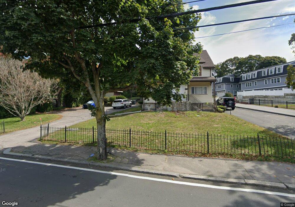
252 West St Quincy, MA 02169
Estimated Value: $798,463 - $934,000
4
Beds
2
Baths
1,930
Sq Ft
$449/Sq Ft
Est. Value
About This Home
This home is located at 252 West St, Quincy, MA 02169 and is currently estimated at $865,616, approximately $448 per square foot. 252 West St is a home located in Norfolk County with nearby schools including South West Middle School, Lincoln-Hancock Community School, and Quincy High School.
Ownership History
Date
Name
Owned For
Owner Type
Purchase Details
Closed on
Aug 3, 2022
Sold by
Houston Winston
Bought by
Winston Houston Ret
Current Estimated Value
Purchase Details
Closed on
May 13, 2021
Sold by
Maco Realty Llc
Bought by
Houston Winston
Purchase Details
Closed on
Jan 22, 2014
Sold by
Connolly Steven B
Bought by
Maco Realty Llc
Purchase Details
Closed on
May 27, 2003
Sold by
Jones Ruth I and Webber Ruth I
Bought by
Connolly Steven B
Home Financials for this Owner
Home Financials are based on the most recent Mortgage that was taken out on this home.
Original Mortgage
$356,000
Interest Rate
5.86%
Mortgage Type
Purchase Money Mortgage
Create a Home Valuation Report for This Property
The Home Valuation Report is an in-depth analysis detailing your home's value as well as a comparison with similar homes in the area
Purchase History
| Date | Buyer | Sale Price | Title Company |
|---|---|---|---|
| Winston Houston Ret | -- | None Available | |
| Houston Winston | $781,000 | None Available | |
| Maco Realty Llc | -- | -- | |
| Connolly Steven B | $445,000 | -- |
Source: Public Records
Mortgage History
| Date | Status | Borrower | Loan Amount |
|---|---|---|---|
| Previous Owner | Connolly Steven B | $356,000 | |
| Previous Owner | Maco Realty Llc | $40,000 | |
| Previous Owner | Maco Realty Llc | $15,000 |
Source: Public Records
Tax History
| Year | Tax Paid | Tax Assessment Tax Assessment Total Assessment is a certain percentage of the fair market value that is determined by local assessors to be the total taxable value of land and additions on the property. | Land | Improvement |
|---|---|---|---|---|
| 2025 | $8,469 | $734,500 | $324,500 | $410,000 |
| 2024 | $7,980 | $708,100 | $309,700 | $398,400 |
| 2023 | $7,724 | $694,000 | $295,600 | $398,400 |
| 2022 | $7,329 | $611,800 | $238,900 | $372,900 |
| 2021 | $6,755 | $556,400 | $238,900 | $317,500 |
| 2020 | $6,915 | $556,300 | $238,900 | $317,400 |
| 2019 | $6,219 | $495,500 | $232,400 | $263,100 |
| 2018 | $6,154 | $461,300 | $216,100 | $245,200 |
| 2017 | $6,338 | $447,300 | $206,400 | $240,900 |
| 2016 | $5,817 | $405,100 | $188,800 | $216,300 |
| 2015 | $5,596 | $383,300 | $178,800 | $204,500 |
| 2014 | $4,962 | $333,900 | $178,800 | $155,100 |
Source: Public Records
Map
Nearby Homes
- 510 Willard St
- 36 Village Dr
- 459 Willard St Unit 303
- 9 Westford St
- 87 Village Dr
- 25 McDonald St
- 51 Branch St Unit 2
- 132 Centre St
- 211 Copeland St
- 57 Buckley St
- 21 Totman St Unit 308
- 21 Totman St Unit 205
- 21 Totman St Unit 404
- 21 Totman St Unit 309
- 21 Totman St Unit 203
- 21 Totman St Unit PH-406
- 21 Totman St Unit 301
- 21 Totman St Unit PH-405
- 21 Totman St Unit 407
- 40 Cross St Unit 1
- 252 West St Unit 1
- 254 West St
- 244 West St
- 9 Schlager Ave
- 264R West St
- 264 West St
- 264 West St Unit R
- 247 West St
- 15 Schlager Ave
- 260 West St Unit 4
- 260 West St Unit 5
- 260 West St Unit 7
- 260 West St Unit 6
- 260 West St Unit 2
- 260 West St Unit 1
- 260 West St Unit 3
- 241 West St
- 253 West St
- 236 West St
- 257 West St
Your Personal Tour Guide
Ask me questions while you tour the home.