Estimated Value: $353,000 - $401,000
4
Beds
3
Baths
2,795
Sq Ft
$135/Sq Ft
Est. Value
About This Home
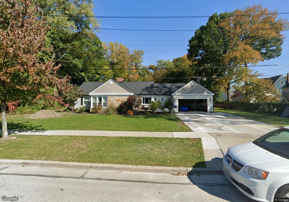
This home is located at 252 Westbridge Dr, Berea, OH 44017 and is currently estimated at $376,174, approximately $134 per square foot. 252 Westbridge Dr is a home located in Cuyahoga County with nearby schools including Grindstone Elementary School, Berea-Midpark Middle School, and Berea-Midpark High School.
Ownership History
Date
Name
Owned For
Owner Type
Purchase Details
Closed on
Aug 24, 2011
Sold by
Knebusch Jonathan W and Knebusch Ann
Bought by
Soltis Andrew J and Soltis Kelly C
Current Estimated Value
Home Financials for this Owner
Home Financials are based on the most recent Mortgage that was taken out on this home.
Original Mortgage
$153,015
Outstanding Balance
$105,847
Interest Rate
4.55%
Mortgage Type
FHA
Estimated Equity
$270,327
Purchase Details
Closed on
Mar 20, 2008
Sold by
Clark Katherine H and Clark Katherine A
Bought by
Knebusch Jonathan W and Knebusch Ann
Home Financials for this Owner
Home Financials are based on the most recent Mortgage that was taken out on this home.
Original Mortgage
$175,655
Interest Rate
5.74%
Mortgage Type
Purchase Money Mortgage
Purchase Details
Closed on
Aug 19, 2004
Sold by
Clark Katherine H
Bought by
Clark Katherine H and Clark Katherine A
Purchase Details
Closed on
Jan 1, 1975
Bought by
Clark Katherine H
Create a Home Valuation Report for This Property
The Home Valuation Report is an in-depth analysis detailing your home's value as well as a comparison with similar homes in the area
Home Values in the Area
Average Home Value in this Area
Purchase History
| Date | Buyer | Sale Price | Title Company |
|---|---|---|---|
| Soltis Andrew J | $157,000 | Barrister Titl Agency | |
| Knebusch Jonathan W | $184,900 | Executive Title Agency | |
| Clark Katherine H | -- | -- | |
| Clark Katherine H | -- | -- |
Source: Public Records
Mortgage History
| Date | Status | Borrower | Loan Amount |
|---|---|---|---|
| Open | Soltis Andrew J | $153,015 | |
| Previous Owner | Knebusch Jonathan W | $175,655 |
Source: Public Records
Tax History
| Year | Tax Paid | Tax Assessment Tax Assessment Total Assessment is a certain percentage of the fair market value that is determined by local assessors to be the total taxable value of land and additions on the property. | Land | Improvement |
|---|---|---|---|---|
| 2024 | $6,148 | $106,330 | $18,515 | $87,815 |
| 2023 | $5,383 | $77,950 | $16,940 | $61,010 |
| 2022 | $5,349 | $77,950 | $16,940 | $61,010 |
| 2021 | $5,273 | $77,490 | $16,940 | $60,550 |
| 2020 | $5,036 | $65,660 | $14,350 | $51,310 |
| 2019 | $4,902 | $187,600 | $41,000 | $146,600 |
| 2018 | $4,868 | $65,660 | $14,350 | $51,310 |
| 2017 | $4,397 | $54,960 | $15,370 | $39,590 |
| 2016 | $4,365 | $54,960 | $15,370 | $39,590 |
| 2015 | $5,603 | $54,960 | $15,370 | $39,590 |
| 2014 | $5,603 | $54,960 | $15,370 | $39,590 |
Source: Public Records
Map
Nearby Homes
- 211 W Bridge St
- 209 Gibson St
- 146 Marian Ln
- 160 Marian Ln Unit 6A
- 216 Kraft St
- 57 Riverside Dr
- 93 W 5th Ave
- 404 Crescent Dr
- 300 West St
- 287 Edgewood Dr
- 388 Fairwood Cir
- 487 Karen Dr
- 49 Monroe St
- 56 3rd Ave
- 516 Fair St
- 628 Lindbergh Blvd
- 0 E Bagley Rd Unit 5111166
- 275 Quarrystone Ln
- 428 Park Place
- 725 Shakespeare Dr
- 202 Stanford Dr
- 206 Stanford Dr
- 196 Stanford Dr
- 219 Elmwood Dr
- 190 Stanford Dr
- 272 Westbridge Dr
- 220 Stanford Dr
- 186 Stanford Dr
- 225 Elmwood Dr
- 226 Stanford Dr
- 180 Stanford Dr
- 222 Westbridge Dr
- 278 Westbridge Dr
- 231 Elmwood Dr
- 232 Stanford Dr
- 176 Stanford Dr
- 189 Stanford Dr
- 232 Elmwood Dr
- 174 Stanford Dr
- 238 Stanford Dr
Your Personal Tour Guide
Ask me questions while you tour the home.