Estimated Value: $515,000 - $542,000
3
Beds
2
Baths
2,048
Sq Ft
$259/Sq Ft
Est. Value
About This Home
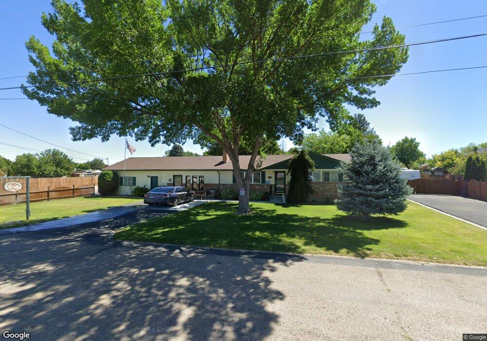
This home is located at 2520 S Powerline Rd, Nampa, ID 83686 and is currently estimated at $529,453, approximately $258 per square foot. 2520 S Powerline Rd is a home located in Canyon County with nearby schools including Greenhurst Elementary School, South Middle School, and Skyview High School.
Ownership History
Date
Name
Owned For
Owner Type
Purchase Details
Closed on
May 7, 2024
Sold by
Wilkerson Imogene E
Bought by
Imogene E Wilkerson Family Trust and Wilkerson
Current Estimated Value
Purchase Details
Closed on
Jul 17, 2020
Sold by
Wilkerson Imogene E and Estate Of William R Wilkerson
Bought by
Wilkerson Imogene E
Purchase Details
Closed on
Feb 24, 2012
Sold by
Wilkerson William R and Wilkerson Imogene E
Bought by
Wilkerson William R and Wilkerson Imogene E
Home Financials for this Owner
Home Financials are based on the most recent Mortgage that was taken out on this home.
Original Mortgage
$135,000
Interest Rate
3.83%
Mortgage Type
New Conventional
Create a Home Valuation Report for This Property
The Home Valuation Report is an in-depth analysis detailing your home's value as well as a comparison with similar homes in the area
Home Values in the Area
Average Home Value in this Area
Purchase History
| Date | Buyer | Sale Price | Title Company |
|---|---|---|---|
| Imogene E Wilkerson Family Trust | -- | None Listed On Document | |
| Wilkerson Imogene E | -- | None Available | |
| Wilkerson William R | -- | Pioneer Title Canyon Ca |
Source: Public Records
Mortgage History
| Date | Status | Borrower | Loan Amount |
|---|---|---|---|
| Previous Owner | Wilkerson William R | $135,000 |
Source: Public Records
Tax History Compared to Growth
Tax History
| Year | Tax Paid | Tax Assessment Tax Assessment Total Assessment is a certain percentage of the fair market value that is determined by local assessors to be the total taxable value of land and additions on the property. | Land | Improvement |
|---|---|---|---|---|
| 2025 | $2,387 | $521,700 | $169,800 | $351,900 |
| 2024 | $2,387 | $510,500 | $169,800 | $340,700 |
| 2023 | $2,204 | $490,600 | $169,800 | $320,800 |
| 2022 | $3,675 | $497,800 | $159,000 | $338,800 |
| 2021 | $2,837 | $365,800 | $79,500 | $286,300 |
| 2020 | $2,453 | $289,400 | $66,400 | $223,000 |
| 2019 | $2,122 | $212,900 | $44,000 | $168,900 |
| 2018 | $2,015 | $0 | $0 | $0 |
| 2017 | $1,861 | $0 | $0 | $0 |
| 2016 | $1,805 | $0 | $0 | $0 |
| 2015 | $1,773 | $0 | $0 | $0 |
| 2014 | $1,687 | $139,600 | $33,500 | $106,100 |
Source: Public Records
Map
Nearby Homes
- 2714 S Almond Ct
- 946 S Almond Ct
- 945 S Almond Ct
- 1612 E York Ave
- 2121 Lambert Dr
- 1921 E Explorer Ct
- 2117 E Massachusetts Ave
- 2102 S Chicago St
- 2020 E Lost River Ave
- 1835 E Kentucky Ave
- 709 E Trail Creek Dr
- 1515 Primrose Dr
- 2019 Kentucky Dr
- 525 E Greenhurst Rd
- 1801 E Iowa Ave
- 2622 Boulder Ave
- 2908 Seminole Dr
- 1157 S Powerline Rd
- 1426 E Sharons Loop
- 1426 Chicago St
- 1506 E Nebraska Ave
- 1514 E Nebraska Ave
- 2525 S Florence St
- 2512 S Powerline Rd
- 1522 E Nebraska Ave
- 2520 S Florence St
- 1509 E Nebraska Ave
- 1604 E Nebraska Ave
- 1517 E Nebraska Ave
- 1601 E Nebraska Ave
- 1510 E Nevada Ave
- 1612 E Nebraska Ave
- 2516 S Florence St
- 1522 E Nevada Ave
- 2421 S Florence St
- 2420 S Powerline Rd
- 2710 S Powerline Rd
- 1622 E Nebraska Ave
- 1604 E Nevada Ave
- 2712 S Powerline Rd