Estimated Value: $1,152,578 - $1,269,000
5
Beds
5
Baths
4,008
Sq Ft
$300/Sq Ft
Est. Value
About This Home
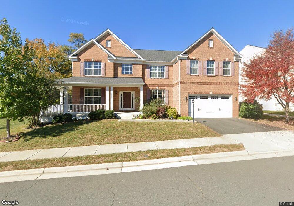
This home is located at 25205 Crested Wheat Dr, Aldie, VA 20105 and is currently estimated at $1,200,895, approximately $299 per square foot. 25205 Crested Wheat Dr is a home located in Loudoun County with nearby schools including Pinebrook Elementary School, Mercer Middle School, and John Champe High School.
Ownership History
Date
Name
Owned For
Owner Type
Purchase Details
Closed on
Mar 28, 2014
Sold by
Greenfield Gtis Hov Residences
Bought by
Narain Sunil K
Current Estimated Value
Home Financials for this Owner
Home Financials are based on the most recent Mortgage that was taken out on this home.
Original Mortgage
$397,000
Outstanding Balance
$300,996
Interest Rate
4.27%
Mortgage Type
New Conventional
Estimated Equity
$899,899
Create a Home Valuation Report for This Property
The Home Valuation Report is an in-depth analysis detailing your home's value as well as a comparison with similar homes in the area
Home Values in the Area
Average Home Value in this Area
Purchase History
| Date | Buyer | Sale Price | Title Company |
|---|---|---|---|
| Narain Sunil K | $647,000 | -- |
Source: Public Records
Mortgage History
| Date | Status | Borrower | Loan Amount |
|---|---|---|---|
| Open | Narain Sunil K | $397,000 |
Source: Public Records
Tax History Compared to Growth
Tax History
| Year | Tax Paid | Tax Assessment Tax Assessment Total Assessment is a certain percentage of the fair market value that is determined by local assessors to be the total taxable value of land and additions on the property. | Land | Improvement |
|---|---|---|---|---|
| 2025 | $9,046 | $1,123,700 | $298,800 | $824,900 |
| 2024 | $9,019 | $1,042,640 | $273,800 | $768,840 |
| 2023 | $8,454 | $966,180 | $273,800 | $692,380 |
| 2022 | $8,502 | $955,320 | $243,800 | $711,520 |
| 2021 | $7,890 | $805,140 | $208,800 | $596,340 |
| 2020 | $7,687 | $742,710 | $198,800 | $543,910 |
| 2019 | $7,477 | $715,540 | $198,800 | $516,740 |
| 2018 | $7,832 | $721,800 | $178,800 | $543,000 |
| 2017 | $7,825 | $695,580 | $178,800 | $516,780 |
| 2016 | $7,797 | $680,990 | $0 | $0 |
| 2015 | $7,526 | $484,270 | $0 | $484,270 |
| 2014 | $7,431 | $464,600 | $0 | $464,600 |
Source: Public Records
Map
Nearby Homes
- 25184 Crested Wheat Dr
- 25381 Patriot Terrace
- 25312 Trumpet Vine Terrace
- 41725 McMonagle Square
- 25427 Elm Terrace
- 25174 Coats Square
- 41735 Experience Way
- 41597 Hoffman Dr
- 41925 Moreland Mine Terrace
- 41753 Cynthia Terrace
- 25362 Vacation Place
- Sullivan 31-F2 Plan at South 620 - Single Family Home
- Vesper 34-F2 Plan at South 620 - Villa
- Vida 34-F2 Plan at South 620 - Villa
- 25591 Red Cherry Dr
- 25593 Red Cherry Dr
- Tyson 28-D1 Plan at South 620 - Townhome
- Tyra 28-D1 Plan at South 620 - Townhome
- Travis 28-D1 Plan at South 620 - Townhome
- 25605 Red Cherry Dr
- 25201 Crested Wheat Dr
- 25191 Crested Wheat Dr
- 25208 Crested Wheat Dr
- 25204 Crested Wheat Dr
- 25210 Crested Wheat Dr
- 25235 Barley Grass Square
- 25202 Crested Wheat Dr
- 25198 Crested Wheat Dr
- 0 Prairie Fire Square
- 0 Prairie Fire Square Unit LO7765665
- 0 Prairie Fire Square Unit LO7767107
- 0 Prairie Fire Square Unit 1009709700
- 0 Prairie Fire Square Unit 1009627900
- 0 Prairie Fire Square Unit 1009527458
- 0 Prairie Fire Square Unit 1009525020
- 25196 Crested Wheat Dr
- 25185 Crested Wheat Dr
- 0 Kilkeen Way
- 25192 Crested Wheat Dr
- 25247 Barley Grass Square