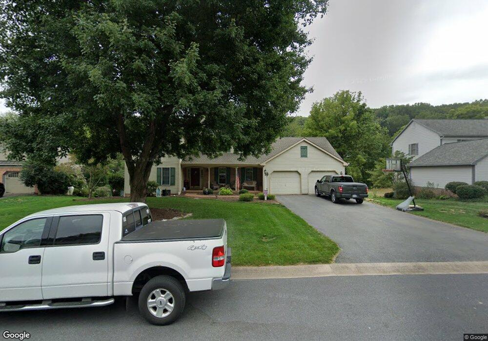
2521 Brookside Dr Lancaster, PA 17601
East Hempfield NeighborhoodEstimated Value: $628,972 - $667,000
4
Beds
3
Baths
2,818
Sq Ft
$228/Sq Ft
Est. Value
About This Home
This home is located at 2521 Brookside Dr, Lancaster, PA 17601 and is currently estimated at $642,743, approximately $228 per square foot. 2521 Brookside Dr is a home located in Lancaster County with nearby schools including Centerville Elementary School, Centerville Middle School, and Hempfield High School.
Ownership History
Date
Name
Owned For
Owner Type
Purchase Details
Closed on
Jun 19, 2007
Sold by
Clingan Thomas D and Clingan Barbara S
Bought by
Fix John R and Fix Laura L
Current Estimated Value
Home Financials for this Owner
Home Financials are based on the most recent Mortgage that was taken out on this home.
Original Mortgage
$300,000
Outstanding Balance
$115,640
Interest Rate
6.14%
Mortgage Type
Purchase Money Mortgage
Estimated Equity
$527,103
Create a Home Valuation Report for This Property
The Home Valuation Report is an in-depth analysis detailing your home's value as well as a comparison with similar homes in the area
Home Values in the Area
Average Home Value in this Area
Purchase History
| Date | Buyer | Sale Price | Title Company |
|---|---|---|---|
| Fix John R | $375,000 | Fidelity National Title |
Source: Public Records
Mortgage History
| Date | Status | Borrower | Loan Amount |
|---|---|---|---|
| Open | Fix John R | $300,000 |
Source: Public Records
Tax History
| Year | Tax Paid | Tax Assessment Tax Assessment Total Assessment is a certain percentage of the fair market value that is determined by local assessors to be the total taxable value of land and additions on the property. | Land | Improvement |
|---|---|---|---|---|
| 2025 | $7,283 | $337,000 | $90,800 | $246,200 |
| 2024 | $7,283 | $337,000 | $90,800 | $246,200 |
| 2023 | $7,137 | $337,000 | $90,800 | $246,200 |
| 2022 | $6,941 | $337,000 | $90,800 | $246,200 |
| 2021 | $6,830 | $337,000 | $90,800 | $246,200 |
| 2020 | $6,830 | $337,000 | $90,800 | $246,200 |
| 2019 | $6,715 | $337,000 | $90,800 | $246,200 |
| 2018 | $1,321 | $337,000 | $90,800 | $246,200 |
| 2017 | $7,274 | $288,900 | $60,800 | $228,100 |
| 2016 | $7,274 | $288,900 | $60,800 | $228,100 |
| 2015 | $1,460 | $288,900 | $60,800 | $228,100 |
| 2014 | $5,498 | $288,900 | $60,800 | $228,100 |
Source: Public Records
Map
Nearby Homes
- 123 Pinnacle Point Dr
- 214 Winding Hill Dr
- 107 Treetops Dr
- 9 Spring Walk Ct
- 2808 Spring Valley Rd
- 401 Country Place Dr
- 1006 Country Place Dr
- 765 Sylvan Rd
- 1828 Buchers Mill
- 2482 Spring Water Cir
- 2457 Spring Water Cir
- 2458 Spring Water Cir
- 2456 Spring Water Cir
- 2454 Spring Water Cir
- 2318 Marietta Ave
- 2336 Wood St
- 900 Cardinal Rd
- 2120 Shaaron Dr
- 825 Robin Rd
- 421 Rohrerstown Rd
- 2517 Brookside Dr
- 2525 Brookside Dr
- 2629 Chestnut Valley Dr
- 2633 Chestnut Valley Dr
- 2513 Brookside Dr
- 2520 Brookside Dr
- 2625 Chestnut Valley Dr
- 2516 Brookside Dr
- 2534 Brookside Dr
- 2637 Chestnut Valley Dr
- 2524 Brookside Dr
- 2509 Brookside Dr
- 2621 Chestnut Valley Dr
- 2512 Brookside Dr
- 2530 Brookside Dr
- 2630 Chestnut Valley Dr
- 2611 Wexford Dr
- 2636 Chestnut Valley Dr
- 2624 Chestnut Valley Dr
- 2641 Chestnut Valley Dr
Your Personal Tour Guide
Ask me questions while you tour the home.