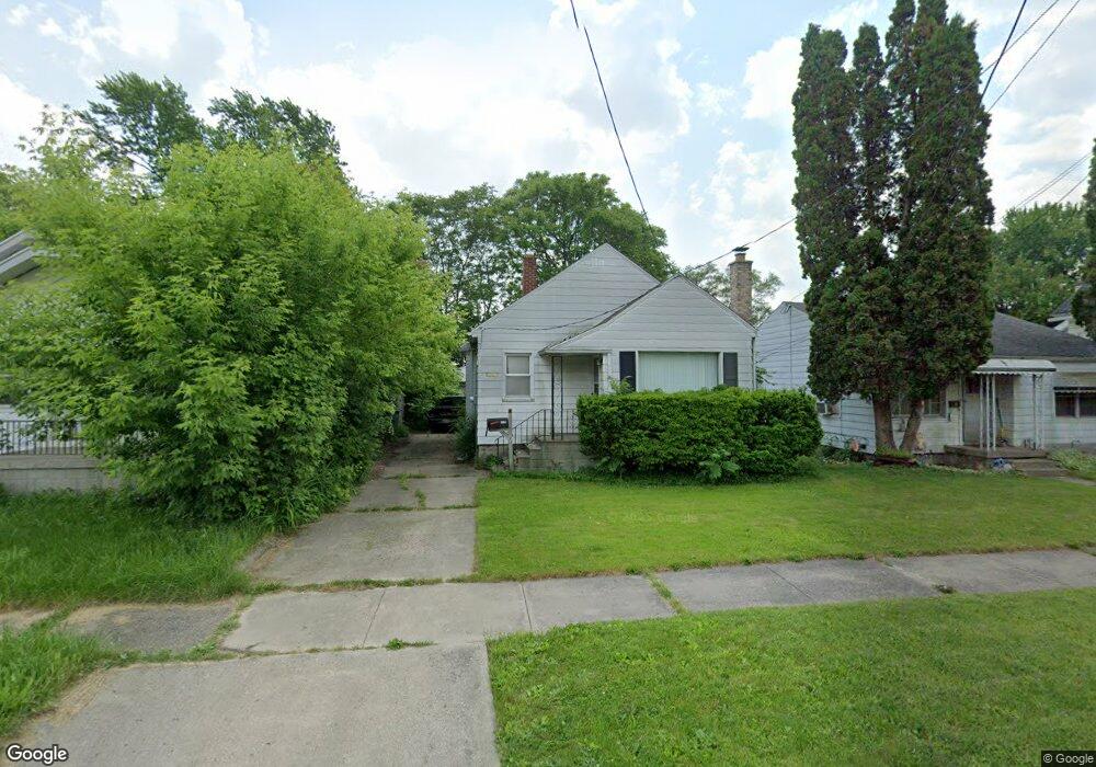
2521 Brown St Flint, MI 48503
Southwest Flint NeighborhoodEstimated Value: $41,000 - $70,000
3
Beds
1
Bath
991
Sq Ft
$51/Sq Ft
Est. Value
About This Home
This home is located at 2521 Brown St, Flint, MI 48503 and is currently estimated at $50,572, approximately $51 per square foot. 2521 Brown St is a home located in Genesee County with nearby schools including Eisenhower School, Flint Southwestern Classical Academy, and St. Paul Lutheran School.
Ownership History
Date
Name
Owned For
Owner Type
Purchase Details
Closed on
Oct 13, 2009
Sold by
Donovan Shaun
Bought by
Luck Michael
Current Estimated Value
Purchase Details
Closed on
Jun 16, 2009
Sold by
Midfirst Bank
Bought by
The Secretary Of Housing & Urban Develop
Purchase Details
Closed on
May 13, 2009
Sold by
Rekowski Mary M
Bought by
Midfirst Bank
Purchase Details
Closed on
Jun 29, 2000
Sold by
Cannon J Cannon C and Cannon T L
Bought by
Rekowski Mary Monica
Home Financials for this Owner
Home Financials are based on the most recent Mortgage that was taken out on this home.
Original Mortgage
$56,500
Interest Rate
7.96%
Mortgage Type
FHA
Create a Home Valuation Report for This Property
The Home Valuation Report is an in-depth analysis detailing your home's value as well as a comparison with similar homes in the area
Home Values in the Area
Average Home Value in this Area
Purchase History
| Date | Buyer | Sale Price | Title Company |
|---|---|---|---|
| Luck Michael | -- | None Available | |
| The Secretary Of Housing & Urban Develop | -- | None Available | |
| Midfirst Bank | $56,045 | None Available | |
| Rekowski Mary Monica | $56,500 | Lawyers Title Insurance Corp |
Source: Public Records
Mortgage History
| Date | Status | Borrower | Loan Amount |
|---|---|---|---|
| Previous Owner | Rekowski Mary Monica | $56,500 |
Source: Public Records
Tax History Compared to Growth
Tax History
| Year | Tax Paid | Tax Assessment Tax Assessment Total Assessment is a certain percentage of the fair market value that is determined by local assessors to be the total taxable value of land and additions on the property. | Land | Improvement |
|---|---|---|---|---|
| 2025 | $791 | $18,100 | $0 | $0 |
| 2024 | $724 | $18,300 | $0 | $0 |
| 2023 | $715 | $13,300 | $0 | $0 |
| 2022 | $0 | $11,500 | $0 | $0 |
| 2021 | $738 | $10,400 | $0 | $0 |
| 2020 | $673 | $9,300 | $0 | $0 |
| 2019 | $660 | $8,400 | $0 | $0 |
| 2018 | $676 | $8,800 | $0 | $0 |
| 2017 | $847 | $0 | $0 | $0 |
| 2016 | $841 | $0 | $0 | $0 |
| 2015 | -- | $0 | $0 | $0 |
| 2014 | -- | $0 | $0 | $0 |
| 2012 | -- | $10,300 | $0 | $0 |
Source: Public Records
Map
Nearby Homes
- 2537 Swayze St
- 2433 Brown St
- 2429 Brown St
- 2608 Cumings Ave
- 2509 Corunna Rd
- 2618 Brown St
- 1516 Gainey Ave
- 1506 Downey St
- 1402 Woodcroft Ave
- 2464 Gibson St
- 1505 Downey St
- 1006 Hammond Ave
- 2124 Swayze St
- 2710 Reynolds St
- 2437 Zimmerman St
- 1412 Durand St
- 1114 Clancy Ave
- 1126 Clancy Ave
- 1725 Lincoln Dr
- 932 Bradley Ave
- 2525 Brown St
- 2517 Brown St
- 2513 Brown St
- 2529 Brown St
- 2533 Brown St
- 2509 Brown St
- 2522 Cumings Ave
- 2518 Cumings Ave
- 2526 Cumings Ave
- 2514 Cumings Ave
- 2530 Cumings Ave
- 2537 Brown St
- 2505 Brown St
- 2518 Brown St
- 2522 Brown St
- 2526 Brown St
- 2506 Cumings Ave
- 2534 Cumings Ave
- 2530 Brown St
- 2514 Brown St