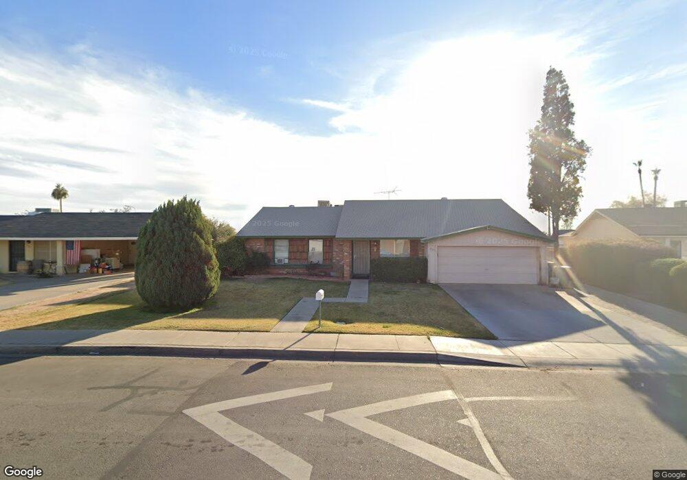
2521 E Commonwealth Cir Chandler, AZ 85225
East Chandler NeighborhoodEstimated Value: $419,811 - $486,000
--
Bed
2
Baths
1,571
Sq Ft
$293/Sq Ft
Est. Value
About This Home
This home is located at 2521 E Commonwealth Cir, Chandler, AZ 85225 and is currently estimated at $459,703, approximately $292 per square foot. 2521 E Commonwealth Cir is a home located in Maricopa County with nearby schools including Chandler Traditional Academy-Humphrey, Willis Junior High School, and BASIS Chandler Primary North Campus.
Ownership History
Date
Name
Owned For
Owner Type
Purchase Details
Closed on
Feb 19, 1999
Sold by
Peralta Pablo I and Peralta Carmen Moraza
Bought by
Donan Jose R and Donan Belen G
Current Estimated Value
Home Financials for this Owner
Home Financials are based on the most recent Mortgage that was taken out on this home.
Original Mortgage
$109,725
Outstanding Balance
$26,038
Interest Rate
6.77%
Mortgage Type
New Conventional
Estimated Equity
$433,665
Purchase Details
Closed on
Mar 20, 1996
Sold by
Vincent Vaughn F and Vincent Virginia
Bought by
Peralta Pablo I and Moraza Peralta Carmen
Home Financials for this Owner
Home Financials are based on the most recent Mortgage that was taken out on this home.
Original Mortgage
$97,853
Interest Rate
8.01%
Mortgage Type
FHA
Create a Home Valuation Report for This Property
The Home Valuation Report is an in-depth analysis detailing your home's value as well as a comparison with similar homes in the area
Home Values in the Area
Average Home Value in this Area
Purchase History
| Date | Buyer | Sale Price | Title Company |
|---|---|---|---|
| Donan Jose R | $114,500 | Security Title Agency | |
| Peralta Pablo I | $99,000 | Nations Title Insurance |
Source: Public Records
Mortgage History
| Date | Status | Borrower | Loan Amount |
|---|---|---|---|
| Open | Donan Jose R | $109,725 | |
| Previous Owner | Peralta Pablo I | $97,853 |
Source: Public Records
Tax History Compared to Growth
Tax History
| Year | Tax Paid | Tax Assessment Tax Assessment Total Assessment is a certain percentage of the fair market value that is determined by local assessors to be the total taxable value of land and additions on the property. | Land | Improvement |
|---|---|---|---|---|
| 2025 | $1,394 | $17,892 | -- | -- |
| 2024 | $1,346 | $17,040 | -- | -- |
| 2023 | $1,346 | $35,020 | $7,000 | $28,020 |
| 2022 | $1,299 | $26,280 | $5,250 | $21,030 |
| 2021 | $1,361 | $25,070 | $5,010 | $20,060 |
| 2020 | $1,355 | $22,810 | $4,560 | $18,250 |
| 2019 | $1,303 | $20,420 | $4,080 | $16,340 |
| 2018 | $1,262 | $18,520 | $3,700 | $14,820 |
| 2017 | $1,176 | $16,780 | $3,350 | $13,430 |
| 2016 | $1,133 | $15,920 | $3,180 | $12,740 |
| 2015 | $1,098 | $15,000 | $3,000 | $12,000 |
Source: Public Records
Map
Nearby Homes
- 76 N 133rd St
- 6 S 132nd St
- 15802 S Gilbert Rd Unit 58
- 15606 S Gilbert Rd Unit 128
- 124 S Cottonwood St
- 25 N Cottonwood St Unit 41
- 252 N Wilson Dr
- 2214 E Frye Rd
- 195 N Cottonwood St Unit 21
- 2691 E Hulet Dr
- 2660 E Hulet Dr
- 2480 E Stephens Place
- 28 E Joseph Way
- 2253 E Kempton Rd
- 382 N Ashley Dr
- 13640 E Williams Field Rd
- 75 E Elgin St
- 111 N Soho Place
- 333 S Cooper Rd
- 194 E Canyon Creek Dr
- 2525 E Commonwealth Cir
- 2517 E Commonwealth Cir
- 55 S 133rd St
- 2529 E Commonwealth Cir
- 13302 E Boston St
- 2520 E Commonwealth Cir
- 2516 E Commonwealth Cir
- 2528 E Commonwealth Cir
- 13304 E Boston St
- 67 S 133rd St
- 2512 E Commonwealth Cir
- 2532 E Commonwealth Cir
- 2523 E Coronita Cir
- 2533 E Commonwealth Cir
- 2519 E Coronita Cir
- 66 S 133rd St
- 2509 E Commonwealth Cir
- 13312 E Boston St
- 54 S 133rd St
- 2515 E Coronita Cir