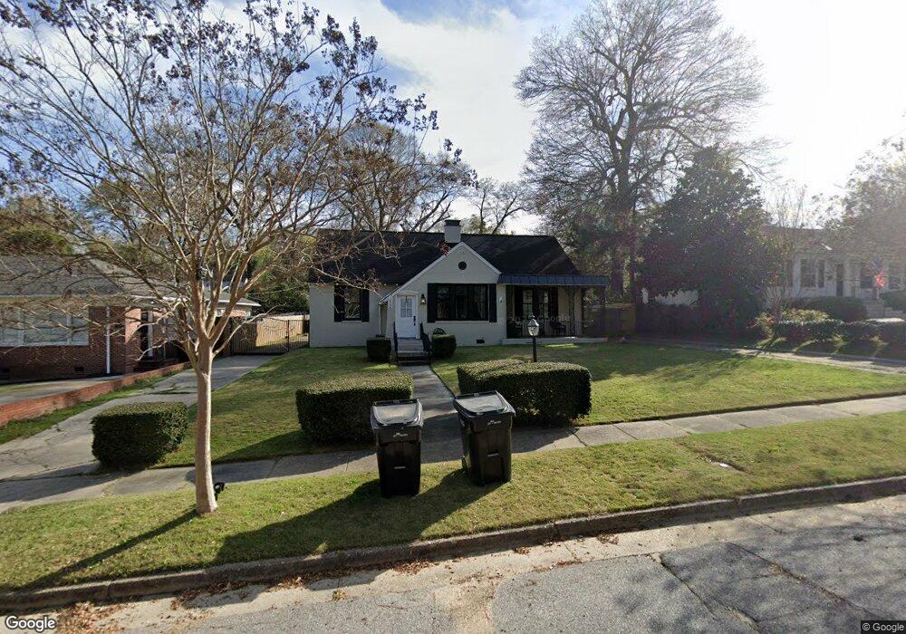
2522 Harding Dr Columbus, GA 31906
Wyntonn Grove NeighborhoodEstimated Value: $335,558 - $412,000
4
Beds
3
Baths
2,405
Sq Ft
$159/Sq Ft
Est. Value
About This Home
This home is located at 2522 Harding Dr, Columbus, GA 31906 and is currently estimated at $381,390, approximately $158 per square foot. 2522 Harding Dr is a home located in Muscogee County with nearby schools including Richards Middle School, Hardaway High School, and Wynnton Elementary School.
Ownership History
Date
Name
Owned For
Owner Type
Purchase Details
Closed on
Sep 18, 2017
Sold by
Patrick Poole Llc
Bought by
Benjamin Alvin Lee and Benjamin Andrea M
Current Estimated Value
Home Financials for this Owner
Home Financials are based on the most recent Mortgage that was taken out on this home.
Original Mortgage
$226,000
Outstanding Balance
$188,675
Interest Rate
3.89%
Mortgage Type
VA
Estimated Equity
$192,715
Purchase Details
Closed on
Nov 30, 2016
Sold by
Winfred H
Bought by
Patrick Poole Llc
Create a Home Valuation Report for This Property
The Home Valuation Report is an in-depth analysis detailing your home's value as well as a comparison with similar homes in the area
Home Values in the Area
Average Home Value in this Area
Purchase History
| Date | Buyer | Sale Price | Title Company |
|---|---|---|---|
| Benjamin Alvin Lee | $226,000 | -- | |
| Patrick Poole Llc | $70,000 | -- |
Source: Public Records
Mortgage History
| Date | Status | Borrower | Loan Amount |
|---|---|---|---|
| Open | Benjamin Alvin Lee | $226,000 |
Source: Public Records
Tax History Compared to Growth
Tax History
| Year | Tax Paid | Tax Assessment Tax Assessment Total Assessment is a certain percentage of the fair market value that is determined by local assessors to be the total taxable value of land and additions on the property. | Land | Improvement |
|---|---|---|---|---|
| 2025 | -- | $115,128 | $17,612 | $97,516 |
| 2024 | -- | $115,128 | $17,612 | $97,516 |
| 2023 | $0 | $115,128 | $17,612 | $97,516 |
| 2022 | $147 | $91,012 | $17,612 | $73,400 |
| 2021 | $147 | $84,540 | $17,612 | $66,928 |
| 2020 | $1 | $84,540 | $17,612 | $66,928 |
| 2019 | $195 | $168,364 | $17,612 | $150,752 |
| 2018 | $382 | $90,400 | $9,440 | $80,960 |
| 2017 | $1,151 | $28,000 | $4,600 | $23,400 |
| 2016 | $4,216 | $102,195 | $8,372 | $93,823 |
| 2015 | $4,221 | $102,195 | $8,372 | $93,823 |
| 2014 | $4,226 | $102,195 | $8,372 | $93,823 |
| 2013 | -- | $102,195 | $8,372 | $93,823 |
Source: Public Records
Map
Nearby Homes
- 2533 15th St
- 1513 Wells Dr
- 1319 Hilton Ave
- 1310 S Dixon Dr
- 1500 Preston Dr
- 2911 Gardenia St
- 1164 Tate Dr
- 2916 Gardenia St
- 2227 15th St
- 1700 Stark Ave
- 1706 Stark Ave
- 2726 Marion St
- 1714 Iris Dr
- 1717 Stark Ave
- 1806 Stark Ave
- 1301 Rigdon Rd
- 2125 13th St Unit 12
- 2133 13th St
- 2010 Wells Dr
- 1227 Forest Ave Unit 4
- 2530 Harding Dr
- 2525 15th St
- 2536 Harding Dr
- 2521 15th St
- 2529 15th St
- 1514 Hilton Ave
- 2523 Harding Dr
- 1520 Hilton Ave Unit B
- 1520 Hilton Ave
- 1510 Hilton Ave
- 2527 Harding Dr
- 2519 Harding Dr
- 1521 Dixon Dr
- 1526 Hilton Ave
- 1533 Dixon Dr
- 1537 Dixon Dr
- 1503 Dixon Dr Unit A
- 1503 Dixon Dr
- 1541 Dixon Dr
- 1538 Hilton Ave