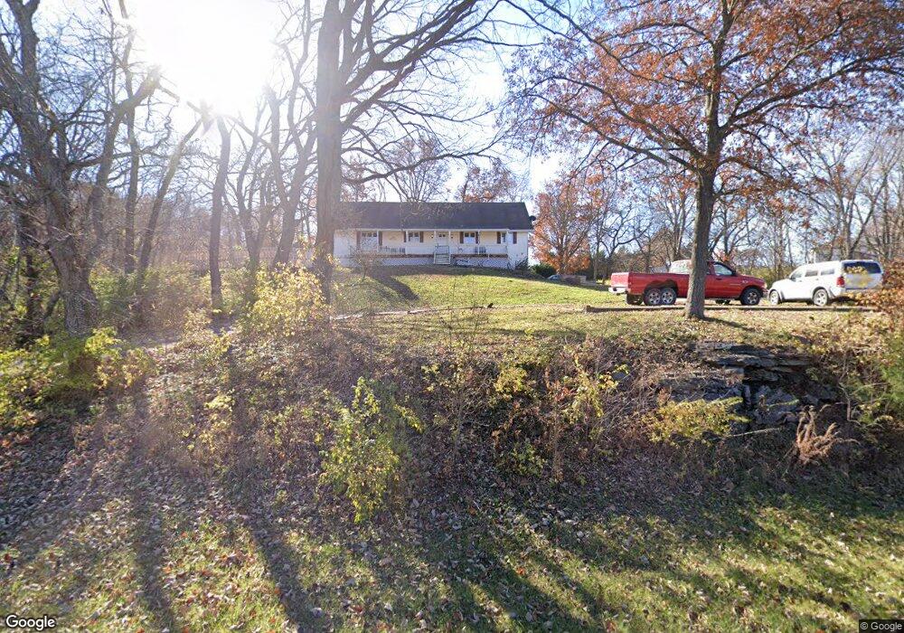
25221 Wornall Rd Excelsior Springs, MO 64024
Estimated Value: $321,000 - $374,082
3
Beds
2
Baths
1,764
Sq Ft
$196/Sq Ft
Est. Value
About This Home
This home is located at 25221 Wornall Rd, Excelsior Springs, MO 64024 and is currently estimated at $345,361, approximately $195 per square foot. 25221 Wornall Rd is a home located in Clay County with nearby schools including Excelsior Springs High School.
Ownership History
Date
Name
Owned For
Owner Type
Purchase Details
Closed on
Oct 8, 2004
Sold by
Cititrust Bank
Bought by
Kotalik Thomas W and Kotalik Lorrie L
Current Estimated Value
Home Financials for this Owner
Home Financials are based on the most recent Mortgage that was taken out on this home.
Original Mortgage
$123,920
Outstanding Balance
$61,495
Interest Rate
5.8%
Mortgage Type
Purchase Money Mortgage
Estimated Equity
$342,477
Purchase Details
Closed on
Jun 23, 2004
Sold by
Stephan Gregory K and Stephan Cheryle J
Bought by
Citi Trust Bank and Travelers Bank & Trust Fsb
Create a Home Valuation Report for This Property
The Home Valuation Report is an in-depth analysis detailing your home's value as well as a comparison with similar homes in the area
Home Values in the Area
Average Home Value in this Area
Purchase History
| Date | Buyer | Sale Price | Title Company |
|---|---|---|---|
| Kotalik Thomas W | -- | First American Title Ins Co | |
| Citi Trust Bank | $168,000 | -- |
Source: Public Records
Mortgage History
| Date | Status | Borrower | Loan Amount |
|---|---|---|---|
| Open | Kotalik Thomas W | $123,920 |
Source: Public Records
Tax History Compared to Growth
Tax History
| Year | Tax Paid | Tax Assessment Tax Assessment Total Assessment is a certain percentage of the fair market value that is determined by local assessors to be the total taxable value of land and additions on the property. | Land | Improvement |
|---|---|---|---|---|
| 2025 | $2,672 | $49,040 | -- | -- |
| 2024 | $2,672 | $43,240 | -- | -- |
| 2023 | $2,662 | $43,240 | $0 | $0 |
| 2022 | $2,437 | $39,180 | $0 | $0 |
| 2021 | $2,449 | $39,178 | $4,750 | $34,428 |
| 2020 | $2,268 | $35,570 | $0 | $0 |
| 2019 | $2,293 | $35,570 | $0 | $0 |
| 2018 | $2,223 | $34,470 | $0 | $0 |
| 2017 | $2,152 | $34,470 | $4,750 | $29,720 |
| 2016 | $2,152 | $34,470 | $4,750 | $29,720 |
| 2015 | $2,176 | $34,470 | $4,750 | $29,720 |
| 2014 | $2,116 | $33,150 | $4,750 | $28,400 |
Source: Public Records
Map
Nearby Homes
- 25421 Marel Rd
- 24218 NE 136th St
- 2116 Bradford Place
- 2305 Arbor Ln
- 2210 Piedmont Place
- 2081 Rock Bridge Pkwy
- 2407 Merlot Place
- 240 Rock Bridge Pkwy
- 2017 Karlton Way
- 220 Rock Bridge Pkwy
- 2021 Riverstone Dr
- 609 Kimberly Dr
- 617 Lodwick Ln
- 206 Crest Dr
- 106 Sunset Ln
- Lot 2 Wornall Rd
- 2017 Wornall Rd
- 125 Crown Hill Rd
- 606 Patrick Dr
- 0 Mccleary Rd Unit HMS2499816
- 25220 Marel Rd
- 13917 Carmel Rd
- 13909 Carmel Rd
- 25409 Wornall Rd
- 25410 Marel Rd
- 0 NE 140th St
- 25407 Marel Rd
- 25207 Marel Rd
- 25415 Marel Rd
- 25219 Marel Rd
- 13800 Carmel Rd
- 13917 Romayne Dr
- 25416 Marel Rd
- 14008 Rocky Hollow Rd
- 25607 Marel Rd
- 13919 Romayne Dr
- 25218 NE 136th St
- 25204 NE 136th St
- 25622 Marel Rd
- 25619 Marel Rd