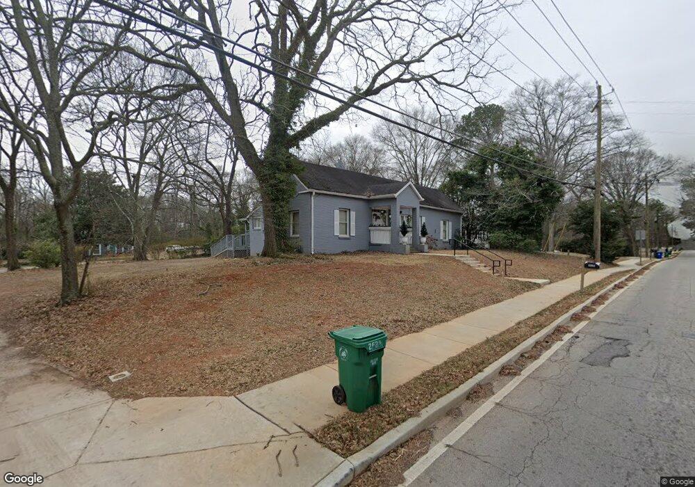
2523 Mcafee Rd Decatur, GA 30032
Estimated Value: $236,738 - $338,000
3
Beds
2
Baths
1,640
Sq Ft
$183/Sq Ft
Est. Value
About This Home
This home is located at 2523 Mcafee Rd, Decatur, GA 30032 and is currently estimated at $300,185, approximately $183 per square foot. 2523 Mcafee Rd is a home located in DeKalb County with nearby schools including Toney Elementary School, Columbia Middle School, and Columbia High School.
Ownership History
Date
Name
Owned For
Owner Type
Purchase Details
Closed on
Sep 3, 2009
Sold by
Maz Lalita
Bought by
Maz Lalita and Maz Vernice P
Current Estimated Value
Purchase Details
Closed on
Dec 10, 2008
Sold by
2006-He3 Citigroup Cmlti
Bought by
Maz Lalita
Purchase Details
Closed on
Oct 7, 2008
Sold by
Borokini Bankole
Bought by
Us Bank Na 2006-He3
Purchase Details
Closed on
Jul 5, 2006
Sold by
Addae Alfred
Bought by
Borokini Bankole
Home Financials for this Owner
Home Financials are based on the most recent Mortgage that was taken out on this home.
Original Mortgage
$45,000
Interest Rate
6.54%
Mortgage Type
Stand Alone Refi Refinance Of Original Loan
Purchase Details
Closed on
Dec 3, 2004
Sold by
Addae Alfred
Bought by
Anglade Lindsay
Home Financials for this Owner
Home Financials are based on the most recent Mortgage that was taken out on this home.
Original Mortgage
$156,750
Interest Rate
5.66%
Mortgage Type
New Conventional
Purchase Details
Closed on
Apr 21, 2004
Sold by
Jpmorgan Chase Bank
Bought by
Addae Alfred
Home Financials for this Owner
Home Financials are based on the most recent Mortgage that was taken out on this home.
Original Mortgage
$94,000
Interest Rate
6.25%
Mortgage Type
Purchase Money Mortgage
Purchase Details
Closed on
Feb 3, 2004
Sold by
Harruna Razak
Bought by
Jp Morgan Chase Bk
Purchase Details
Closed on
May 9, 2003
Sold by
Burgess Damon
Bought by
Harruna Razak
Home Financials for this Owner
Home Financials are based on the most recent Mortgage that was taken out on this home.
Original Mortgage
$162,000
Interest Rate
5.86%
Mortgage Type
New Conventional
Purchase Details
Closed on
Feb 24, 2003
Sold by
Neighborhood Investment Group
Bought by
Burgess Damon
Purchase Details
Closed on
Jan 7, 2003
Sold by
Parks Brenda
Bought by
Neighborhood Investment Group
Purchase Details
Closed on
Sep 18, 1998
Sold by
Goober Lee V
Bought by
Parks Brenda
Home Financials for this Owner
Home Financials are based on the most recent Mortgage that was taken out on this home.
Original Mortgage
$55,385
Interest Rate
6.76%
Mortgage Type
New Conventional
Create a Home Valuation Report for This Property
The Home Valuation Report is an in-depth analysis detailing your home's value as well as a comparison with similar homes in the area
Home Values in the Area
Average Home Value in this Area
Purchase History
| Date | Buyer | Sale Price | Title Company |
|---|---|---|---|
| Maz Lalita | -- | -- | |
| Maz Lalita | $33,900 | -- | |
| Us Bank Na 2006-He3 | $46,575 | -- | |
| Borokini Bankole | $225,000 | -- | |
| Anglade Lindsay | $165,000 | -- | |
| Addae Alfred | $76,500 | -- | |
| Jp Morgan Chase Bk | $135,261 | -- | |
| Harruna Razak | $180,000 | -- | |
| Burgess Damon | $85,000 | -- | |
| Neighborhood Investment Group | $80,000 | -- | |
| Parks Brenda | $49,000 | -- |
Source: Public Records
Mortgage History
| Date | Status | Borrower | Loan Amount |
|---|---|---|---|
| Previous Owner | Borokini Bankole | $45,000 | |
| Previous Owner | Anglade Lindsay | $156,750 | |
| Previous Owner | Addae Alfred | $94,000 | |
| Previous Owner | Harruna Razak | $162,000 | |
| Previous Owner | Parks Brenda | $55,385 |
Source: Public Records
Tax History Compared to Growth
Tax History
| Year | Tax Paid | Tax Assessment Tax Assessment Total Assessment is a certain percentage of the fair market value that is determined by local assessors to be the total taxable value of land and additions on the property. | Land | Improvement |
|---|---|---|---|---|
| 2025 | $2,604 | $95,200 | $29,360 | $65,840 |
| 2024 | $2,648 | $95,360 | $19,720 | $75,640 |
| 2023 | $2,648 | $89,080 | $19,720 | $69,360 |
| 2022 | $2,223 | $80,400 | $4,240 | $76,160 |
| 2021 | $2,022 | $71,680 | $4,240 | $67,440 |
| 2020 | $1,688 | $57,000 | $4,240 | $52,760 |
| 2019 | $1,359 | $43,240 | $3,040 | $40,200 |
| 2018 | $995 | $37,240 | $3,040 | $34,200 |
| 2017 | $1,073 | $31,560 | $3,040 | $28,520 |
| 2016 | $810 | $24,640 | $3,040 | $21,600 |
| 2014 | $1,024 | $23,000 | $3,040 | $19,960 |
Source: Public Records
Map
Nearby Homes
- 2505 Mellville Ave
- 2076 Windy Hill Rd
- 2425 Mellville Ave
- 2453 Mellville Ave
- 2653 Tilson Rd
- 2671 Tilson Rd
- 2623 Northview Ave
- 2390 Mellville Ave
- 2616 Northview Ave
- 2628 Northview Ave
- 2554 Brentwood Rd
- 2564 Brentwood Rd
- 2490 Brentwood Rd
- 2413 Hillside Ave
- 2369 Mcafee Rd
- 1902 Canterbury St
- 2392 Marion Cir
- 2665 Northview Ave
- 2196 Knoll Dr
- 2203 Knoll Dr
- 2519 Mcafee Rd
- 2535 Mcafee Rd
- 2511 Mcafee Rd
- 2533 Mcafee Rd
- 2512 Mcafee Rd
- 2543 Mcafee Rd
- 2538 Mcafee Rd
- 2530 Mcafee Rd
- 2536 Mcafee Rd
- 2504 Mcafee Rd
- 2503 Mcafee Rd
- 2540 Mcafee Rd
- 2551 Mcafee Rd Unit 1
- 2551 Mcafee Rd
- 2049 Windy Hill Rd
- 2498 Mcafee Rd
- 2493 Mcafee Rd
- 2535 Mellville Ave
- 2523 Mellville Ave
- 2527 Mellville Ave