
Landlord's Agent in 2020
Mark Lovfald
RE/MAX
51 Total Sales
Estimated Value: $460,000 - $616,000
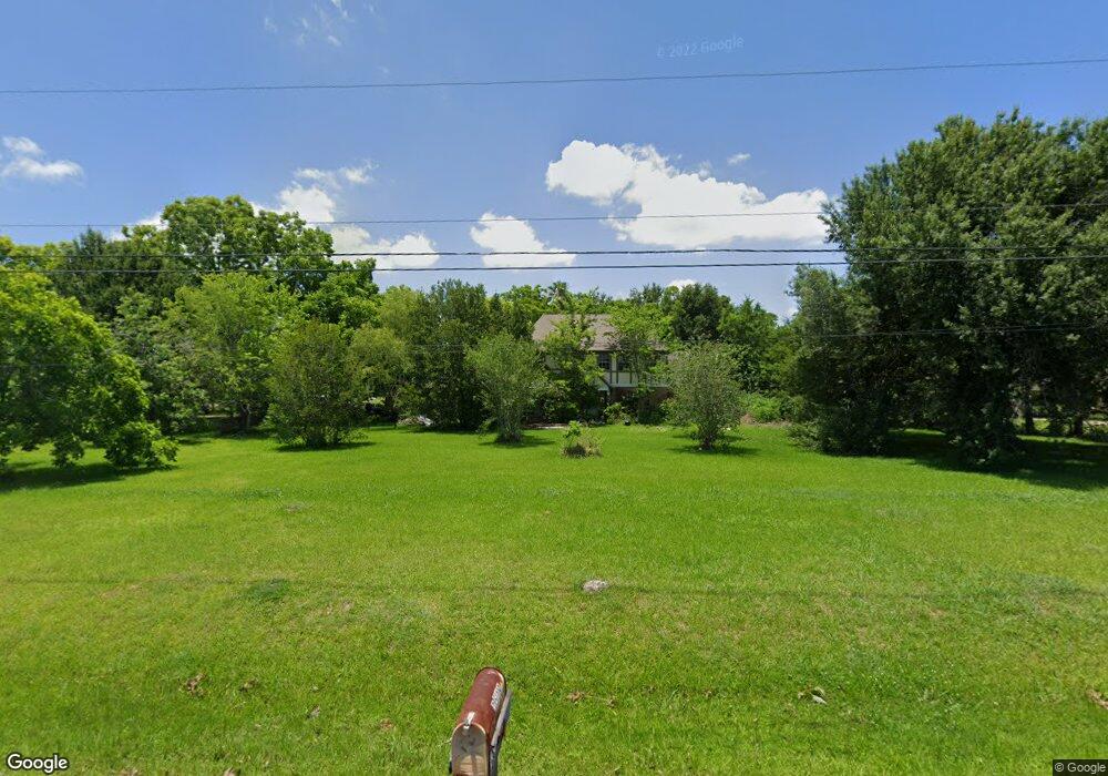
READY FOR QUICK MOVE IN. COUNTRY STYLE LIVING YET CLOSE TO EVERYTHING! RARE CUSTOM BLY 4/2/2 ON 1.5 ACRES. HORSES WELCOME (RESTRICTIONS APPLY)*MASTER BEDROOM DOWN*EXTENSIVE TILE FLOORS*BOTH FORMALS*SPACIOUS SECONDARY BEDROOMS UP*COUNTRY KITCHEN OPEN TO LIVING AREA*BRICK BREAKFAST BAR*LARGE COVERED FRONT AND BACK PORCH*OVERSIZED 4 CAR DETACHED GARAGE*WITHIN WALKING DISTANCE TO RUSTIC OAKS ELEMENTARY. EZ ACESS TO MAJOR ROADS/SCHOOLS/COMMERCE
Last Agent to Rent the Property
RE/MAX Space Center License #0434171 Listed on: 09/12/2019
| Date | Event | Price | List to Sale | Price per Sq Ft |
|---|---|---|---|---|
| 03/05/2025 03/05/25 | Off Market | $1,995 | -- | -- |
| 12/30/2021 12/30/21 | Off Market | $1,795 | -- | -- |
| 03/13/2020 03/13/20 | Rented | $1,995 | -4.8% | -- |
| 02/12/2020 02/12/20 | Under Contract | -- | -- | -- |
| 09/12/2019 09/12/19 | For Rent | $2,095 | +16.7% | -- |
| 10/25/2018 10/25/18 | Rented | $1,795 | -10.0% | -- |
| 09/25/2018 09/25/18 | Under Contract | -- | -- | -- |
| 08/03/2018 08/03/18 | For Rent | $1,995 | -- | -- |
| Year | Tax Paid | Tax Assessment Tax Assessment Total Assessment is a certain percentage of the fair market value that is determined by local assessors to be the total taxable value of land and additions on the property. | Land | Improvement |
|---|---|---|---|---|
| 2025 | $8,176 | $481,180 | $174,300 | $306,880 |
| 2023 | $8,176 | $496,220 | $157,790 | $338,430 |
| 2022 | $10,006 | $399,360 | $157,790 | $241,570 |
| 2021 | $9,025 | $337,210 | $136,740 | $200,470 |
| 2020 | $8,526 | $316,000 | $126,230 | $189,770 |
| 2019 | $8,460 | $313,500 | $126,230 | $187,270 |
| 2018 | $8,383 | $312,000 | $136,740 | $175,260 |
| 2017 | $8,101 | $300,000 | $147,270 | $152,730 |
| 2016 | $7,102 | $263,000 | $98,180 | $164,820 |
| 2014 | $4,577 | $215,000 | $70,130 | $144,870 |
Landlord's Agent in 2020
Mark Lovfald
RE/MAX
51 Total Sales
J
Tenant's Agent in 2020
Johnny Page
Coldwell Banker Realty - Katy
(281) 832-4481
46 Total Sales
Seller's Agent in 2018
John Nugent
RE/MAX
(281) 488-1212
22 Total Sales
J
Buyer's Agent in 2018
Janice Williams
UTR TEXAS, REALTORS
(832) 221-5441
33 Total Sales
Source: Houston Association of REALTORS®
MLS Number: 49344571
APN: 8225-0015-130
Disclaimer: Certain information contained herein is derived from information provided by parties other than Homes.com. All information provided is deemed reliable, but is not guaranteed to be accurate and should be independently verified.
![]() Copyright 2025, Houston REALTORS® Information Service, Inc.
Copyright 2025, Houston REALTORS® Information Service, Inc.
The information provided is exclusively for consumers’ personal, non-commercial use, and may not be used for any purpose other than to identify prospective properties consumers may be interested in purchasing.
Information is deemed reliable but not guaranteed.