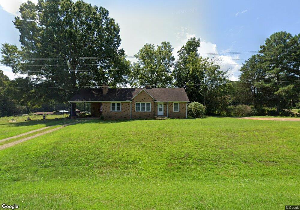
2524 Highway 73 Iron Station, NC 28080
Estimated Value: $215,000 - $296,000
3
Beds
1
Bath
1,272
Sq Ft
$191/Sq Ft
Est. Value
About This Home
This home is located at 2524 Highway 73, Iron Station, NC 28080 and is currently estimated at $243,545, approximately $191 per square foot. 2524 Highway 73 is a home located in Lincoln County with nearby schools including Iron Station Elementary School, East Lincoln Middle School, and East Lincoln High School.
Ownership History
Date
Name
Owned For
Owner Type
Purchase Details
Closed on
Sep 30, 2021
Sold by
Gordon Perkins Jr Guy and Gordon Cheree Helen
Bought by
Perkins Guy Hampton
Current Estimated Value
Purchase Details
Closed on
Aug 24, 2009
Sold by
Perkins Lois S
Bought by
Perkins Guy Gordon
Purchase Details
Closed on
Jun 28, 2005
Sold by
Perkins Lois S and Perkins Lois S
Bought by
Perkins Guy Gordon
Create a Home Valuation Report for This Property
The Home Valuation Report is an in-depth analysis detailing your home's value as well as a comparison with similar homes in the area
Home Values in the Area
Average Home Value in this Area
Purchase History
| Date | Buyer | Sale Price | Title Company |
|---|---|---|---|
| Perkins Guy Hampton | -- | Pendleton Law Firm Pa | |
| Perkins Guy Gordon | -- | None Available | |
| Perkins Guy Gordon | -- | None Available |
Source: Public Records
Tax History Compared to Growth
Tax History
| Year | Tax Paid | Tax Assessment Tax Assessment Total Assessment is a certain percentage of the fair market value that is determined by local assessors to be the total taxable value of land and additions on the property. | Land | Improvement |
|---|---|---|---|---|
| 2025 | $1,205 | $170,604 | $44,048 | $126,556 |
| 2024 | $1,185 | $170,604 | $44,048 | $126,556 |
| 2023 | $1,180 | $170,604 | $44,048 | $126,556 |
| 2022 | $850 | $98,848 | $29,374 | $69,474 |
| 2021 | $969 | $114,747 | $42,283 | $72,464 |
| 2020 | $831 | $114,747 | $42,283 | $72,464 |
| 2019 | $808 | $114,747 | $42,283 | $72,464 |
| 2018 | $850 | $104,585 | $40,953 | $63,632 |
| 2017 | $743 | $104,585 | $40,953 | $63,632 |
| 2016 | $743 | $104,585 | $40,953 | $63,632 |
| 2015 | $815 | $104,585 | $40,953 | $63,632 |
| 2014 | $855 | $111,824 | $42,124 | $69,700 |
Source: Public Records
Map
Nearby Homes
- 000 N Carolina 73
- 341 Camp Creek Rd
- Lot 6 Walnut Ridge Rd Unit 6
- 00 Timber Rd
- 375 Timber Rd
- 1894 N Carolina 73
- 429 Link Dr
- 132 Huncoat Hollow Ln
- 1011 Lester Trail
- 5045 Amity Ln Unit 12
- 1279 Craig Dr
- 1076 Furnace Rd
- 3132 Fox Den Cir
- 3960 Orchard Rd
- 812 Trinity Ln
- 1481 Depot St
- 1554 Forum Ln
- 00 Southmont Rd
- Lot #42 Sardis Ct
- 5039 Penn Rd
- 2551 Nc 73 Hwy
- 2462 Highway 73
- 2590 Nc 73 Hwy
- 151 Guy Perkins Trail
- 148 Rudisill Ln
- 196 Fea Ln
- 121 Mossy Rock Trail
- 2626 Highway 73
- 189 Fea Ln
- 2430 Highway 73
- 128 Woodward Way
- 2633 Highway 73
- 147 Woodward Way
- 140 Woodward Way Unit 4
- 9 Woodward Way Unit 9
- 1002 Secretariat Ct
- Lot 11 Woodward Way
- 4605 Rye Ct
- 4600 Rye Ct
- Lot 10 Woodward Way Unit 10