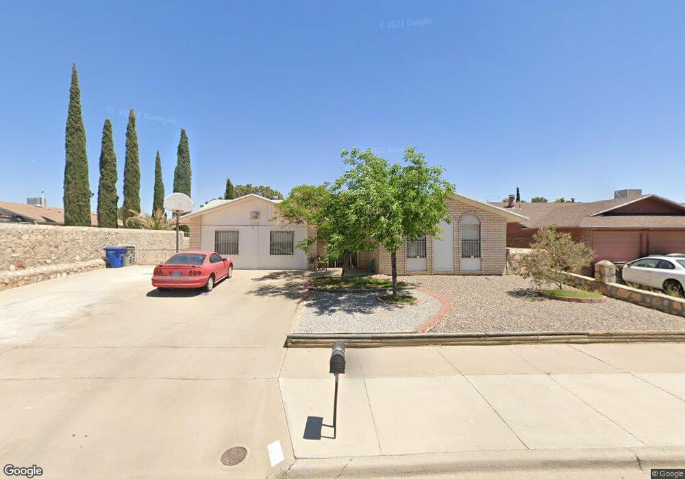
2528 Sea Palm Dr El Paso, TX 79936
Glen Cove NeighborhoodEstimated Value: $199,000 - $232,000
3
Beds
2
Baths
1,308
Sq Ft
$169/Sq Ft
Est. Value
About This Home
This home is located at 2528 Sea Palm Dr, El Paso, TX 79936 and is currently estimated at $221,300, approximately $169 per square foot. 2528 Sea Palm Dr is a home located in El Paso County with nearby schools including Glen Cove Elementary School, J.M. Hanks Middle School, and J M Hanks High School.
Ownership History
Date
Name
Owned For
Owner Type
Purchase Details
Closed on
Jul 19, 2001
Sold by
Barron David W and Barron Rebecca A
Bought by
Mora Mona E
Current Estimated Value
Home Financials for this Owner
Home Financials are based on the most recent Mortgage that was taken out on this home.
Original Mortgage
$52,800
Outstanding Balance
$20,407
Interest Rate
7.18%
Estimated Equity
$200,893
Create a Home Valuation Report for This Property
The Home Valuation Report is an in-depth analysis detailing your home's value as well as a comparison with similar homes in the area
Home Values in the Area
Average Home Value in this Area
Purchase History
| Date | Buyer | Sale Price | Title Company |
|---|---|---|---|
| Mora Mona E | -- | -- |
Source: Public Records
Mortgage History
| Date | Status | Borrower | Loan Amount |
|---|---|---|---|
| Open | Mora Mona E | $52,800 |
Source: Public Records
Tax History Compared to Growth
Tax History
| Year | Tax Paid | Tax Assessment Tax Assessment Total Assessment is a certain percentage of the fair market value that is determined by local assessors to be the total taxable value of land and additions on the property. | Land | Improvement |
|---|---|---|---|---|
| 2025 | $2,148 | $190,755 | -- | -- |
| 2024 | $2,148 | $173,414 | -- | -- |
| 2023 | $2,053 | $157,649 | $0 | $0 |
| 2022 | $4,451 | $143,317 | $0 | $0 |
| 2021 | $4,235 | $141,055 | $22,772 | $118,283 |
| 2020 | $3,741 | $118,444 | $19,094 | $99,350 |
| 2018 | $3,655 | $117,521 | $19,094 | $98,427 |
| 2017 | $3,353 | $109,682 | $19,094 | $90,588 |
| 2016 | $3,353 | $109,682 | $19,094 | $90,588 |
| 2015 | $2,559 | $109,682 | $19,094 | $90,588 |
| 2014 | $2,559 | $108,927 | $19,094 | $89,833 |
Source: Public Records
Map
Nearby Homes
- 11201 Skipper Dr
- 11276 Skipper Dr
- 2348 Sea Side Dr
- 2612 Lake Victoria Dr
- 2624 Lake Victoria Dr
- 11132 Wharf Cove Dr
- 2604 Anise Dr
- 11129 Nautical Dr
- 2101 E Glen Dr
- 11237 Pony Soldier Ave
- 2308 Tom Watson Ct
- 2825 Wong Place Unit A/D
- 2913 Lake Champlain St
- 11445 David Carrasco Dr
- 11345 Patricia Ave
- 11349 Patricia Ave
- 3121 Red Sails Dr
- 2600 Lake Michigan Dr
- 1913 Seagull Dr
- 11312 Ardelle Ave
- 2524 Sea Palm Dr
- 11216 Skipper Dr
- 11220 Skipper Dr
- 2525 Rudder Place
- 2520 Sea Palm Dr
- 11224 Skipper Dr
- 2521 Rudder Place
- 2529 Sea Palm Dr
- 2533 Sea Palm Dr
- 2525 Sea Palm Dr
- 2517 Rudder Place
- 2516 Sea Palm Dr
- 2537 Sea Palm Dr
- 2521 Sea Palm Dr
- 2513 Rudder Place
- 11221 Skipper Dr
- 2517 Sea Palm Dr
- 11217 Skipper Dr
- 11217 Skipper Dr Unit 1
- 2528 Rudder Place