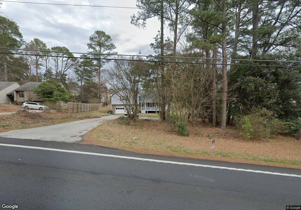
2528 Stone Dr SW Lilburn, GA 30047
Estimated Value: $332,000 - $353,000
3
Beds
3
Baths
2,512
Sq Ft
$137/Sq Ft
Est. Value
About This Home
This home is located at 2528 Stone Dr SW, Lilburn, GA 30047 and is currently estimated at $344,130, approximately $136 per square foot. 2528 Stone Dr SW is a home located in Gwinnett County with nearby schools including Shiloh Elementary School, Shiloh Middle School, and Shiloh High School.
Ownership History
Date
Name
Owned For
Owner Type
Purchase Details
Closed on
Jul 19, 2010
Sold by
Federal Natl Mtg Assn Fnma
Bought by
Sisay Dereje
Current Estimated Value
Home Financials for this Owner
Home Financials are based on the most recent Mortgage that was taken out on this home.
Original Mortgage
$77,710
Outstanding Balance
$51,315
Interest Rate
4.75%
Mortgage Type
FHA
Estimated Equity
$292,815
Purchase Details
Closed on
Mar 18, 1997
Sold by
Summer Robin H Debbie C
Bought by
Peters Ambrose P Cathy L
Create a Home Valuation Report for This Property
The Home Valuation Report is an in-depth analysis detailing your home's value as well as a comparison with similar homes in the area
Home Values in the Area
Average Home Value in this Area
Purchase History
| Date | Buyer | Sale Price | Title Company |
|---|---|---|---|
| Sisay Dereje | $80,000 | -- | |
| Peters Ambrose P Cathy L | $117,900 | -- |
Source: Public Records
Mortgage History
| Date | Status | Borrower | Loan Amount |
|---|---|---|---|
| Open | Sisay Dereje | $77,710 | |
| Closed | Peters Ambrose P Cathy L | $0 |
Source: Public Records
Tax History Compared to Growth
Tax History
| Year | Tax Paid | Tax Assessment Tax Assessment Total Assessment is a certain percentage of the fair market value that is determined by local assessors to be the total taxable value of land and additions on the property. | Land | Improvement |
|---|---|---|---|---|
| 2025 | $3,391 | $122,000 | $31,200 | $90,800 |
| 2024 | $3,513 | $122,000 | $31,200 | $90,800 |
| 2023 | $3,513 | $133,280 | $31,200 | $102,080 |
| 2022 | $2,537 | $76,720 | $14,000 | $62,720 |
| 2021 | $2,573 | $76,720 | $14,000 | $62,720 |
| 2020 | $2,445 | $82,440 | $14,000 | $68,440 |
| 2019 | $2,648 | $82,440 | $14,000 | $68,440 |
| 2018 | $2,031 | $54,400 | $10,200 | $44,200 |
| 2016 | $2,270 | $64,000 | $12,000 | $52,000 |
| 2015 | $2,293 | $64,000 | $12,000 | $52,000 |
| 2014 | $2,316 | $54,960 | $10,000 | $44,960 |
Source: Public Records
Map
Nearby Homes
- 4922 Signal Ct SW
- 5015 Shadow Path Ln SW
- 2390 Stone Dr SW
- 4806 Dean Ln SW
- 5018 Castlewood Dr SW
- 5027 Castlewood Dr SW
- 2701 Gardenwood Ct SW
- 2421 Rockbridge Rd SW
- 2251 Colonial Oak Way
- 126 Castle Club Dr
- 2291 Rodao Dr SW
- 2700 Riverfront Dr Unit 4
- 2650 Riverfront Dr
- 580 Overlook Dr
- 0 Hudson Dr Unit 7586860
- 5263 Pounds Dr N
- 5315 Pounds Dr S Unit 5
- 2877 Heather Row Ridge SW
- 5334 Pounds Dr N
- 2224 Hudson Dr SW
- 2526 Stone Dr SW
- 2536 Stone Dr SW
- 2516 Stone Dr SW
- 4983 Kiowa Ct SW
- 4973 Kiowa Ct SW Unit 10
- 2506 Stone Dr SW
- 4967 Mystere Cir SW
- 4957 Mystere Cir SW
- 4977 Mystere Cir SW
- 4963 Kiowa Ct SW
- 2500 Stone Dr SW
- 4947 Mystere Cir SW
- 4984 Kiowa Ct SW
- 4937 Mystere Cir SW Unit 1
- 2521 Stone Dr SW
- 2501 Stone Dr SW
- 4953 Kiowa Ct SW
- 2496 Stone Dr SW
- 2537 Stone Dr SW Unit 1
- 4964 Kiowa Ct SW Unit 10