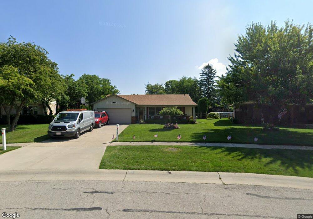
2529 Michael Ln Maumee, OH 43537
Estimated Value: $246,792 - $276,000
3
Beds
2
Baths
1,468
Sq Ft
$176/Sq Ft
Est. Value
About This Home
This home is located at 2529 Michael Ln, Maumee, OH 43537 and is currently estimated at $258,198, approximately $175 per square foot. 2529 Michael Ln is a home located in Lucas County with nearby schools including Holloway Elementary School, Springfield Middle School, and Springfield High School.
Ownership History
Date
Name
Owned For
Owner Type
Purchase Details
Closed on
Aug 6, 1996
Sold by
Ackerman Douglas R
Bought by
Rodriguez Michael R and Rodriguez Kathleen A
Current Estimated Value
Home Financials for this Owner
Home Financials are based on the most recent Mortgage that was taken out on this home.
Original Mortgage
$89,250
Outstanding Balance
$5,239
Interest Rate
8.33%
Mortgage Type
New Conventional
Estimated Equity
$252,959
Purchase Details
Closed on
Sep 19, 1988
Sold by
Ackerman J J and M J
Create a Home Valuation Report for This Property
The Home Valuation Report is an in-depth analysis detailing your home's value as well as a comparison with similar homes in the area
Home Values in the Area
Average Home Value in this Area
Purchase History
| Date | Buyer | Sale Price | Title Company |
|---|---|---|---|
| Rodriguez Michael R | $105,000 | -- | |
| -- | -- | -- |
Source: Public Records
Mortgage History
| Date | Status | Borrower | Loan Amount |
|---|---|---|---|
| Open | Rodriguez Michael R | $89,250 |
Source: Public Records
Tax History
| Year | Tax Paid | Tax Assessment Tax Assessment Total Assessment is a certain percentage of the fair market value that is determined by local assessors to be the total taxable value of land and additions on the property. | Land | Improvement |
|---|---|---|---|---|
| 2025 | -- | $61,950 | $20,020 | $41,930 |
| 2024 | $1,894 | $61,950 | $20,020 | $41,930 |
| 2023 | $4,018 | $57,610 | $17,885 | $39,725 |
| 2022 | $4,016 | $57,610 | $17,885 | $39,725 |
| 2021 | $3,779 | $57,610 | $17,885 | $39,725 |
| 2020 | $3,619 | $50,015 | $14,945 | $35,070 |
| 2019 | $3,535 | $50,015 | $14,945 | $35,070 |
| 2018 | $3,410 | $50,015 | $14,945 | $35,070 |
| 2017 | $3,314 | $43,680 | $14,945 | $28,735 |
| 2016 | $3,344 | $124,800 | $42,700 | $82,100 |
| 2015 | $3,338 | $124,800 | $42,700 | $82,100 |
| 2014 | $2,950 | $42,010 | $14,390 | $27,620 |
| 2013 | $2,950 | $42,010 | $14,390 | $27,620 |
Source: Public Records
Map
Nearby Homes
- 6652 Sue Ln
- 6705 Garden Rd Unit 6705
- 6731 Garden Rd Unit 6731
- 6418 Scarsdale Rd
- 6945 Garden Rd
- 6856 Morningdew Blvd
- 2161 Longacre Ln
- 7009 Shadowcreek Dr
- 2024 Inglewood Rd
- 2001 Perrysburg Holland Rd
- 8822 Garden Rd
- 2822 Pleasant Hill Rd
- 2437 Knights Hill Ln
- 6640 Salisbury Rd
- 6661 Brick Yard Ct
- 36 Wolf Ridge Dr
- 7223 Hunters Chase
- 2324 Mill Race Ct
- 3385 Manley Rd
- 6744 W Meadows Ln
- 6620 Sue Ln
- 2545 Michael Ln
- 2540 Bonnie Ln
- 2544 Bonnie Ln
- 6626 Sue Ln
- 2551 Michael Ln
- 6548 Marie Ln
- 2548 Michael Ln
- 6611 Garden Rd Unit 6611
- 6609 Garden Rd
- 6605 Garden Rd Unit 6605
- 6603 Garden Rd Unit 6603
- 6613 Garden Rd Unit 6613
- 6615 Garden Rd Unit 6615
- 6519 Garden Rd
- 2559 Michael Ln
- 6632 Sue Ln
- 6517 Garden Rd
- 6515 Garden Rd Unit 6515
- 6513 Garden Rd
Your Personal Tour Guide
Ask me questions while you tour the home.