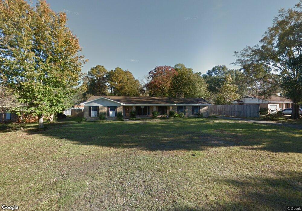
2529 S Daniels Rd Mobile, AL 36605
Neshota NeighborhoodEstimated Value: $179,000 - $269,000
3
Beds
2
Baths
2,230
Sq Ft
$98/Sq Ft
Est. Value
About This Home
This home is located at 2529 S Daniels Rd, Mobile, AL 36605 and is currently estimated at $218,235, approximately $97 per square foot. 2529 S Daniels Rd is a home located in Mobile County with nearby schools including Dr. Robert W. Gilliard Elementary School, Ben C Rain High School, and Revelation Christian School.
Ownership History
Date
Name
Owned For
Owner Type
Purchase Details
Closed on
Oct 21, 2004
Sold by
Smith Verline
Bought by
Browning Louis G and Browning Myrtle Inge
Current Estimated Value
Home Financials for this Owner
Home Financials are based on the most recent Mortgage that was taken out on this home.
Original Mortgage
$113,450
Outstanding Balance
$54,513
Interest Rate
5.64%
Mortgage Type
Unknown
Estimated Equity
$163,722
Create a Home Valuation Report for This Property
The Home Valuation Report is an in-depth analysis detailing your home's value as well as a comparison with similar homes in the area
Home Values in the Area
Average Home Value in this Area
Purchase History
| Date | Buyer | Sale Price | Title Company |
|---|---|---|---|
| Browning Louis G | -- | -- | |
| Smith Verline | -- | -- |
Source: Public Records
Mortgage History
| Date | Status | Borrower | Loan Amount |
|---|---|---|---|
| Open | Browning Louis G | $113,450 |
Source: Public Records
Tax History
| Year | Tax Paid | Tax Assessment Tax Assessment Total Assessment is a certain percentage of the fair market value that is determined by local assessors to be the total taxable value of land and additions on the property. | Land | Improvement |
|---|---|---|---|---|
| 2025 | $805 | $14,660 | $1,700 | $12,960 |
| 2024 | $805 | $14,660 | $1,700 | $12,960 |
| 2023 | $805 | $13,890 | $1,700 | $12,190 |
| 2022 | $748 | $13,830 | $1,500 | $12,330 |
| 2021 | $643 | $11,990 | $1,500 | $10,490 |
| 2020 | $643 | $12,000 | $1,500 | $10,500 |
| 2019 | $608 | $11,370 | $1,500 | $9,870 |
| 2018 | $616 | $11,520 | $0 | $0 |
| 2017 | $624 | $11,660 | $0 | $0 |
| 2016 | $723 | $13,400 | $0 | $0 |
| 2013 | $652 | $12,040 | $0 | $0 |
Source: Public Records
Map
Nearby Homes
- 2637 Robin Hood Dr
- 2374 Willowdale St
- 2467 Dauphin Island Pkwy
- 2315 S Hillwood Dr
- 2204 David Dr
- 1715 Gulfdale Dr
- 2905 Lott Dr
- 2753 S Lartigue Ave
- 2283 Cedar Point Rd
- 221 Riverbend Dr Unit 221
- 222 Riverbend Dr
- 301 Riverbend Dr
- 1550 N Lartigue Ave
- 1550 S Lartigue Ave
- 209 Riverbend Dr Unit 209
- 1904 Riverside Dr
- 3128 Club House Rd
- 1909 Riverside Dr
- 2001 Ostrom Dr
- 2113 Old Military Rd
- 2570 E Daniels Rd
- 2525 S Daniels Rd
- 2560 E Daniels Rd
- 2517 S Daniels Rd
- 2556 E Daniels Rd
- 2526 S Daniels Rd
- 1905 Merry Ln
- 2507 W Daniels Rd
- 1909 Merry Ln
- 2528 S Daniels Rd
- 2530 S Daniels Rd
- 2571 E Daniels Rd
- 2532 S Daniels Rd
- 2550 E Daniels Rd
- 2571 E Daniels Rd
- 2567 E Daniels Rd
- 2524 S Daniels Rd
- 2522 S Daniels Rd
- 2516 S Daniels Rd
- 1913 Merry Ln
Your Personal Tour Guide
Ask me questions while you tour the home.