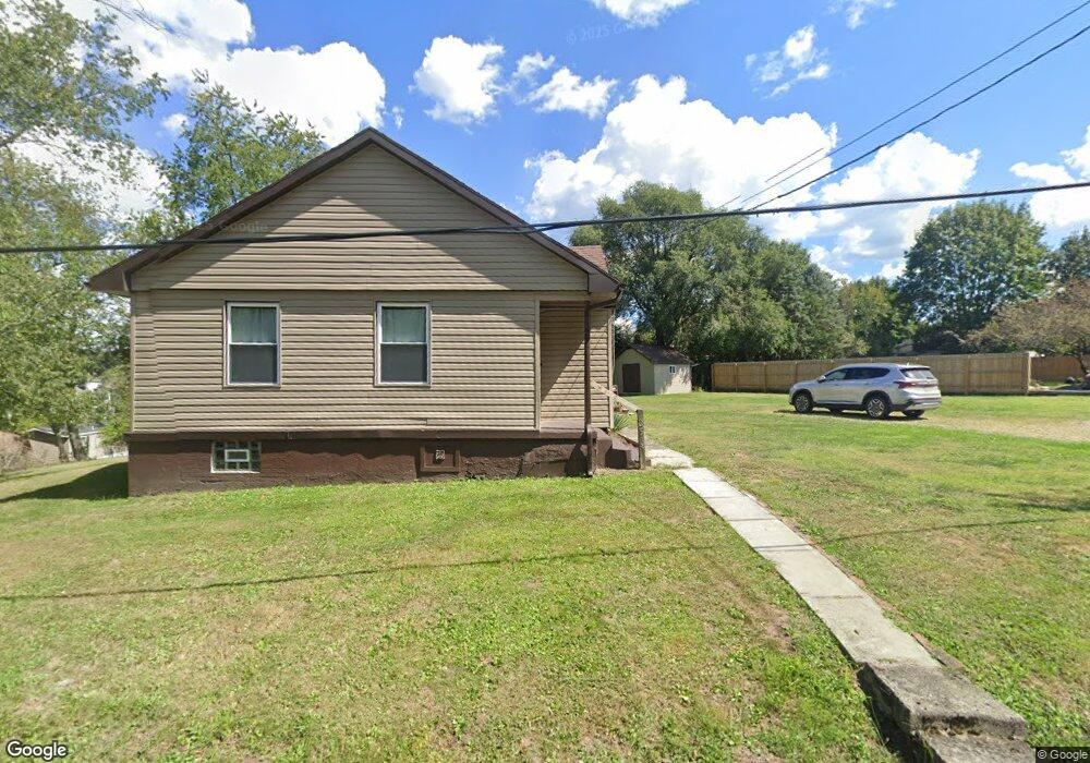
253 Brinker St Latrobe, PA 15650
Estimated Value: $61,000 - $201,000
--
Bed
--
Bath
1,148
Sq Ft
$107/Sq Ft
Est. Value
About This Home
This home is located at 253 Brinker St, Latrobe, PA 15650 and is currently estimated at $123,380, approximately $107 per square foot. 253 Brinker St is a home located in Westmoreland County with nearby schools including Grandview Elementary School, Derry Area Middle School, and Derry Area Senior High School.
Ownership History
Date
Name
Owned For
Owner Type
Purchase Details
Closed on
Feb 17, 2023
Sold by
Lesco Federal Credit Union
Bought by
Mckenzie Edward and Mckenzie Denise
Current Estimated Value
Purchase Details
Closed on
Oct 6, 2022
Sold by
Albert James
Bought by
Lesco Federal Credit Union
Purchase Details
Closed on
Aug 29, 2012
Sold by
David Misty L and Rhodes Misty L
Bought by
David Misty L and David Dane E
Home Financials for this Owner
Home Financials are based on the most recent Mortgage that was taken out on this home.
Original Mortgage
$60,000
Interest Rate
3.56%
Mortgage Type
Unknown
Purchase Details
Closed on
Mar 19, 2001
Sold by
Cmar Sally M
Bought by
Rhoades Misty L
Create a Home Valuation Report for This Property
The Home Valuation Report is an in-depth analysis detailing your home's value as well as a comparison with similar homes in the area
Home Values in the Area
Average Home Value in this Area
Purchase History
| Date | Buyer | Sale Price | Title Company |
|---|---|---|---|
| Mckenzie Edward | $52,500 | -- | |
| Lesco Federal Credit Union | $7,955 | -- | |
| David Misty L | -- | None Available | |
| Rhoades Misty L | $52,000 | -- |
Source: Public Records
Mortgage History
| Date | Status | Borrower | Loan Amount |
|---|---|---|---|
| Previous Owner | David Misty L | $60,000 |
Source: Public Records
Tax History Compared to Growth
Tax History
| Year | Tax Paid | Tax Assessment Tax Assessment Total Assessment is a certain percentage of the fair market value that is determined by local assessors to be the total taxable value of land and additions on the property. | Land | Improvement |
|---|---|---|---|---|
| 2025 | $1,038 | $8,350 | $2,800 | $5,550 |
| 2024 | $1,038 | $8,350 | $2,800 | $5,550 |
| 2023 | $1,472 | $12,550 | $3,300 | $9,250 |
| 2022 | $1,459 | $12,550 | $3,300 | $9,250 |
| 2021 | $1,459 | $12,550 | $3,300 | $9,250 |
| 2020 | $1,434 | $12,550 | $3,300 | $9,250 |
| 2019 | $1,403 | $12,550 | $3,300 | $9,250 |
| 2018 | $1,340 | $12,550 | $3,300 | $9,250 |
| 2017 | $1,305 | $12,550 | $3,300 | $9,250 |
| 2016 | $1,249 | $12,550 | $3,300 | $9,250 |
| 2015 | $1,249 | $12,550 | $3,300 | $9,250 |
| 2014 | $1,249 | $12,550 | $3,300 | $9,250 |
Source: Public Records
Map
Nearby Homes
- 253 Brinker St
- 248 Brinker St
- 237 Brinker St
- 243 Brinker St
- 234 Brinker St
- 226 Brinker St
- 260 Brinker St
- 220 Richmond St
- 227 Richmond St
- 225 Brinker St
- 216 Richmond St
- 280 Brinker St
- 204 Richmond St
- 211 Richmond St
- 130 Brennan Ave
- 218 Brinker St
- 215 Richmond St
- 217 Brinker St
- 126 Brennan Ave
- 136 Brennan Ave