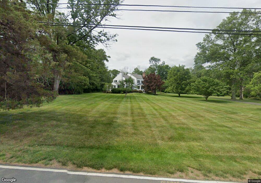
253 Herrontown Rd Princeton, NJ 08540
Estimated Value: $1,648,000 - $2,065,000
--
Bed
--
Bath
3,976
Sq Ft
$478/Sq Ft
Est. Value
About This Home
This home is located at 253 Herrontown Rd, Princeton, NJ 08540 and is currently estimated at $1,901,331, approximately $478 per square foot. 253 Herrontown Rd is a home located in Mercer County with nearby schools including Littlebrook Elementary School, Princeton Middle School, and Princeton High School.
Ownership History
Date
Name
Owned For
Owner Type
Purchase Details
Closed on
Nov 15, 1993
Sold by
Hamlett Joseph
Bought by
Stanley Robert and Tanley Carrie
Current Estimated Value
Home Financials for this Owner
Home Financials are based on the most recent Mortgage that was taken out on this home.
Original Mortgage
$196,000
Interest Rate
7.08%
Create a Home Valuation Report for This Property
The Home Valuation Report is an in-depth analysis detailing your home's value as well as a comparison with similar homes in the area
Home Values in the Area
Average Home Value in this Area
Purchase History
| Date | Buyer | Sale Price | Title Company |
|---|---|---|---|
| Stanley Robert | $245,000 | -- |
Source: Public Records
Mortgage History
| Date | Status | Borrower | Loan Amount |
|---|---|---|---|
| Previous Owner | Stanley Robert | $196,000 |
Source: Public Records
Tax History Compared to Growth
Tax History
| Year | Tax Paid | Tax Assessment Tax Assessment Total Assessment is a certain percentage of the fair market value that is determined by local assessors to be the total taxable value of land and additions on the property. | Land | Improvement |
|---|---|---|---|---|
| 2025 | $29,053 | $1,091,000 | $413,000 | $678,000 |
| 2024 | $27,428 | $1,091,000 | $413,000 | $678,000 |
| 2023 | $27,428 | $1,091,000 | $413,000 | $678,000 |
| 2022 | $26,533 | $1,091,000 | $413,000 | $678,000 |
| 2021 | $26,609 | $1,091,000 | $413,000 | $678,000 |
| 2020 | $27,266 | $1,126,700 | $460,000 | $666,700 |
| 2019 | $26,725 | $1,126,700 | $460,000 | $666,700 |
| 2018 | $26,275 | $1,126,700 | $460,000 | $666,700 |
| 2017 | $22,089 | $960,400 | $460,000 | $500,400 |
| 2016 | $21,743 | $960,400 | $460,000 | $500,400 |
| 2015 | $21,244 | $960,400 | $460,000 | $500,400 |
| 2014 | $20,985 | $960,400 | $460,000 | $500,400 |
Source: Public Records
Map
Nearby Homes
- 231 Bertrand Dr
- 1082 Princeton Kingston Rd
- 1082 Kingston Rd
- 119 Poe Rd
- 32 Gulick Rd
- 36 Needham Way Unit D
- 36 -D Needham Way
- 8B Brookline Ct
- 8 -B Brookline Ct Unit B
- 19G Evert Ct
- 50 Broadripple Dr
- 10 Shaw Dr
- 100 Jackson Ave
- 150 Leabrook Ln
- 33 Kennedy Ct
- 8 Governors Ln
- 23 Taft Ct
- 569 Riverside Dr
- 567 Riverside Dr
- 67 Locust Ln
- 285 Herrontown Rd
- 231 Herrontown Rd
- 275 Herrontown Rd
- 265 Herrontown Rd
- 88 Caldwell Dr
- 58 Caldwell Dr
- 188 Herrontown Rd
- 283 Herrontown Rd
- 221 Herrontown Rd
- 178 Herrontown Rd
- 74 Caldwell Dr
- 168 Herrontown Rd
- 63 Caldwell Dr
- 239 Herrontown Rd
- 158 Herrontown Rd
- 64 Caldwell Dr
- 315 Herrontown Rd
- 53 Caldwell Dr
- 148 Herrontown Rd
- 52 Caldwell Dr