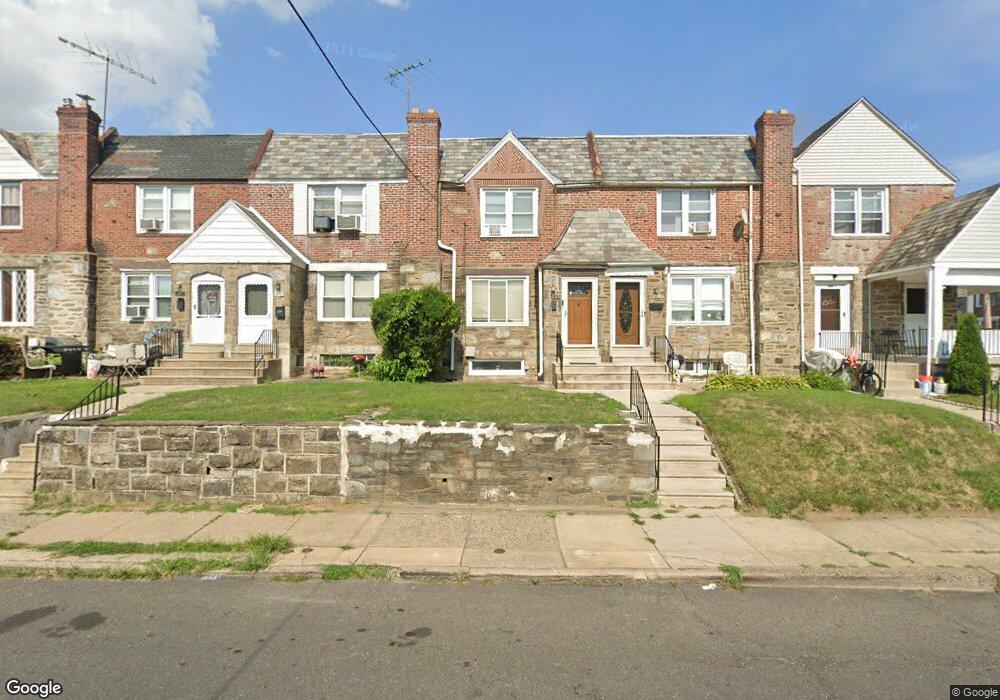
253 N Wycombe Ave Lansdowne, PA 19050
Estimated Value: $169,741 - $200,000
3
Beds
2
Baths
1,278
Sq Ft
$149/Sq Ft
Est. Value
About This Home
This home is located at 253 N Wycombe Ave, Lansdowne, PA 19050 and is currently estimated at $190,435, approximately $149 per square foot. 253 N Wycombe Ave is a home located in Delaware County with nearby schools including Charles Kelly El School, Upper Darby High School, and Vision Academy Charter School.
Ownership History
Date
Name
Owned For
Owner Type
Purchase Details
Closed on
Aug 29, 2000
Sold by
Demott Richard B and Demott Mary P
Bought by
Martin Michael and Martin Sherry
Current Estimated Value
Home Financials for this Owner
Home Financials are based on the most recent Mortgage that was taken out on this home.
Original Mortgage
$54,959
Outstanding Balance
$19,988
Interest Rate
8.07%
Mortgage Type
FHA
Estimated Equity
$170,447
Create a Home Valuation Report for This Property
The Home Valuation Report is an in-depth analysis detailing your home's value as well as a comparison with similar homes in the area
Home Values in the Area
Average Home Value in this Area
Purchase History
| Date | Buyer | Sale Price | Title Company |
|---|---|---|---|
| Martin Michael | $55,000 | Fidelity National Title Ins |
Source: Public Records
Mortgage History
| Date | Status | Borrower | Loan Amount |
|---|---|---|---|
| Open | Martin Michael | $54,959 |
Source: Public Records
Tax History Compared to Growth
Tax History
| Year | Tax Paid | Tax Assessment Tax Assessment Total Assessment is a certain percentage of the fair market value that is determined by local assessors to be the total taxable value of land and additions on the property. | Land | Improvement |
|---|---|---|---|---|
| 2025 | $3,234 | $76,470 | $14,620 | $61,850 |
| 2024 | $3,234 | $76,470 | $14,620 | $61,850 |
| 2023 | $3,204 | $76,470 | $14,620 | $61,850 |
| 2022 | $3,117 | $76,470 | $14,620 | $61,850 |
| 2021 | $4,203 | $76,470 | $14,620 | $61,850 |
| 2020 | $3,683 | $56,940 | $18,280 | $38,660 |
| 2019 | $3,619 | $56,940 | $18,280 | $38,660 |
| 2018 | $3,577 | $56,940 | $0 | $0 |
| 2017 | $3,484 | $56,940 | $0 | $0 |
| 2016 | $312 | $56,940 | $0 | $0 |
| 2015 | $312 | $56,940 | $0 | $0 |
| 2014 | $312 | $56,940 | $0 | $0 |
Source: Public Records
Map
Nearby Homes
- 243 Coverly Rd
- 239 N Maple Ave
- 291 N Wycombe Ave
- 7247 Guilford Rd
- 178 N Union Ave
- 319 E Essex Ave
- 317 E Essex Ave
- 315 E Essex Ave
- 164 Woodland Ave
- 404 Croyden Rd
- 143 Springton Rd
- 149 Springton Rd
- 7229 Clinton Rd
- 209 E Greenwood Ave
- 142 Springton Rd
- 226 E Greenwood Ave
- 7216 Clinton Rd
- 7265 Calvin Rd
- 88 E Essex Ave
- 669 Long Ln
- 247 N Wycombe Ave
- 245 N Wycombe Ave
- 243 N Wycombe Ave
- 265 N Wycombe Ave
- 263 N Wycombe Ave
- 259 N Wycombe Ave
- 257 N Wycombe Ave
- 251 N Wycombe Ave
- 249 N Wycombe Ave
- 241 N Wycombe Ave
- 212 Le Carra Dr
- 200 Le Carra Dr
- 239 N Wycombe Ave
- 202 Le Carra Dr
- 271 N Wycombe Ave Unit 1
- 271 N Wycombe Ave
- 206 Le Carra Dr
- 210 Le Carra Dr
- 260 N Wycombe Ave
- 248 N Wycombe Ave Unit 2