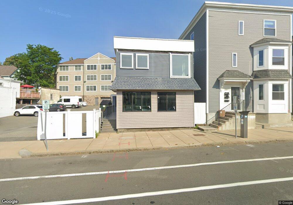
253 Rantoul St Unit 19 Beverly, MA 01915
Downtown Beverly NeighborhoodEstimated Value: $513,141
Studio
3
Baths
3,975
Sq Ft
$129/Sq Ft
Est. Value
About This Home
This home is located at 253 Rantoul St Unit 19, Beverly, MA 01915 and is currently estimated at $513,141, approximately $129 per square foot. 253 Rantoul St Unit 19 is a home located in Essex County with nearby schools including Beverly High School, Waldorf School at Moraine Farm, and The Phoenix School.
Ownership History
Date
Name
Owned For
Owner Type
Purchase Details
Closed on
Oct 29, 2012
Sold by
Atlas Mortgage Corp
Bought by
253 Rantoul St Rlty Ll
Current Estimated Value
Purchase Details
Closed on
Jul 13, 2007
Sold by
Rangeway Farms Llc
Bought by
Atlas Mortgage Corp
Purchase Details
Closed on
Jan 31, 2007
Sold by
Atlas Mortgage Corp and Avelino Dev Co Inc
Bought by
Atlas Mtg Corp
Purchase Details
Closed on
Dec 22, 2005
Sold by
Rangeway Farms Llc
Bought by
Avelino Dev Co Inc
Home Financials for this Owner
Home Financials are based on the most recent Mortgage that was taken out on this home.
Original Mortgage
$2,400,000
Interest Rate
6.36%
Mortgage Type
Commercial
Purchase Details
Closed on
Jan 22, 2003
Sold by
Daren Rt and Darren Rt
Bought by
Rangeway Farms Llc
Create a Home Valuation Report for This Property
The Home Valuation Report is an in-depth analysis detailing your home's value as well as a comparison with similar homes in the area
Home Values in the Area
Average Home Value in this Area
Purchase History
| Date | Buyer | Sale Price | Title Company |
|---|---|---|---|
| 253 Rantoul St Rlty Ll | -- | -- | |
| 253 Rantoul St Rlty Ll | -- | -- | |
| Atlas Mortgage Corp | $293,750 | -- | |
| Atlas Mtg Corp | $2,150,000 | -- | |
| Avelino Dev Co Inc | $780,000 | -- | |
| Rangeway Farms Llc | $670,000 | -- |
Source: Public Records
Mortgage History
| Date | Status | Borrower | Loan Amount |
|---|---|---|---|
| Previous Owner | Rangeway Farms Llc | $2,400,000 | |
| Previous Owner | Rangeway Farms Llc | $450,000 |
Source: Public Records
Tax History
| Year | Tax Paid | Tax Assessment Tax Assessment Total Assessment is a certain percentage of the fair market value that is determined by local assessors to be the total taxable value of land and additions on the property. | Land | Improvement |
|---|---|---|---|---|
| 2025 | $11,241 | $524,300 | $0 | $524,300 |
| 2024 | $10,981 | $500,500 | $0 | $500,500 |
| 2023 | $11,046 | $500,500 | $0 | $500,500 |
| 2022 | $8,059 | $337,200 | $0 | $337,200 |
| 2021 | $8,037 | $323,300 | $0 | $323,300 |
| 2020 | $7,258 | $293,500 | $0 | $293,500 |
| 2019 | $7,458 | $293,500 | $0 | $293,500 |
| 2018 | $7,112 | $276,500 | $0 | $276,500 |
| 2017 | $7,099 | $264,600 | $0 | $264,600 |
| 2016 | $6,988 | $264,600 | $0 | $264,600 |
| 2015 | $6,147 | $239,200 | $0 | $239,200 |
Source: Public Records
Map
Nearby Homes
- 261 Rantoul St
- 315 Rantoul St Unit 406
- 348 Rantoul St Unit 202
- 34 Chase St
- 17 Pond St
- 40 Railroad Ave Unit B2
- The Cabot Collection
- 13 Fayette St Unit 3
- 60 Rantoul St Unit 604N
- 60 Rantoul St Unit 114N
- 24 Franklin Place
- 50 Rantoul St Unit 509S
- 16 School St Unit 3
- 23 1/2 Lovett St
- 12 Summit Ave Unit 4
- 6 Pilgrim Heights
- 94 Essex St
- 412 Cabot St
- 6 Charles St
- 7 Lothrop St
- 253 Rantoul St
- 48 Federal St Unit 306
- 48 Federal St Unit 305
- 48 Federal St Unit 304
- 48 Federal St Unit 303
- 48 Federal St Unit 302
- 48 Federal St Unit 301
- 48 Federal St Unit 206
- 48 Federal St Unit 205
- 48 Federal St Unit 204
- 48 Federal St Unit 203
- 48 Federal St Unit 202
- 48 Federal St Unit 201
- 48 Federal St Unit 106
- 48 Federal St Unit 105
- 48 Federal St Unit 104
- 48 Federal St Unit 103
- 48 Federal St Unit 102
- 48 Federal St Unit 101
- 251 Rantoul St
Your Personal Tour Guide
Ask me questions while you tour the home.