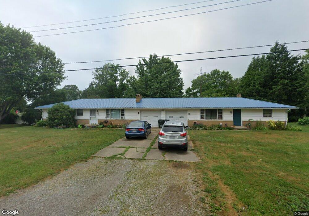
253 Shadyside St NE East Canton, OH 44730
Estimated Value: $175,000 - $218,000
5
Beds
2
Baths
1,968
Sq Ft
$103/Sq Ft
Est. Value
About This Home
This home is located at 253 Shadyside St NE, East Canton, OH 44730 and is currently estimated at $202,699, approximately $102 per square foot. 253 Shadyside St NE is a home located in Stark County with nearby schools including East Canton Elementary School, East Canton Middle School, and East Canton High School.
Ownership History
Date
Name
Owned For
Owner Type
Purchase Details
Closed on
Jul 25, 2016
Bought by
Angel R Vaughn
Current Estimated Value
Home Financials for this Owner
Home Financials are based on the most recent Mortgage that was taken out on this home.
Interest Rate
3.45%
Purchase Details
Closed on
Jun 4, 2003
Sold by
Lowe Dewey P
Bought by
Lowe Dewey P and The Dewey P Lowe Revocable Living Trust
Purchase Details
Closed on
Apr 30, 1991
Create a Home Valuation Report for This Property
The Home Valuation Report is an in-depth analysis detailing your home's value as well as a comparison with similar homes in the area
Home Values in the Area
Average Home Value in this Area
Purchase History
| Date | Buyer | Sale Price | Title Company |
|---|---|---|---|
| Angel R Vaughn | -- | -- | |
| Lowe Dewey P | -- | -- | |
| -- | $88,000 | -- |
Source: Public Records
Mortgage History
| Date | Status | Borrower | Loan Amount |
|---|---|---|---|
| Closed | Angel R Vaughn | -- |
Source: Public Records
Tax History Compared to Growth
Tax History
| Year | Tax Paid | Tax Assessment Tax Assessment Total Assessment is a certain percentage of the fair market value that is determined by local assessors to be the total taxable value of land and additions on the property. | Land | Improvement |
|---|---|---|---|---|
| 2025 | -- | $57,120 | $17,220 | $39,900 |
| 2024 | -- | $57,120 | $17,220 | $39,900 |
| 2023 | $2,202 | $48,830 | $14,880 | $33,950 |
| 2022 | $2,091 | $48,830 | $14,880 | $33,950 |
| 2021 | $2,099 | $48,830 | $14,880 | $33,950 |
| 2020 | $2,066 | $43,620 | $13,270 | $30,350 |
| 2019 | $2,033 | $43,620 | $13,270 | $30,350 |
| 2018 | $2,017 | $43,620 | $13,270 | $30,350 |
| 2017 | $1,817 | $42,050 | $12,290 | $29,760 |
| 2016 | $1,795 | $40,160 | $12,290 | $27,870 |
| 2015 | $1,276 | $28,260 | $12,290 | $15,970 |
| 2014 | $1,980 | $40,050 | $10,330 | $29,720 |
| 2013 | $994 | $40,050 | $10,330 | $29,720 |
Source: Public Records
Map
Nearby Homes
- 137 Noble St W
- 223 Nassau St W
- 233 Nassau St W
- 225 - 227 Plum St N
- 0 Lincoln St SE Unit 5157290
- 0 Lincoln St SE Unit 5157308
- 0 Lincoln St SE Unit 5157344
- 2260 Broadway Ave NE
- 6416 15th St NE
- 1527 Johns Ave SE
- 2425 Miday Ave NE
- 6969 Georgetown St NE
- 4520 Georgetown Rd NE
- 1990 Belfort Ave
- 8225 Georgetown St
- 1702 View Pointe Ave
- 1639 Horizon Dr
- 908 Sand Lot Cir
- 3894 Tulane Ave
- 4060 Hambleton Ave NE
- 242 Orchard St NE
- 265 Shadyside St NE
- 233 Shadyside St NE
- 252 Shadyside St NE
- 242 Shadyside St NE
- 264 Shadyside St NE
- 224 Orchard St NE
- 241 Orchard St NE
- 232 Shadyside St NE
- 223 Shadyside St NE
- 274 Shadyside St NE
- 221 Orchard St NE
- 253 Willow St N
- 243 Willow St N
- 118 Shadyside St NE
- 506 Wood St N
- 311 Willow St N
- 522 Wood St N
- 456 Wood St N
- 450 Wood St N