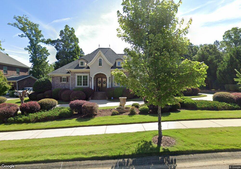
253 Wren Creek Cir Blythewood, SC 29016
Estimated Value: $511,000 - $721,000
4
Beds
4
Baths
3,010
Sq Ft
$194/Sq Ft
Est. Value
About This Home
This home is located at 253 Wren Creek Cir, Blythewood, SC 29016 and is currently estimated at $583,667, approximately $193 per square foot. 253 Wren Creek Cir is a home located in Richland County with nearby schools including Bethel-Hanberry Elementary School, Muller Road Middle, and Westwood High School.
Ownership History
Date
Name
Owned For
Owner Type
Purchase Details
Closed on
Sep 28, 2015
Sold by
Thompson Mary A and Thompson John D
Bought by
Hayes Chrisandra R
Current Estimated Value
Home Financials for this Owner
Home Financials are based on the most recent Mortgage that was taken out on this home.
Original Mortgage
$405,000
Outstanding Balance
$319,620
Interest Rate
3.97%
Mortgage Type
New Conventional
Estimated Equity
$264,047
Purchase Details
Closed on
Aug 16, 2006
Sold by
Wren Creek Development Llc
Bought by
Thompson John David and Thompson Mary Ann
Create a Home Valuation Report for This Property
The Home Valuation Report is an in-depth analysis detailing your home's value as well as a comparison with similar homes in the area
Home Values in the Area
Average Home Value in this Area
Purchase History
| Date | Buyer | Sale Price | Title Company |
|---|---|---|---|
| Hayes Chrisandra R | $171,346 | -- | |
| Thompson John David | $55,000 | None Available |
Source: Public Records
Mortgage History
| Date | Status | Borrower | Loan Amount |
|---|---|---|---|
| Open | Hayes Chrisandra R | $405,000 |
Source: Public Records
Tax History Compared to Growth
Tax History
| Year | Tax Paid | Tax Assessment Tax Assessment Total Assessment is a certain percentage of the fair market value that is determined by local assessors to be the total taxable value of land and additions on the property. | Land | Improvement |
|---|---|---|---|---|
| 2023 | $386 | $0 | $0 | $0 |
| 2021 | $324 | $11,904 | $2,000 | $9,904 |
| 2020 | $324 | $0 | $0 | $0 |
| 2019 | $286 | $0 | $0 | $0 |
| 2018 | $249 | $0 | $0 | $0 |
| 2017 | $249 | $0 | $0 | $0 |
| 2016 | $249 | $0 | $0 | $0 |
| 2015 | $2,951 | $12,460 | $0 | $0 |
| 2014 | $2,945 | $311,500 | $0 | $0 |
| 2013 | -- | $12,460 | $0 | $0 |
Source: Public Records
Map
Nearby Homes
- 3 Wading Bird Loop
- 125 Upper Wing Trail
- 43 Glen Ord Ct
- 189 Wading Bird Loop
- 38 Athlone Ct
- 436 Manhasset Ct
- 293 Hawkins Creek Rd
- 203 Roundtree Rd
- 220 Hawkins Creek Rd
- 105 Dunwoody Place
- 471 Turkey Farm Rd
- 270 Honey Hill Way
- 721 Wimbee Ct
- 720 Wimbee Ct
- 52 Roundtree Rd
- 48 Roundtree Rd
- 40 Roundtree Rd
- 44 Roundtree Rd
- 781 Pebblebranch Ln
- 785 Pebblebranch Ln
- 249 Wren Creek Cir
- 200 Wren Creek Cir
- 250 Wren Creek Cir
- 1170 Wren Creek Dr
- 206 Wren Creek Cir
- 242 Wren Creek Cir
- 212 Wren Creek Cir
- 205 Wren Creek Cir
- 218 Wren Creek Cir
- 209 Wren Creek Cir
- 226 Wren Creek Cir
- 180 Upper Wing Trail
- 184 Upper Wing Trail
- 1188 Wren Creek Dr
- 282 Turkey Farm Rd
- 176 Upper Wing Trail
- 221 Wren Creek Cir
- 186 Upper Wing Trail
- 225 Wren Creek Cir
- 1111 Wren Creek Dr