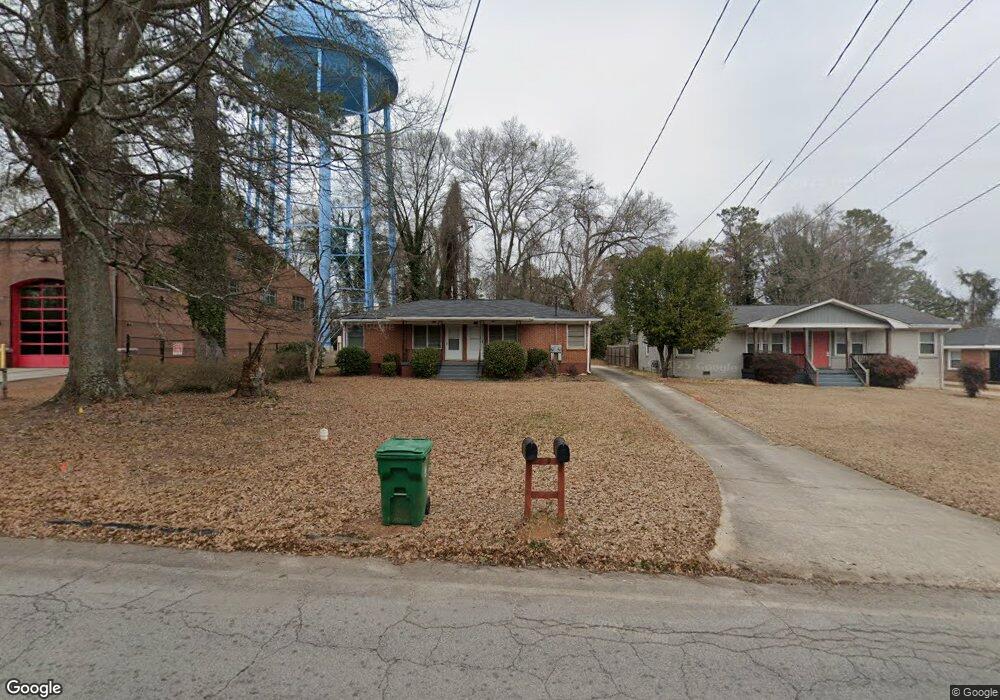
2530 Mcafee Rd Decatur, GA 30032
East Lake Terrace NeighborhoodEstimated Value: $291,000 - $383,000
4
Beds
2
Baths
100
Sq Ft
$3,355/Sq Ft
Est. Value
About This Home
This home is located at 2530 Mcafee Rd, Decatur, GA 30032 and is currently estimated at $335,498, approximately $3,354 per square foot. 2530 Mcafee Rd is a home located in DeKalb County with nearby schools including Toney Elementary School, Columbia Middle School, and Columbia High School.
Ownership History
Date
Name
Owned For
Owner Type
Purchase Details
Closed on
Apr 8, 2022
Sold by
Shaw Otis Jr Estate
Bought by
Tindall Nathaniel W
Current Estimated Value
Home Financials for this Owner
Home Financials are based on the most recent Mortgage that was taken out on this home.
Original Mortgage
$198,750
Interest Rate
3.85%
Mortgage Type
New Conventional
Create a Home Valuation Report for This Property
The Home Valuation Report is an in-depth analysis detailing your home's value as well as a comparison with similar homes in the area
Home Values in the Area
Average Home Value in this Area
Purchase History
| Date | Buyer | Sale Price | Title Company |
|---|---|---|---|
| Tindall Nathaniel W | $265,000 | -- |
Source: Public Records
Mortgage History
| Date | Status | Borrower | Loan Amount |
|---|---|---|---|
| Previous Owner | Tindall Nathaniel W | $198,750 |
Source: Public Records
Tax History Compared to Growth
Tax History
| Year | Tax Paid | Tax Assessment Tax Assessment Total Assessment is a certain percentage of the fair market value that is determined by local assessors to be the total taxable value of land and additions on the property. | Land | Improvement |
|---|---|---|---|---|
| 2025 | $5,372 | $105,440 | $63,600 | $41,840 |
| 2024 | $5,463 | $107,560 | $63,600 | $43,960 |
| 2023 | $5,463 | $106,000 | $60,400 | $45,600 |
| 2022 | $4,231 | $82,640 | $30,400 | $52,240 |
| 2021 | $4,541 | $89,720 | $30,400 | $59,320 |
| 2020 | $3,441 | $64,640 | $30,400 | $34,240 |
| 2019 | $3,660 | $69,640 | $5,480 | $64,160 |
| 2018 | $2,411 | $54,360 | $5,480 | $48,880 |
| 2017 | $2,457 | $42,040 | $5,480 | $36,560 |
| 2016 | $2,304 | $38,480 | $5,480 | $33,000 |
| 2014 | $1,433 | $18,320 | $1,840 | $16,480 |
Source: Public Records
Map
Nearby Homes
- 2505 Mellville Ave
- 2425 Mellville Ave
- 2076 Windy Hill Rd
- 2453 Mellville Ave
- 2671 Tilson Rd
- 2653 Tilson Rd
- 2623 Northview Ave
- 2616 Northview Ave
- 2628 Northview Ave
- 1902 Canterbury St
- 2522 Brentwood Ct
- 2665 Northview Ave
- 2390 Mellville Ave
- 2413 Hillside Ave
- 2564 Brentwood Rd
- 2648 Glenvalley Dr
- 2369 Mcafee Rd
- 1937 Don Juan Ln
- 2490 Brentwood Rd
- 2392 Marion Cir
- 2536 Mcafee Rd
- 2538 Mcafee Rd
- 2540 Mcafee Rd
- 2535 Mellville Ave
- 2523 Mcafee Rd
- 2527 Mellville Ave
- 2541 Mellville Ave
- 2512 Mcafee Rd
- 2523 Mellville Ave
- 2519 Mcafee Rd
- 2535 Mcafee Rd
- 2517 Mellville Ave
- 2543 Mcafee Rd
- 2504 Mcafee Rd
- 2549 Mellville Ave
- 2513 Mellville Ave
- 2551 Mcafee Rd Unit 1
- 2551 Mcafee Rd
- 2511 Mcafee Rd
- 2555 Mellville Ave