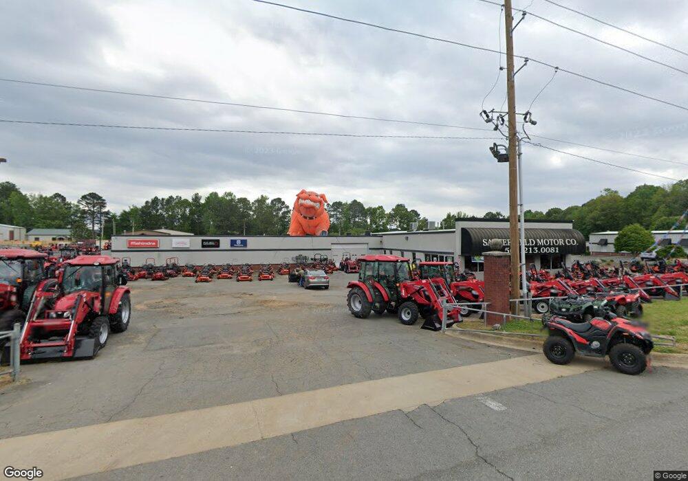
25307 Interstate 30 Bryant, AR 72022
Estimated Value: $1,756,059
--
Bed
--
Bath
3,200
Sq Ft
$549/Sq Ft
Est. Value
About This Home
This home is located at 25307 Interstate 30, Bryant, AR 72022 and is currently estimated at $1,756,059, approximately $548 per square foot. 25307 Interstate 30 is a home located in Saline County with nearby schools including Hill Farm Elementary School, Bryant Middle School, and Bethel Middle School.
Ownership History
Date
Name
Owned For
Owner Type
Purchase Details
Closed on
Sep 24, 2024
Sold by
Lexington Park Inc and Lexington Park Corporate Center Inc
Bought by
I-30 Business Park Of Bryant Llc
Current Estimated Value
Purchase Details
Closed on
Mar 6, 2015
Sold by
Terraforma Llc
Bought by
25307 I 30 Llc
Purchase Details
Closed on
Jan 13, 2004
Bought by
Car Aag Bry Llc
Purchase Details
Closed on
Apr 24, 2003
Bought by
Tonnon Real Estate
Purchase Details
Closed on
Jan 4, 2000
Bought by
Tinnon
Purchase Details
Closed on
Oct 4, 1995
Bought by
Lexington Park Inc
Create a Home Valuation Report for This Property
The Home Valuation Report is an in-depth analysis detailing your home's value as well as a comparison with similar homes in the area
Home Values in the Area
Average Home Value in this Area
Purchase History
| Date | Buyer | Sale Price | Title Company |
|---|---|---|---|
| I-30 Business Park Of Bryant Llc | -- | None Listed On Document | |
| 25307 I 30 Llc | $900,000 | None Available | |
| Car Aag Bry Llc | $2,390,000 | -- | |
| Tonnon Real Estate | -- | -- | |
| Tinnon | $307,000 | -- | |
| Lexington Park Inc | $100,000 | -- |
Source: Public Records
Tax History Compared to Growth
Tax History
| Year | Tax Paid | Tax Assessment Tax Assessment Total Assessment is a certain percentage of the fair market value that is determined by local assessors to be the total taxable value of land and additions on the property. | Land | Improvement |
|---|---|---|---|---|
| 2025 | $8,563 | $160,055 | $57,460 | $102,595 |
| 2024 | $7,811 | $160,055 | $57,460 | $102,595 |
| 2023 | $8,563 | $160,055 | $57,460 | $102,595 |
| 2022 | $8,355 | $160,055 | $57,460 | $102,595 |
| 2021 | $7,760 | $148,100 | $57,460 | $90,640 |
| 2020 | $7,760 | $148,100 | $57,460 | $90,640 |
| 2019 | $7,760 | $148,100 | $57,460 | $90,640 |
| 2018 | $7,760 | $148,100 | $57,460 | $90,640 |
| 2017 | $7,760 | $148,100 | $57,460 | $90,640 |
| 2016 | $5,421 | $132,970 | $57,460 | $75,510 |
| 2015 | $5,421 | $100,990 | $25,480 | $75,510 |
| 2014 | $4,928 | $100,990 | $25,480 | $75,510 |
Source: Public Records
Map
Nearby Homes
- 4227 Millbrook Dr
- 2812 Timbercreek Dr
- 4905 N Shobe Rd
- 21.94 Acres Highway 5
- 2104 Magna Carta Ln
- 3214 Meadowlake Dr
- 32-acres Bryant Parkway I 30 and Hwy 5
- Tract B Alexander Rd
- 2411 Shadowcreek
- 3432 Centark Cir
- 5308 Glenn Cove
- 5506 Glenn Cove
- 3458 Garden Club Dr
- 1175 Oak Glenn Loop
- 2193 Fern Valley Dr
- 3104 Debra Gaye Dr
- 6089 Saddle Hill Dr
- 5001 Woodstream Dr
- 3200 Robbins Dr
- 9401 D Highway 5
- LOT 7 Corporate Center Dr
- 3005 Corporate Center Dr
- 3011 Corporate Center Dr
- 3017 Corporate Center Dr Unit I-30 South
- 3002 Northfield Dr
- 2924 Northfield Dr
- 3010 Northfield Dr
- 2916 Northfield Dr
- 3018 Northfield Dr
- 0 Corporate Center Dr Unit I-30 South 20035752
- 0 Corporate Center Dr Unit 20030546
- 0 Corporate Center Dr Unit 10333971
- 0 Corporate Center Dr Unit 10376415
- 3102 Northfield Dr
- 2906 Northfield Dr
- 0 I-30 Unit 15034116
- 0 I-30 Unit 15034115
- 0 I-30 Unit 15034117
- 3110 Northfield Dr
- 4303 Millbrook Dr
