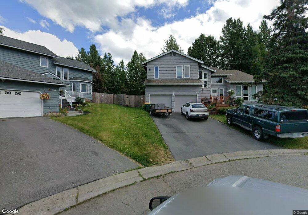
2531 Maylen Cir Anchorage, AK 99516
Huffman-O'Malley NeighborhoodEstimated Value: $427,000 - $587,401
4
Beds
3
Baths
2,282
Sq Ft
$232/Sq Ft
Est. Value
About This Home
This home is located at 2531 Maylen Cir, Anchorage, AK 99516 and is currently estimated at $530,134, approximately $232 per square foot. 2531 Maylen Cir is a home located in Anchorage Municipality with nearby schools including Huffman Elementary School, Goldenview Middle School, and South Anchorage High School.
Ownership History
Date
Name
Owned For
Owner Type
Purchase Details
Closed on
Oct 22, 2015
Sold by
Rognes Jeff R and Rognes Kristin A
Bought by
Wilson Henry H and Moran Gladys H
Current Estimated Value
Home Financials for this Owner
Home Financials are based on the most recent Mortgage that was taken out on this home.
Original Mortgage
$364,800
Outstanding Balance
$218,511
Interest Rate
3.85%
Mortgage Type
New Conventional
Estimated Equity
$311,623
Purchase Details
Closed on
Oct 22, 1993
Sold by
Woolcock Michael R
Bought by
Rognes Jeff R and Rognes Kristin A
Home Financials for this Owner
Home Financials are based on the most recent Mortgage that was taken out on this home.
Original Mortgage
$164,000
Interest Rate
6.81%
Mortgage Type
New Conventional
Create a Home Valuation Report for This Property
The Home Valuation Report is an in-depth analysis detailing your home's value as well as a comparison with similar homes in the area
Home Values in the Area
Average Home Value in this Area
Purchase History
| Date | Buyer | Sale Price | Title Company |
|---|---|---|---|
| Wilson Henry H | -- | Fatic | |
| Rognes Jeff R | -- | -- | |
| Rognes Jeff R | -- | -- |
Source: Public Records
Mortgage History
| Date | Status | Borrower | Loan Amount |
|---|---|---|---|
| Open | Wilson Henry H | $364,800 | |
| Previous Owner | Rognes Jeff R | $164,000 |
Source: Public Records
Tax History Compared to Growth
Tax History
| Year | Tax Paid | Tax Assessment Tax Assessment Total Assessment is a certain percentage of the fair market value that is determined by local assessors to be the total taxable value of land and additions on the property. | Land | Improvement |
|---|---|---|---|---|
| 2025 | $8,018 | $527,100 | $129,900 | $397,200 |
| 2024 | $8,018 | $496,600 | $129,900 | $366,700 |
| 2023 | $7,839 | $460,300 | $129,900 | $330,400 |
| 2022 | $7,261 | $431,200 | $129,900 | $301,300 |
| 2021 | $7,480 | $415,100 | $129,900 | $285,200 |
| 2020 | $7,007 | $412,200 | $129,900 | $282,300 |
| 2019 | $6,650 | $406,500 | $129,900 | $276,600 |
| 2018 | $6,448 | $393,200 | $129,900 | $263,300 |
| 2017 | $6,104 | $389,800 | $129,900 | $259,900 |
| 2016 | $5,401 | $414,500 | $129,900 | $284,600 |
| 2015 | $5,401 | $393,400 | $129,900 | $263,500 |
| 2014 | $5,401 | $368,500 | $120,000 | $248,500 |
Source: Public Records
Map
Nearby Homes
- 2701 Kempton Hills Dr
- 2048 Meander Dr
- 2521 Winterchase Cir
- 2020 Steeple Dr
- 12283 Timberwood Cir
- 3025 Huffman Rd
- 12241 Gander St
- 13105 Stephenson St
- 3040 Chesapeake Cir
- 13470 Baywind Cir
- 13530 Westwind Dr
- 13481 Baywind Dr
- 1677 Circlewood Dr
- 12101 Wagner St
- 1800 Hamilton Dr
- 13322 Diggins Dr
- 000 Wagner St
- 13540 Seachant Cir
- 2000 Jarvis Ave
- 2735 Meadow Wood Cir
- 2521 Maylen Cir
- 2530 Maylen Cir
- 2511 Maylen Cir
- 2530 Brandy Cir
- 2520 Maylen Cir
- 2540 Brandy Cir
- 2510 Maylen Cir
- 2501 Maylen Cir
- 2520 Brandy Cir
- 2501 Autumn Dr
- 2500 Brandy Cir
- 12775 Lake Otis Pkwy
- 2441 Maylen Cir
- 2511 Autumn Dr
- 2441 Autumn Dr
- 2441 Autumn Cir
- 12701 Lake Otis Pkwy
- 2511 Autumn Cir
- 2541 Brandy Cir
- 2440 Maylen Cir