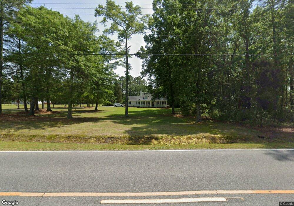
2531 Pauls Path Rd Kinston, NC 28504
Estimated Value: $264,343 - $278,000
3
Beds
2
Baths
2,315
Sq Ft
$117/Sq Ft
Est. Value
About This Home
This home is located at 2531 Pauls Path Rd, Kinston, NC 28504 and is currently estimated at $271,836, approximately $117 per square foot. 2531 Pauls Path Rd is a home located in Lenoir County with nearby schools including Banks Elementary School, E.B. Frink Middle School, and North Lenoir High School.
Ownership History
Date
Name
Owned For
Owner Type
Purchase Details
Closed on
Dec 6, 2016
Sold by
Moore John Tyler and Moore Brittany Thigpen
Bought by
Creech Thomas Jordan and Gray Jessica Paige
Current Estimated Value
Purchase Details
Closed on
Jul 24, 2014
Sold by
Gay Burton A and Gay Tamara Turner
Bought by
Moore John Tyler and Moore Brittany Thigpen
Home Financials for this Owner
Home Financials are based on the most recent Mortgage that was taken out on this home.
Original Mortgage
$244,000
Interest Rate
4.5%
Mortgage Type
Adjustable Rate Mortgage/ARM
Create a Home Valuation Report for This Property
The Home Valuation Report is an in-depth analysis detailing your home's value as well as a comparison with similar homes in the area
Home Values in the Area
Average Home Value in this Area
Purchase History
| Date | Buyer | Sale Price | Title Company |
|---|---|---|---|
| Creech Thomas Jordan | $150,500 | None Available | |
| Moore John Tyler | $244,000 | None Available |
Source: Public Records
Mortgage History
| Date | Status | Borrower | Loan Amount |
|---|---|---|---|
| Previous Owner | Moore John Tyler | $244,000 |
Source: Public Records
Tax History Compared to Growth
Tax History
| Year | Tax Paid | Tax Assessment Tax Assessment Total Assessment is a certain percentage of the fair market value that is determined by local assessors to be the total taxable value of land and additions on the property. | Land | Improvement |
|---|---|---|---|---|
| 2025 | $2,466 | $328,038 | $33,663 | $294,375 |
| 2024 | $1,398 | $144,898 | $24,726 | $120,172 |
| 2023 | $1,398 | $144,898 | $24,726 | $120,172 |
| 2022 | $1,398 | $144,898 | $24,726 | $120,172 |
| 2021 | $1,394 | $144,898 | $24,726 | $120,172 |
| 2020 | $1,394 | $144,898 | $24,726 | $120,172 |
| 2019 | $1,398 | $144,898 | $24,726 | $120,172 |
| 2018 | $1,376 | $144,898 | $24,726 | $120,172 |
| 2017 | $1,293 | $144,898 | $24,726 | $120,172 |
Source: Public Records
Map
Nearby Homes
- 2886 Fox Run Cir
- 2912 Fox Run Cir
- 3128 Kelly Rd
- 2683 Stokes Cir
- 2673 Stokes Cir
- 2712 Stokes Cir
- Lot 2 Branchwood Dr
- 2443 Creekside Rd
- 2746 Pinewood Dr
- 3145 Lakewood Dr Unit 3155
- 2585 Cabin Branch Rd
- 2544 Dogwood Ln
- 3178 Alton Phillips Rd
- 2193 Dogwood Ln
- 3255 Caroline Nicole Dr
- 2445 Tammy Dr
- 2704 Forrest Dr
- 2634 Forrest Dr
- 3216 Dexter Cir
- 2526 Moulton Dr
- 3189 Fox Run Cir
- 2807 Fox Run Cir
- 2196 Thatcher Dr
- 3181 Fox Run Cir
- 2195 Thatcher Dr
- 2501 Pauls Path Rd
- 2853 Fox Run Cir
- 3163 Fox Run Cir
- 2182 Thatcher Dr
- 2801 Nautica Place
- 3190 Fox Run Cir
- 2171 Thatcher Dr
- 2601 Pauls Path Rd
- 2809 Churchill Dr
- 2865 Fox Run Cir
- 3137 Fox Run Cir
- 2549 Birch Cir
- 2802 Nautica Place
- 3178 Fox Run Cir
- 2831 Churchill Dr