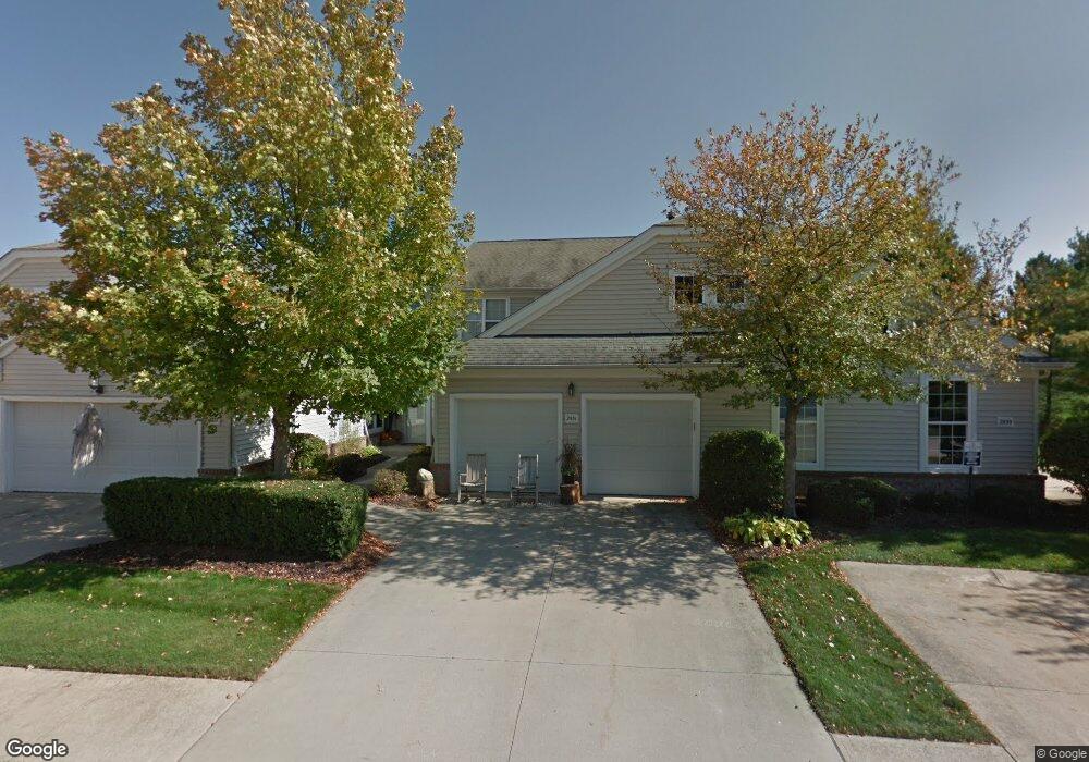
2531 Wyndgate Ct Unit 2531 Westlake, OH 44145
Estimated Value: $361,785 - $384,000
3
Beds
3
Baths
1,709
Sq Ft
$217/Sq Ft
Est. Value
About This Home
This home is located at 2531 Wyndgate Ct Unit 2531, Westlake, OH 44145 and is currently estimated at $370,946, approximately $217 per square foot. 2531 Wyndgate Ct Unit 2531 is a home located in Cuyahoga County with nearby schools including Dover Intermediate School, Lee Burneson Middle School, and Westlake High School.
Ownership History
Date
Name
Owned For
Owner Type
Purchase Details
Closed on
Sep 22, 1999
Sold by
Wyndgate Club Ltd
Bought by
Wesolowski John E and Marcantino Patti J
Current Estimated Value
Home Financials for this Owner
Home Financials are based on the most recent Mortgage that was taken out on this home.
Original Mortgage
$125,000
Interest Rate
6.75%
Create a Home Valuation Report for This Property
The Home Valuation Report is an in-depth analysis detailing your home's value as well as a comparison with similar homes in the area
Home Values in the Area
Average Home Value in this Area
Purchase History
| Date | Buyer | Sale Price | Title Company |
|---|---|---|---|
| Wesolowski John E | $174,700 | Lorain County Title Co Inc |
Source: Public Records
Mortgage History
| Date | Status | Borrower | Loan Amount |
|---|---|---|---|
| Previous Owner | Wesolowski John E | $125,000 |
Source: Public Records
Tax History Compared to Growth
Tax History
| Year | Tax Paid | Tax Assessment Tax Assessment Total Assessment is a certain percentage of the fair market value that is determined by local assessors to be the total taxable value of land and additions on the property. | Land | Improvement |
|---|---|---|---|---|
| 2024 | $5,118 | $105,560 | $10,885 | $94,675 |
| 2023 | $4,855 | $85,650 | $8,580 | $77,070 |
| 2022 | $4,779 | $85,650 | $8,580 | $77,070 |
| 2021 | $4,790 | $85,650 | $8,580 | $77,070 |
| 2020 | $4,461 | $73,190 | $7,320 | $65,870 |
| 2019 | $4,327 | $209,100 | $20,900 | $188,200 |
| 2018 | $4,148 | $73,190 | $7,320 | $65,870 |
| 2017 | $3,987 | $63,140 | $6,300 | $56,840 |
| 2016 | $3,967 | $63,140 | $6,300 | $56,840 |
| 2015 | $4,171 | $63,140 | $6,300 | $56,840 |
| 2014 | $4,171 | $65,100 | $6,510 | $58,590 |
Source: Public Records
Map
Nearby Homes
- 2075 Bassett Rd
- 28744 Woodmill Dr
- 29579 Devonshire Oval
- 2066 Bradley Rd
- 1900 Sperrys Forge Trail
- 29379 Detroit Rd
- 29363 Detroit Rd Unit 5
- 31035 Wilderness Trail
- 1476 Bobby Ln Unit 7
- 28323 Farrs Garden Path
- 1625 Cedarwood Dr Unit 218
- 31072 Riviera Ln
- 1670 Cedarwood Dr Unit 148
- 29772 Hilliard Oak Ln
- 1510 Alder Ln Unit 7C
- 3115 Bradley Rd
- 1480 Cedarwood Dr Unit 21F
- 3184 Oakmont Cir
- 31587 Turtle Cr
- 2962 Forest Lake Dr
- 2535 Wyndgate Ct Unit 2535
- 2527 Wyndgate Ct Unit 2527
- 2523 Wyndgate Ct Unit 2523
- 2551 Wyndgate Ct Unit 2551
- 2555 Wyndgate Ct Unit 255
- 2534 Wyndgate Ct Unit 2534
- 2530 Wyndgate Ct Unit 2530
- 2526 Wyndgate Ct Unit 2526
- 2547 Wyndgate Ct Unit 2547
- 2567 Wyndgate Ct Unit 2567
- 2542 Wyndgate Ct Unit 2542
- 2559 Wyndgate Ct Unit 2559
- 2563 Wyndgate Ct Unit 2563
- 2550 Wyndgate Ct Unit 2550
- 2554 Wyndgate Ct Unit 2554
- 2558 Wyndgate Ct Unit 2558
- 2562 Wyndgate Ct Unit 2562
- 2492 Crimson Dr Unit 2492
- 2496 Crimson Dr
- 2500 Crimson Dr Unit 2500